
 United Kingdom
 France
 Germany
 Netherlands
 Sweden
 USA
USA
 Italy
Italy
 Spain
Spain
More From Contributor


Yemen Reise Know-How
Indexed, waterproof and tear-resistant road map of Yemen with topographic and tourist information, published by Reise Know-How as part of their highly acclaimed World Mapping Project. The map is double-sided to present the area at best possible scale on a convenient size sheet. The island of Socotra is shown as an inset.Topography is shown by altitude colouring with contours, spot heights, mountain passes, and names of hill and mountain ranges. Desert areas, seasonal rivers and lakes, water holes, hot springs, palm groves and coral reefs are also marked. Internal administrative boundaries are shown with names of the provinces. All place names are shown transliterated, with alternative names provided for many locations. Road network includes unsurfaced roads and tracks,
indicating locations of border crossings to Saudi Arabia and Oman. Local airfields are also marked. A range of symbols highlights various places of interest, including archaeological remains, selected hotels, beaches, etc. The map also indicates locations of oil wells. The map has a latitude and longitude grid at intervals of 1° and an index of place names. Map legend includes English.
indicating locations of border crossings to Saudi Arabia and Oman. Local airfields are also marked. A range of symbols highlights various places of interest, including archaeological remains, selected hotels, beaches, etc. The map also indicates locations of oil wells. The map has a latitude and longitude grid at intervals of 1° and an index of place names. Map legend includes English.

Product Description
Reviews/Comments
Add New
Intelligent Comparison
Archived Product

Armenia Reise Know-How Stanfords
£11.50
Archived Product
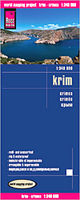
Crimea Reise Know-How Stanfords
£10.50
Archived Product
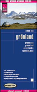
Greenland Reise Know-How Stanfords
£7.50
Archived Product
Yucatan Reise Know-How Stanfords
£11.50
Archived Product

Poland Reise Know-How Stanfords
£10.50
Archived Product
Borneo Reise Know-How Stanfords
£10.50
Archived Product
Taiwan Reise Know-How Stanfords
£10.50
Archived Product
Ukraine Reise Know-How Stanfords
£10.50
Vouchers
No voucher codes found.
Do you know a voucher code for this product or supplier? Add it to Insights for others to use.
Do you know a voucher code for this product or supplier? Add it to Insights for others to use.
 Denmark