
 United Kingdom
 France
 Germany
 Netherlands
 Sweden
 USA
USA
 Italy
Italy
 Spain
Spain
More From Contributor


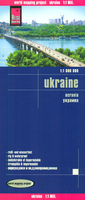
Ukraine Reise Know-How
Indexed, light, waterproof and tear-resistant road map of Ukraine with topographic and tourist information, published by Reise Know-How as part of their highly acclaimed World Mapping Project. The map is double-sided to provide the best balance between a good scale and a convenient size sheet.Road and rail networks are easy to see on a clear base which presents topography by altitude colouring with contours, spot heights, mountain passes and names of mountain ranges. Swamps and salt marshes are also marked. Road network includes local roads, shows driving distances on main and secondary routes and indicates locations of petrol stations and border crossinngs.National parks and protected areas are marked and symbols highlight various places of interest. Also indicated is the boundary
of the danger zone around Chernobyl. Names of towns and villages are in Roman and Cyrillic alphabets, both on the map and in the extensive index; names of geographical features and protected areas are shown only transliterated. Coverage includes all but a small corner of Moldova. The map has a latitude and longitude grid at intervals of 1º. Map legend includes English. ”World Mapping Project” is an extensive series of maps at varying scales, aiming to provide coverage of countries and regions worldwide using clear, well presented cartography with both topographic and tourist information.
of the danger zone around Chernobyl. Names of towns and villages are in Roman and Cyrillic alphabets, both on the map and in the extensive index; names of geographical features and protected areas are shown only transliterated. Coverage includes all but a small corner of Moldova. The map has a latitude and longitude grid at intervals of 1º. Map legend includes English. ”World Mapping Project” is an extensive series of maps at varying scales, aiming to provide coverage of countries and regions worldwide using clear, well presented cartography with both topographic and tourist information.

Product Description
Reviews/Comments
Add New
Intelligent Comparison
Archived Product
Brazil Reise Know-How Stanfords
£10.50
Archived Product
Borneo Reise Know-How Stanfords
£10.50
Archived Product
Taiwan Reise Know-How Stanfords
£10.50
Archived Product

Uzbekistan Reise Know-How Stanfords
£11.50
Archived Product
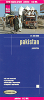
Pakistan Reise Know-How Stanfords
£10.50
Archived Product
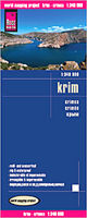
Crimea Reise Know-How Stanfords
£10.50
Archived Product
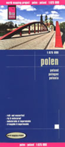
Poland Reise Know-How Stanfords
£10.50
Archived Product
Istria Reise Know-How Stanfords
£10.50
Vouchers
No voucher codes found.
Do you know a voucher code for this product or supplier? Add it to Insights for others to use.
Do you know a voucher code for this product or supplier? Add it to Insights for others to use.
 Denmark