
 United Kingdom
 France
 Germany
 Netherlands
 Sweden
 USA
USA
 Italy
Italy
 Spain
Spain
More From Contributor


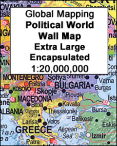
World Global Mapping Political Wall Map X-LARGE ENCAPSULATED
Political map of the world from Global Mapping, extra large size 199 x 135cm (78.5” x 53” approx) – encapsulated version, with bright colouring of the individual countries pleasantly contrasted by the light blue oceans, relief shading for mountain ranges on land and the structure of the ocean floor, a panel of country flags, etc. The map is part of Global Mapping series of political maps presenting the world in four different sizes, as indicated below. This particular version has not yet been updated to show South Sudan or the new International Date Line and, unlike the three smaller versions, does not include a panel of flags.GLOBAL MAPPING POLITICAL MAPS OF THE WORLD:FORMAT & SIZES: the maps are available on paper or encapsulated and in four sizes: 199 x 135cm, 138 x 95cm,
99.5 x 69.5cm and 69.5 x 61cm on paper but slightly larger when encapsulated – please see individual entries for exact measurements. PRESENTATION: country names are in English. Within Europe, city names are as used in their countries (Köln, Wien, Warszawa); elsewhere the names vary (e.g. Viangchan for Vientiane). In USA, Canada, Brazil and Australia the map shows names of states/provinces, with their borders and administrative capitals. Relief shading shows elevation on land and particularly effectively on the ocean floor. On all four sizes clocks show time difference from GMT (but without indicating the exact geographical area covered by each time zone); the International Date Line is not included on the smallest version. Small, medium and large size versions include a panel of
country flags under the map.PLEASE NOTE: as the scale and the size of the map increases, each version includes more cities and more geographical information (mountain ranges, islands, etc).*LAMINATED and ENCAPSULATED WALL MAPS:**Laminated* wall maps have a thin layer of plastic usually applied to the printed side only. They can be written on with suitable marker pens without any damage to the map but, unless laminated on both sides, they are not damp-proof.*Encapsulated* wall maps are sealed between two sheets of plastic. They are more rigid and heavier than laminated maps of the same size. They are damp-proof and do not crinkle in humid conditions. Encapsulation gives the map a shiny surface, similar to being displayed behind glass.Many publishers and retailers often use these two
terms interchangeably. Our map titles and descriptions follow the definitions provided above.

Product Description
Reviews/Comments
Add New
Intelligent Comparison
Archived Product
Europe: Global Mapping Political Wall Map ENCAPSULATED Stanfords
£23.99
Archived Product

World Global Mapping Antique Political Wall Map LARGE PAPER Stanfords
£11.99
Archived Product
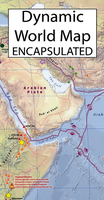
Dynamic World Global Mapping Wall Map ENCAPSULATED Stanfords
£25.99
Archived Product
Europe Maps International Political Wall Map X-LARGE ENCAPSULATED Stanfords
£37.99
Archived Product
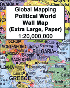
Global Mapping Political World Wall Map EXTRA LARGE, PAPER Stanfords
£22.99
Archived Product
World NGS Classic Wall Map LARGE ENCAPSULATED Stanfords
£49.99
Archived Product
Europe Maps International Political Wall Map LARGE ENCAPSULATED Stanfords
£28.99
Archived Product
Europe: Global Mapping Political Wall Map PAPER Stanfords
£10.99
Vouchers
No voucher codes found.
Do you know a voucher code for this product or supplier? Add it to Insights for others to use.
Do you know a voucher code for this product or supplier? Add it to Insights for others to use.
 Denmark