
 United Kingdom
 France
 Germany
 Netherlands
 Sweden
 USA
USA
 Italy
Italy
 Spain
Spain
More From Contributor


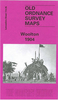
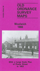


Woolton 1904
Woolton in 1904 in a fascinating series of reproductions of old Ordnance Survey plans in the Alan Godfrey Editions, ideal for anyone interested in the history of their neighbourhood or family. Selected towns in Great Britain and Ireland are covered by maps showing the extent of urban development in the last decades of the 19th and early 20th century.In this title: the map covers the village of Woolton, south-east of Liverpool, with part of Allerton, Coverage stretches from Allerton Road eastward to Halewood Road, and from Woolton Park southward to Doe Park. The village centre of Woolton is central to the map and features here include St Peter's church, St Mary's RC church, Woolton Quarries, gas works, Woolton Heyes, and houses neatly delineated, including several named villas.
Outside the village centre features include Woolton Hall Hydro, Liverpool Convalescent Institution, Woolton Grange, Gateacre Nurseries, Allerton Tower, Allerton Priory, Fletcher's Farm, Allerton (house), etc. On the reverse are street directory entries for Allerton Road, Woolton High Street, Woolton Street.About the Alan Godfrey Editions of the 25
Outside the village centre features include Woolton Hall Hydro, Liverpool Convalescent Institution, Woolton Grange, Gateacre Nurseries, Allerton Tower, Allerton Priory, Fletcher's Farm, Allerton (house), etc. On the reverse are street directory entries for Allerton Road, Woolton High Street, Woolton Street.About the Alan Godfrey Editions of the 25
Product Description
Reviews/Comments
Add New
Intelligent Comparison
Archived Product

Woolton 1904 Stanfords
£3.50
Archived Product

Bolton 1908 Stanfords
£3.50
Archived Product

Wilton 1901 Stanfords
£3.50
Archived Product

Boston 1904 Stanfords
£3.50
Archived Product

Wollaston 1901 Stanfords
£3.50
Archived Product
Gorleston 1904 Stanfords
£2.95
Archived Product

Gorleston 1904 Stanfords
£3.50
Archived Product
Flixton 1904 Stanfords
£2.95
Vouchers
No voucher codes found.
Do you know a voucher code for this product or supplier? Add it to Insights for others to use.
Do you know a voucher code for this product or supplier? Add it to Insights for others to use.
 Denmark