More From Contributor

£9.99
Boston street plan & on the reverse a road map of the north-eastern seaboard of USA between Philadelphia & the Canadian border, both indexed, on a double-sided map from ITMB printed on light, waterproof & tear-resistant synthetic paper. On one side is a very clear, indexed street plan at 1:10, 000 of Boston’s central districts, extending across the Charles River to include Cambridge, with the Harvard University Campus in the north-western corner of the map. In the east coverage

Includes::
the Logan International Airport with road & water shuttle access to it. MBTA transit, subway & Silver Line Bus-Way routes are clearly marked, & the whole system is also shown on a separate diagram. For drivers the plan highlights main traffic arteries & indicates one way streets. Symbols mark numerous places of interest, including locations of several hotels. Also provided is a small road map of the city’s environs. On the reverse is an indexed road map at 1:1, 000, 000 showing the north-eastern coast between Philadelphia & the Canadian border, extending within the New York State to Syracuse (i.e. including the Adirondacks but not Niagara Falls). The map shows the region’s road network on a base with altitude colouring to present the topography, & highlights various places of interest. Insets provide a street plan of the Lower Manhattan (with So Ho & the East Village but not beyond them), plus a road map of a section of New York City with access to the JFK & La Guardia airports. To see other regional titles from ITMB covering USA please click on the series link.

...
Archived Product
£11.19
Boston in the City Guide Series from Lonely Planet, profiling in comprehensive detail the history, major sights, best places to eat, nightlife, accommodation & shopping possibilities of an extensive range of cities worldwide. Frank & informal in style, the guides are renowned for their appeal to independent travellers & are written & researched by local authors. Each guide is divided into 11 main sections
- Getting Started, Background, Neighbourhoods, Shopping, Eating, Drinking & Nightlife, The Arts, Sports & Activities, Gay & Lesbian, Sleeping & Day Trips & Excursions. The Background section details the history, arts, architecture, environment, media, fashion & government & politics of the city. An
...
Archived Product
£4.95
Boston
- Grantham
- King's Lynn
- Wisbech Street Atlas at 1:19, 000 (3.3 to 1 mile) in a series of A5, paperback street


...
Archived Product
£14.99
Boston, Tattershall, Billinghay & Heckington area on a detailed topographic & GPS compatible map No. 261, waterproof version, from the Ordnance Survey’s 1:25, 000 Explorer series.MOBILE DOWNLOADS: this title & all the other OS Explorer maps include a code for downloading after purchase the digital version onto your smartphone or tablet for viewing on the OS smartphone app.OS EXPLORER SERIES: to see the list of all the titles in the OS Explorer series, both paper & waterproof versions, please click on the series link. The Explorer series, Ordnance Survey’s most detailed maps recommended for anyone enjoying outdoor activities, provides topographic coverage of Great Britain at 1:25, 000 on GPS compatible maps with hiking trails, cycling routes & extensive tourist information. Each printed map is available either on paper or as a waterproof & tear-resistant OS Active Map, as indicated in its title. Britain’s National Parks & other areas of particular tourist interest are presented on often double-sided OL (Outdoor Leisure) maps, whilst most standard format Explorers cover an area of 30 x 20km (approx. 19 x 12 miles). All three versions (paper, waterproof & digital) are the same & provide plenty of recreational & tourist information, indicating the traditional public right of way paths (except in Scotland where different laws apply), including bridleways & byways. National Trails & other long-distance paths are marked, as well as permissive footpaths or bridleways & on-road or traffic-free cycle routes with, where appropriate, their National/ Regional Cycle Network numbers. Boundaries of access land are clearly marked. A wide range of symbols provides additional tourist information, highlighting camping & caravanning sites, information offices & visitors’ centres, parking & picnicking places, country pubs, sport & recreational facilities including cycle hire locations & mountain biking trails, historic buildings & museums, etc. Exceptionally clear presentation of the landscape is provided by contours at 5m or in the uplands at 10m intervals, with additional spot heights plus colouring and/or graphics for different types of woodlands, orchards, heath, marshl&, scree or boulders, & other topographic features. For GPS users the maps have British National Grid lines at 1km intervals, with latitude & longitude given by margin ticks at 1`. Clearly laid out map legend

Includes::
French & German translations for the tourist information symbols.

...
Archived Product
£8.99
Boston, Tattershall, Billinghay & Heckington area on a detailed topographic & GPS compatible map No. 261, paper version, from the Ordnance Survey’s 1:25, 000 Explorer series.MOBILE DOWNLOADS: this title & all the other OS Explorer maps include a code for downloading after purchase the digital version onto your smartphone or tablet for viewing on the OS smartphone app.OS EXPLORER SERIES: to see the list of all the titles in the OS Explorer series, both paper & waterproof versions, please click on the series link. The Explorer series, Ordnance Survey’s most detailed maps recommended for anyone enjoying outdoor activities, provides topographic coverage of Great Britain at 1:25, 000 on GPS compatible maps with hiking trails, cycling routes & extensive tourist information. Each printed map is available either on paper or as a waterproof & tear-resistant OS Active Map, as indicated in its title. Britain’s National Parks & other areas of particular tourist interest are presented on often double-sided OL (Outdoor Leisure) maps, whilst most standard format Explorers cover an area of 30 x 20km (approx. 19 x 12 miles). All three versions (paper, waterproof & digital) are the same & provide plenty of recreational & tourist information, indicating the traditional public right of way paths (except in Scotland where different laws apply), including bridleways & byways. National Trails & other long-distance paths are marked, as well as permissive footpaths or bridleways & on-road or traffic-free cycle routes with, where appropriate, their National/ Regional Cycle Network numbers. Boundaries of access land are clearly marked. A wide range of symbols provides additional tourist information, highlighting camping & caravanning sites, information offices & visitors’ centres, parking & picnicking places, country pubs, sport & recreational facilities including cycle hire locations & mountain biking trails, historic buildings & museums, etc. Exceptionally clear presentation of the landscape is provided by contours at 5m or in the uplands at 10m intervals, with additional spot heights plus colouring and/or graphics for different types of woodlands, orchards, heath, marshl&, scree or boulders, & other topographic features. For GPS users the maps have British National Grid lines at 1km intervals, with latitude & longitude given by margin ticks at 1`. Clearly laid out map legend

Includes::
French & German translations for the tourist information symbols.

...
Archived Product
£14.99
Full-color guide
- Make your trip to Boston unforgettable
- Customize your trip with simple planning tools
- Top experiences


...
Archived Product
£8.95
Boston street plan & on the reverse a road map of the north-eastern seaboard of USA between Philadelphia & the Canadian border, both indexed, on a double-sided map from ITMB printed on light, waterproof & tear-resistant synthetic paper. On one side is a very clear, indexed street plan at 1:10, 000 of Boston ...
Archived Product
£9.99
Map No. 131, Boston & Spalding 1824, in the Cassini Historical Series of old Ordnance Survey mapping of England & Wales at 1:50, 000 in a format designed to offer a convenient comparison with the present day coverage from the OS, & most locations in three different editions. Old historical maps have been combined so that the sheet lines correspond to the current Landranger series & reproduced with the scale changed from one inch to one mile to 1:50, 000. Most locations are covered by three separate maps, showing how the area has changed over the decades, with selected major cities also presented in a fourth edition. * Old Series: the first detailed survey mapping dating for most areas from the first half of the 19th century, in black & white & with relief shown by hachuring.* Revised New Series from 1880s/1900s, with some colouring & a mixture of hachuring & contour lines.* Popular Edition from the inter-war years, with contour lines & colouring to indicate woodlands, parks, etc.* New Popular Edition from the late 1940s, reproduced in the Cassini series for the major cities. Each map

Includes::
notes on the development of Ordnance Survey & the various series produced by them. For those interested in maps & cartography in general, the Cassini series also provides a fascinating insight into how Ordnance Survey cartographic style has developed over a period of over 100 years. Coverage in this title

Includes::
present day Wisbech, Holbeach, Langrick, Leverton, Hubbert’s Bridge, Butterwick, Swineshead, Kirton, Bicker, Donnington, Sutterton, Gosberton, Fosdyke, Moulton Seas End, Holbeach St Matthew, Gedney Drove End, Lutton, Sutton Bridge, Long Sutton, Terrington St Clement, Tydd St Mary, Tydd St Giles, Walpole St Peter, Wiggenhall St Mary Magdalen, Sutton St James, Holbeach Drove, Holbeach St Johns, Whaplode, Moulton, Pinchbeck, Cowbit, Deeping St Nicholas & Crowl&.* PLEASE NOTE: Stanfords can also print on request mapping from all four series *centring the map on a location of your choice.* For more information please click on the link below.


...
Archived Product
£14.99
Map No. 131, Boston & Spalding 1824-1922 (3-map set), in the Cassini Historical Series of old Ordnance Survey mapping of England & Wales at 1:50, 000 in a format designed to offer a convenient comparison with the present day coverage from the OS, & most locations in three different editions. Old historical maps have been combined so that the sheet lines correspond to the current Landranger series & reproduced with the scale changed from one inch to one mile to 1:50, 000. Most locations are covered by three separate maps, showing how the area has changed over the decades, with selected major cities also presented in a fourth edition. Old Series: the first detailed survey mapping dating for most areas from the first half of the 19th century, in black & white & with relief shown by hachuring. Revised New Series from 1880s/1900s, with some colouring & a mixture of hachuring & contour lines. Popular Edition from the inter-war years, with contour lines & colouring to indicate woodlands, parks, etc. New Popular Edition from the late 1940s, reproduced in the Cassini series for the major cities. Each map

Includes::
notes on the development of Ordnance Survey & the various series produced by them. For those interested in maps & cartography in general, the Cassini series also provides a fascinating insight into how Ordnance Survey cartographic style has developed over a period of over 100 years. Coverage in this title

Includes::
present day Wisbech, Holbeach, Langrick, Leverton, Hubbert


...
Archived Product
£9.99
Map No. 131, Boston & Spalding 1901-1902, in the Cassini Historical Series of old Ordnance Survey mapping of England & Wales at 1:50, 000 in a format designed to offer a convenient comparison with the present day coverage from the OS, & most locations in three different editions. Old historical maps have been combined so that the sheet lines correspond to the current Landranger series & reproduced with the scale changed from one inch to one mile to 1:50, 000. Most locations are covered by three separate maps, showing how the area has changed over the decades, with selected major cities also presented in a fourth edition. * Old Series: the first detailed survey mapping dating for most areas from the first half of the 19th century, in black & white & with relief shown by hachuring.* Revised New Series from 1880s/1900s, with some colouring & a mixture of hachuring & contour lines.* Popular Edition from the inter-war years, with contour lines & colouring to indicate woodlands, parks, etc.* New Popular Edition from the late 1940s, reproduced in the Cassini series for the major cities. Each map

Includes::
notes on the development of Ordnance Survey & the various series produced by them. For those interested in maps & cartography in general, the Cassini series also provides a fascinating insight into how Ordnance Survey cartographic style has developed over a period of over 100 years. Coverage in this title

Includes::
present day Wisbech, Holbeach, Langrick, Leverton, Hubbert’s Bridge, Butterwick, Swineshead, Kirton, Bicker, Donnington, Sutterton, Gosberton, Fosdyke, Moulton Seas End, Holbeach St Matthew, Gedney Drove End, Lutton, Sutton Bridge, Long Sutton, Terrington St Clement, Tydd St Mary, Tydd St Giles, Walpole St Peter, Wiggenhall St Mary Magdalen, Sutton St James, Holbeach Drove, Holbeach St Johns, Whaplode, Moulton, Pinchbeck, Cowbit, Deeping St Nicholas & Crowl&.* PLEASE NOTE: Stanfords can also print on request mapping from all four series *centring the map on a location of your choice.* For more information please click on the link below.


...
Archived Product

Boston 1904

Boston in 1904 in a fascinating series of reproductions of old Ordnance Survey plans in the Alan Godfrey Editions, ideal for anyone interested in the history of their neighbourhood or family. Tthe map covers most of the town of Boston, stretching from Liquorpond Street northward to Hospital Bridge Lane, and eastward to Tower Road. Major features include The Haven, station, West Street, Wide Bargate, Market Place, St Botolph`s church, Allan House, River Witham, Maud Foster Drain, Bargate Bridge, Maud Foster Mills, Rout Green Brewery, GNR Workshops, etc. On the reverse is a portion of a contemporary directory, entries A toC. About the Alan Godfrey Editions of the 25” OS Series:Selected towns in Great Britain and Ireland are covered by maps showing the extent of urban
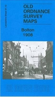
development in the last decades of the 19th and early 20th century. The plans have been taken from the Ordnance Survey mapping and reprinted at about 15 inches to one mile (1:4, 340). On the reverse most maps have historical notes and many also include extracts from contemporary directories. Most maps cover about one mile (1.6kms) north/south, one and a half miles (2.4kms) across; adjoining sheets can be combined to provide wider coverage.FOR MORE INFORMATION AND A COMPLETE LIST OF ALL AVAILABLE TITLES PLEASE CLICK ON THE SERIES LINK.
RIP - This product is no longer available on our network. It was last seen on 25.09.2019

This page now acts as a permanent archive for this product. Add more information using the comments box below to ensure it can still be found by future generations.

Use our search facility to see if it is available from an alternative contributor.
  • External links may include paid for promotion
  • Availability: Out Of Stock
  • Supplier: Stanfords
  • SKU: 9781841512365
Availability: In Stock
£3.50

Product Description

Boston in 1904 in a fascinating series of reproductions of old Ordnance Survey plans in the Alan Godfrey Editions, ideal for anyone interested in the history of their neighbourhood or family. Tthe map covers most of the town of Boston, stretching from Liquorpond Street northward to Hospital Bridge Lane, & eastward to Tower Road. Major features include The Haven, station, West Street, Wide Bargate, Market Place, St Botolph`s church, Allan House, River Witham, Maud Foster Drain, Bargate Bridge, Maud Foster Mills, Rout Green Brewery, GNR Workshops, etc. On the reverse is a portion of a contemporary directory, entries A toC. About the Alan Godfrey Editions of the 25” OS Series: Selected towns in Great Britain & Ireland are covered by maps showing the extent of urban development in the last decades of the 19th & early 20th century. The plans have been taken from the Ordnance Survey mapping & reprinted at about 15 inches to one mile (1:4, 340). On the reverse most maps have historical notes & many also include extracts from contemporary directories. Most maps cover about one mile (1.6kms) north/south, one & a half miles (2.4kms) across; adjoining sheets can be combined to provide wider coverage.FOR MORE INFORMATION & A COMPLETE LIST OF ALL AVAILABLE TITLES PLEASE CLICK ON THE SERIES LINK.

Reviews/Comments

Add New

Price History

Vouchers

No voucher codes found.
Do you know a voucher code for this product or supplier? Add it to Insights for others to use.

Facebook

Jargon Buster

Contemporary - Modern era design
Contemporary - A design reference to indicate post war modern design
History - Anything that happens in the past. An acedemic subject.
Road - a manmade lane or a path that is used to speed up travel.
Contemporary - An object that is living in the same time.
Wide - Something with a large width.
Ideal - Something that satisfies a perfect criteria.
Family - A group of people that live together made up from parents and children.

Supplier Information

Stanfords
Stanfords was established in 1853 and opened their iconic Covent Garden flagship store in 1901. They have become the top retailer of maps, travel books and accessories in the UK and arguably offer the largest selection of maps and travel books worldwide. Famous names such as Captain Robert Falcon Scott, Ranulph Fiennes and Michael Palin have purchased from Stanfords. They now have a shop in Bristol and both stores together with other venues operate a calendar of events including talks, book signings and exhibitions. As a specialist map retailer, the map selection is comprehensive and includes road maps, street maps and walking maps from worldwide destinations, as well as a selection of world atlases and wall maps. Books include travel guides and travel literature. Stanfords also stock globes, from miniatures made of blue marble to magnificent floor-standing globes. The website features a selection of interesting articles on travel topics.
Page Updated: 2023-11-12 20:15:36

Community Generated Product Tags

Oh No! The productWIKI community hasn't generated any tags for this product yet!
Menu