
 United Kingdom
 France
 Germany
 Netherlands
 Sweden
 USA
USA
 Italy
Italy
 Spain
Spain
More From Contributor


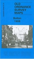
Bolton 1908
Bolton in 1908 in a fascinating series of reproductions of old Ordnance Survey plans in the Alan Godfrey Editions, ideal for anyone interested in the history of their neighbourhood or family. The map covers most of Bolton`s town centre, stretching from Dobson Road eastward to Dorset Street, and from Clarence Street southward to Burnaby Street and Lumsden Street. Features include tramways, Town Hall, Market Hall, Trinity Street station, Great Moor Street station, Deansgate Goods station, Crook Street goods station (all with detail and track layouts), Moor Mills, Bridgeman Street Goods Warehouse, Soho Iron Works, Albion Mills, Lecturers Closes, Mather Street Mill, Flash Street Mills, Bolton Steel Works, Victoria Foundry, St Helena Mill, St Peter`s church, Holy Trinity
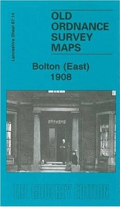
church, Rose Hill Colliery, Springfield, Haulgh Hall, canal, Craddock Lane Sidings, River Croal, Atlas Forge, Derby Street Mills, Stanley Mills, The Saviour`s church, Croal Mill, Gilnow Mill, Queen`s Park, Bolton Infirmary, St George`s church (Little Bolton), etc. On the reverse is a selection of entries from a 1918 street directory, including Bradshawgate, Churchgate, Deansgate, Great Moor Street and Victoria Square. About the Alan Godfrey Editions of the 25” OS Series:Selected towns in Great Britain and Ireland are covered by maps showing the extent of urban development in the last decades of the 19th and early 20th century. The plans have been taken from the Ordnance Survey mapping and reprinted at about 15 inches to one mile (1:4, 340). On the reverse most maps
have historical notes and many also include extracts from contemporary directories. Most maps cover about one mile (1.6kms) north/south, one and a half miles (2.4kms) across; adjoining sheets can be combined to provide wider coverage.FOR MORE INFORMATION AND A COMPLETE LIST OF ALL AVAILABLE TITLES PLEASE CLICK ON THE SERIES LINK.

Product Description
Reviews/Comments
Add New
Intelligent Comparison
Archived Product

Boston 1904 Stanfords
£3.50
Archived Product
Bolton East 1908 Stanfords
£2.95
Archived Product
Bolton East 1908 Stanfords
£3.50
Archived Product

Bolton North 1908 Stanfords
£3.50
Archived Product

Bilston 1901 Stanfords
£3.50
Archived Product
Woolton 1904 Stanfords
£2.95
Archived Product

Woolton 1904 Stanfords
£3.50
Archived Product

Bollington 1907 Stanfords
£3.50
Vouchers
No voucher codes found.
Do you know a voucher code for this product or supplier? Add it to Insights for others to use.
Do you know a voucher code for this product or supplier? Add it to Insights for others to use.
 Denmark