More From Contributor
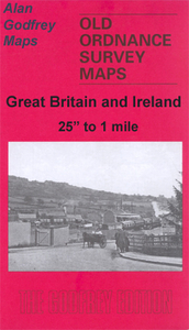
£9.99
Bolivia at 1:1, 250, 000 on an indexed, double-sided map from ITMB, with large, clear street plans of central La Paz, Potosi & Santa Cruz highlighting various places of interest & tourist facilities. The map divides the country north/south, with a generous overlap
- the area between La Paz with Cordillera Real & Cochabamba is shown on both sides. Topography is shown by altitude colouring with spot heights & names of mountain ranges. Marshes & swaps, salt pans & glaciers are marked & national parks or protected areas prominently highlighted. The map shows the country’s road & rail networks, plus local airports. Provincial administrative boundaries are marked & symbols highlight various places of interest, archaeological sites, spas, campsites & mines. Latitude & longitude lines are drawn at intervals of 1º. Each side of the map has a separate index. Clear, well presented insets show the centres of La Paz, Potosi & Sants Cruz, indicating selected tourist accommodation, places of interest & various facilities.
...
Archived Product
£11.50
Bolivia at 1:1, 300, 000on an indexed, waterproof & tear-resistant road map with topographic & tourist information, published by Reise Know-How as part of their highly acclaimed World Mapping Project. The map is double-sided to provide the best balance between a good scale & a convenient size sheet. Road & rail networks are easy to see on a clear base which presents topography by altitude colouring with contours, spot heights, glaciers, mountain passes & names of mountain ranges, geysers, salt pans & marshes. Road network indicates unsurfaced sections of main roads,

Includes::
local tracks, & gives driving distances on main & secondary roads. Ferry connections on Lake Titicaca are also marked. Internal administrative boundaries are shown with names of the provinces. National parks & protected areas are marked & symbols highlight various places of interest, including campsites & selected hotels, archaeological remains, viewpoints, thermal spas, etc. The map has a grid with latitude & longitude at intervals of 1º & an extensive index of localities which lists national parks & nature reserves separately. Map legend

Includes::
English. ” World Mapping Project” is an extensive series of maps at varying scales, aiming to provide coverage of countries & regions worldwide using clear, well presented cartography with both topographic & tourist information.


...
Archived Product
£16.99
This title is more than twice as many maps as our nearest competitor. The features include: expanded coverage of activities from mountaineering to jungle trekking including a dedicated Outdoors chapter; more off-the-beaten-track location coverage that helps readers go further; expanded volunteering information; DIY content that enables travellers to find their own adventures; discerning sleeping, eating, entertainment & tour listings for travellers on any budget; richer cultural content gives excellent insight into Bolivia's indigenous heritage; & the most comprehensive language section of any travel guide, with phrases in Spanish, Quechua & Aymara. ...
Archived Product
£14.50
Hiking maps of the Cordillera Real produced by the German & Austrian Alpine Clubs. Physical relief is shown by contours at 40m intervals, spot heights & hill-shading. Further graphics show natural terrain features e.g. rock faces, glaciers, swamps & forests. Varying grades of road are shown, including dirt tracks & footpaths. UTM coordinates are given in the margins, plus latitude & longitude ticks at 1` intervals. Map legend is in Spanish & German only. ...
Archived Product
£16.99
Topographic survey of Sweden at 1:50, 000, the Terrängkartan, from the Lantmäteriet, covering most of the country in 244 double-sided maps. Please note: the mountainous regions of central & northern Sweden are not covered by this series but presented in a separate “ Fjällkartan
- Mountain Map” series also listed on our website. Each 1:50, 000 topographic survey map covers an area of 37.5 x 40km. The maps have contours at 5 metre intervals, plus relief shading & graphics for rocky outcrops & boulders. Further graphics and/or colouring show different types of land use or vegetation (forests, arable l&, orchards, marshes, peat bogs, etc). An unusual feature of this survey is the colouring indicating buildings below or above two storeys high & “leisure/holiday homes”. The maps indicate privately maintained roads & include all other information expected of topographic survey at this scale. The maps have a 1-km UTM grid, plus latitude & longitude lines 5’ intervals. Map legend

Includes::
English. For coverage of the country’s most visited hiking areas in central & northern Sweden please see Lantmäteriet’s Mountain Map series, listed separately on our website.


...
Archived Product
£16.99
Sverigeserien is an outdoor map series consisting of 116 sheets with coverage of southern & central Sweden & the northern coastline. The map is suitable for outdoor activities such as hiking, excursions, trail running, hunting, fishing, riding, cycling, mountain biking, paddling, skating & much more. Every sheet covers an area of 45x 68km. These topographical maps in scale 1:50 000 contain all the information needed for outdoor activities: Terrain information, hiking trails, illuminated tracks, camping, shelters, golf courses, leisure baths, historical remains, roads in different categories, railway lines & much more. Easy to read topography with contour lines, vertical interval 5 m. Sverigeserien is a high-quality map series & is durable for frequent use! Updated content with map data from Lantmäteriet (National Land Survey of Sweden) & printed on Polyart which is water & tear resistant. This means that the map can be folded repeatedly without breaking & can withstand the challenging weather in Sweden during both winter & summer. Legend is in Swedish, English & German. ...
Archived Product
£16.99
Topographic survey of Sweden at 1:50, 000, the Terrängkartan, from the Lantmäteriet, covering most of the country in 244 double-sided maps. Please note: the mountainous regions of central & northern Sweden are not covered by this series but presented in a separate “ Fjällkartan
- Mountain Map” series also listed on our website. Each 1:50, 000 topographic survey map covers an area of 37.5 x 40km. The maps have contours at 5 metre intervals, plus relief shading & graphics for rocky outcrops & boulders. Further graphics and/or colouring show different types of land use or vegetation (forests, arable l&, orchards, marshes, peat bogs, etc). An unusual feature of this survey is the colouring indicating buildings below or above two storeys high & “leisure/holiday homes”. The maps indicate privately maintained roads & include all other information expected of topographic survey at this scale. The maps have a 1-km UTM grid, plus latitude & longitude lines 5’ intervals. Map legend

Includes::
English. For coverage of the country’s most visited hiking areas in central & northern Sweden please see Lantmäteriet’s Mountain Map series, listed separately on our website.


...
Archived Product
£9.99
The British Lawnmower Museum, Keith Harding`s World of Mechanical Music & Mad Jack`s Sugar Loaf. In a world of theme parks, interactive exhibits, over-priced merchandise & queues, don`t worry, these are names to stir the soul. They are reassuring evidence that there`s still somewhere to turn in search of the small, fascinating, unique &, dammit, British. In a stumbling journey across the country in search of the best we have to offer, our intrepid heroes discovered dinosaurs in South London, a cold war castle in Essex, grown men pretending to be warships in Scarborough, unexplained tunnels under Liverpool & a terraced house in Bedford being kept warm for Jesus` return. & along the way they met the people behind them all: enthusiasts, eccentrics &, you know, those who just sort of fell into looking after a vast collection of gnomes.. . Makes you proud! ...
Archived Product
£14.95
Bollywood Dreams Postcards is a collection of the best images from the very popular Bollywood Dreams publication from Spring 2003. The images include lively & dynamic images from each of the four chapters in the book, ` The Touring Cinema`, ` The Set`, ` The Characters` & ` The Screening`, & show of a broad spectrum of the world-famous Bollywood industry. The images show: portraits of actors in costume & on the set; the touring cinema; action sequences; dances; devoted fans queuing up & in the movie theatres; the projectionists; images of Bollywood posters on the streets & in production. In Bollywood Dreams photographer Jonathan Torgovnik explores the beloved pastime of an Indian population of over 1 billion. As the largest film producer in the world with more than 800 films made each year, the Indian movie industry is a cultural phenomenon. Paying tribute to the stars, filmmakers, technicians & moviegoers who make this possible, Bollywood Dreams puts a human face on the fantastical, spectacle-rich films that compel more than 14 million people to the cinema on a single day in India. Bollywood Dreams is both a behind-the-scenes personal diary of the magic & contagious excitement of Indian film & a discerning photo-essay on the film industry`s profound impact on Indian society. Singular in its conception, this book is unique in the way it introduces the general audience to the profound & spectacular way that Bollywood permeates everyday life in India. In this way Torgovnik`s Bollywood Dreams stands as an important testament to the power of cinema in the twentieth century as both entertainment & social phenomenon. Deriving its name from its American equivalent, Bollywood is the highly successful Indian movie industry predominantly based in Bombay & Madras. Every day more than 14 million people go to the cinema across India to watch films produced by this massive & powerful industry. In India, movies are not just a form of entertainment, it is practically a religion. Streets in major Indian cities are lined with colourful posters of Indian movies & their stars. Movie stars are treated like demi-gods, no match even for American standards of celebrity obsession. More than any other cultural or political institution of the 20th century, the cinema has captured the hearts & minds of India`s growing population of almost one billion even against the stark backdrop of the vast country`s struggle with poverty & hunger & often tense Muslim-Hindu relations. The experience of actually going to the movies in India is as much a part of the Bollywood phenomenon as are the stars themselves & Bollywood Dreams documents this important aspect of understanding the important role Bollywood plays in contemporary Indian culture. ” Going to the cinema, ” Torgovnik says ”is about going to see the actors larger-than-life. It is about living the glamorous life for a few hours & leaving your daily hardships behind.” Once inside the movie theatres, the audience can expect at least three hours of entertainment including several song & dance numbers, love scenes, action sequences, & most surely a happy ending. Each film

Includes::
the necessary ingredients for success: action, violence, music, dance, romance, & morals. The themes of the movies are often social issues like communalism, ethnicity, religion, & caste, & the movie theatres themselves are often fill of lively interaction between viewer & star. Cheers & boos pervade the atmosphere: the audience becomes a part of the film, & likewise, the film becomes a part of them. Bollywood Dreams begins with a vignette of the touring caravans that bring Bollywood on the big screen to India`s villages in portable tents. We then follow the Indian film from its creation on the movie set, to the larger-than-life stars, directors, & character actors, to the editing chamber, to the city streets where ubiquitous promotional posters abound, & finally, to the multitude of movie theatres that abound in India.

...
Archived Product
£19.95
On the streets of the vibrant & anarchic city of Mumbai, the film poster is a familiar splash of colour. It is an invitation to the pleasures of Bollywood, the worlds largest film industry. This most democratic of art forms meets one of the worlds most exciting cinema industries & the result is an explosion of colour, form & typography. Bollywoods film posters have had a long & glorious history that is only now being recognized & noted, & is brilliantly celebrated here in this lavish volume. Bollywood Posters is a must-have for film buffs, graphic designers & art-lovers. ...
Archived Product

Bollington 1907

Bollington in 1907 in a fascinating series of reproductions of old Ordnance Survey plans in the Alan Godfrey Editions, ideal for anyone interested in the history of their neighbourhood or family. The map covers the village of Bollington, stretching from the railway station eastward to High Cliff and Ingersley Hall. Features include the village centre, St John`s church, Oak Bank Print Works, Lower Mill, Clarence Mill, River Dean, iron foundry, Waterhouse Mills, Adelphi Mill, Sowcar, etc. Coverage extends south to Kerridge and Gag Quarry. Other features include Waulkmill, Ingersley Vale Bleach Works, Rainow Mill, Ingersley Hall, Hollin Hall, Hurst Quarry etc. On the reverse is an 1896 directory of Bollington.About the Alan Godfrey Editions of the 25” OS Series:Selected
towns in Great Britain and Ireland are covered by maps showing the extent of urban development in the last decades of the 19th and early 20th century. The plans have been taken from the Ordnance Survey mapping and reprinted at about 15 inches to one mile (1:4, 340). On the reverse most maps have historical notes and many also include extracts from contemporary directories. Most maps cover about one mile (1.6kms) north/south, one and a half miles (2.4kms) across; adjoining sheets can be combined to provide wider coverage.FOR MORE INFORMATION AND A COMPLETE LIST OF ALL AVAILABLE TITLES PLEASE CLICK ON THE SERIES LINK.
RIP - This product is no longer available on our network. It was last seen on 25.09.2019

This page now acts as a permanent archive for this product. Add more information using the comments box below to ensure it can still be found by future generations.

Use our search facility to see if it is available from an alternative contributor.
  • External links may include paid for promotion
  • Availability: Out Of Stock
  • Supplier: Stanfords
  • SKU: 9781841517773
Availability: In Stock
£3.50

Product Description

Bollington in 1907 in a fascinating series of reproductions of old Ordnance Survey plans in the Alan Godfrey Editions, ideal for anyone interested in the history of their neighbourhood or family. The map covers the village of Bollington, stretching from the railway station eastward to High Cliff & Ingersley Hall. Features include the village centre, St John`s church, Oak Bank Print Works, Lower Mill, Clarence Mill, River Dean, iron foundry, Waterhouse Mills, Adelphi Mill, Sowcar, etc. Coverage extends south to Kerridge & Gag Quarry. Other features include Waulkmill, Ingersley Vale Bleach Works, Rainow Mill, Ingersley Hall, Hollin Hall, Hurst Quarry etc. On the reverse is an 1896 directory of Bollington. About the Alan Godfrey Editions of the 25” OS Series: Selected towns in Great Britain & Ireland are covered by maps showing the extent of urban development in the last decades of the 19th & early 20th century. The plans have been taken from the Ordnance Survey mapping & reprinted at about 15 inches to one mile (1:4, 340). On the reverse most maps have historical notes & many also include extracts from contemporary directories. Most maps cover about one mile (1.6kms) north/south, one & a half miles (2.4kms) across; adjoining sheets can be combined to provide wider coverage.FOR MORE INFORMATION & A COMPLETE LIST OF ALL AVAILABLE TITLES PLEASE CLICK ON THE SERIES LINK.

Reviews/Comments

Add New

Price History

Vouchers

No voucher codes found.
Do you know a voucher code for this product or supplier? Add it to Insights for others to use.

Facebook

Jargon Buster

Contemporary - Modern era design
Contemporary - A design reference to indicate post war modern design
iron - An electrical deviced used for removing creases from fabrics
iron - A chemical element (FE). The most common element on earth
History - Anything that happens in the past. An acedemic subject.
Contemporary - An object that is living in the same time.
Mill - A building which can grind grain into flour.
Hall - A room at the inside of an entrance of a house.
Oak - A member of the beech tree family that has acorns growing on it.
Ideal - Something that satisfies a perfect criteria.
Print - A mechanical process of putting text onto paper. It can also relate to a pattern on an item.
Family - A group of people that live together made up from parents and children.

Supplier Information

Stanfords
Stanfords was established in 1853 and opened their iconic Covent Garden flagship store in 1901. They have become the top retailer of maps, travel books and accessories in the UK and arguably offer the largest selection of maps and travel books worldwide. Famous names such as Captain Robert Falcon Scott, Ranulph Fiennes and Michael Palin have purchased from Stanfords. They now have a shop in Bristol and both stores together with other venues operate a calendar of events including talks, book signings and exhibitions. As a specialist map retailer, the map selection is comprehensive and includes road maps, street maps and walking maps from worldwide destinations, as well as a selection of world atlases and wall maps. Books include travel guides and travel literature. Stanfords also stock globes, from miniatures made of blue marble to magnificent floor-standing globes. The website features a selection of interesting articles on travel topics.
Page Updated: 2023-11-12 20:15:36

Community Generated Product Tags

Oh No! The productWIKI community hasn't generated any tags for this product yet!
Menu