More From Contributor
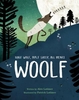
£3.50
Woodley in 1897 in a fascinating series of reproductions of old Ordnance Survey plans in the Alan Godfrey Editions, ideal for anyone interested in the history of their neighbourhood or family. The map covers the eastern part of Bredbury, stretching from Butterhouse Green & Woodley eastward to Greavefold. Features include Victoria Works, St Mark`s church, Butterhouse Green area, stretch of Peak Forest Canal, Cheshire Lines Railway & Sheffield & Midland Joint Railway with Woodley Junction station, Heald Wood, Greavefold with Holy Innocents church, Botany Mill, Wood Mill, Manor House, etc. An 1896 directory of Bredbury is on the reverse. About the Alan Godfrey Editions of the 25” OS Series: Selected towns in Great Britain & Ireland are covered by maps showing the extent of urban development in the last decades of the 19th & early 20th century. The plans have been taken from the Ordnance Survey mapping & reprinted at about 15 inches to one mile (1:4, 340). On the reverse most maps have historical notes & many also include extracts from contemporary directories. Most maps cover about one mile (1.6kms) north/south, one & a half miles (2.4kms) across; adjoining sheets can be combined to provide wider coverage.FOR MORE INFORMATION & A COMPLETE LIST OF ALL AVAILABLE TITLES PLEASE CLICK ON THE SERIES LINK. ...
Archived Product
£10.99
” Woods etc.” is Alice Oswald`s third collection of poems, & follows the success of her widely acclaimed river-poem ” Dart”, which was awarded the T. S. Eliot Prize in 2002. Extending the concerns of ” Dart” & written over a period of several years, these poems combine abrupt honesty with an exuberant rhetorical confidence, at times recalling the oral & anonymous tradition with which they share such affinity. ...
Archived Product
£20.00
A tribute to the natural history of some of our most iconic British woods. The National Trust manages hundreds of woods, covering over 60, 000 acres of England & Wales. They include many of the oldest woodlands in the land & some of the oldest living things of any kind
- trees that are thousands of years old. From Dean to Epping, from Hatfield to Sherwood, this book covers the natural history of our forests & how they have changed the face of our landscape. Covering the different species of trees that give our woods their unique characters, the plants & animals that inhabit them & the way their appearance changes throughout the seasons, Woods is a fascinating & beautifully illustrated celebration of Britain`s trees & the ancient stories that surround them.
...
Archived Product
£14.99
Ben Law has lived as a woodsman in Prickly Nut Wood for over 20 years. His authentic, incredible sense of the land & the wildlife, ...
Archived Product
£3.50
Woodstock & Blenheim Palace in 1919 in a fascinating series of reproductions of old Ordnance Survey plans in the Alan Godfrey Editions, ideal for anyone interested in the history of their neighbourhood or family. The map covers the town of Woodstock, together with Blenheim Palace & much of Blenheim Park & Lower Park. Features in the town include railway station, Woodstock Union Workhouse, St Mary`s church, Woodstock House, Oxford Street, High Street, Market Street, Hensington House, Hensington Within. Blenheim Palace is shown further to the south west, with The Lake, Queen Pool, Column of Victory, Fair Rosamond`s Well, & many avenues etc. The borough of New Woodstock was founded by Henry II who visited Woodstock Park to meet his lover Rosamund Clifford, ` Fair Rosamund`. One of Donizetti`s loveliest operas, Rosmonda d` Inghilterra, is set in Woodstock Park & other composers were also drawn to the tale. So was the GWR, for the branch line`s engine was called Fair Rosamund. Blenheim Palace was built by Vanbrugh for John Churchill, 1st Duke of Marlborough. The map

Includes::
a directory of Woodstock in 1899 plus a timetable for the railway branch About the Alan Godfrey Editions of the 25” OS Series: Selected towns in Great Britain & Ireland are covered by maps showing the extent of urban development in the last decades of the 19th & early 20th century. The plans have been taken from the Ordnance Survey mapping & reprinted at about 15 inches to one mile (1:4, 340). On the reverse most maps have historical notes & many also include extracts from contemporary directories. Most maps cover about one mile (1.6kms) north/south, one & a half miles (2.4kms) across; adjoining sheets can be combined to provide wider coverage.FOR MORE INFORMATION & A COMPLETE LIST OF ALL AVAILABLE TITLES PLEASE CLICK ON THE SERIES LINK.

...
Archived Product
£6.99
A wolf & a sheep fall in love. They have a son that they call Woolf
- he`s half wolf, half woolly sheep! This is Woolf`s story.
...
Archived Product
£2.95
Woolton in 1904 in a fascinating series of reproductions of old Ordnance Survey plans in the Alan Godfrey Editions, ideal for anyone interested in the history of their neighbourhood or family. Selected towns in Great Britain & Ireland are covered by maps showing the extent of urban development in the last decades of the 19th & early 20th century. In this title: the map covers the village of Woolton, south-east of Liverpool, with part of Allerton, Coverage stretches from Allerton Road eastward to Halewood Road, & from Woolton Park southward to Doe Park. The village centre of Woolton is central to the map & features here include St Peter's church, St Mary's RC church, Woolton Quarries, gas works, Woolton Heyes, & houses neatly delineated, including several named villas. Outside the village centre features include Woolton Hall Hydro, Liverpool Convalescent Institution, Woolton Grange, Gateacre Nurseries, Allerton Tower, Allerton Priory, Fletcher's Farm, Allerton (house), etc. On the reverse are street directory entries for Allerton Road, Woolton High Street, Woolton Street. About the Alan Godfrey Editions of the 25 ...
Archived Product
£3.50
Woolton in 1904 in a fascinating series of reproductions of old Ordnance Survey plans in the Alan Godfrey Editions, ideal for anyone interested in the history of their neighbourhood or family. The map covers the village of Woolton, south-east of Liverpool, with part of Allerton, Coverage stretches from Allerton Road eastward to Halewood Road, & from Woolton Park southward to Doe Park. The village centre of Woolton is central to the map & features here include St Peter`s church, St Mary`s RC church, Woolton Quarries, gas works, Woolton Heyes, etc. Outside the village centre features include Woolton Hall Hydro, Liverpool Convalescent Institution, Woolton Grange, Gateacre Nurseries, Allerton Tower, Allerton Priory, Fletcher`s Farm, Allerton (house), etc. On the reverse are street directory entries for Allerton Road, Woolton High Street & Woolton Street. About the Alan Godfrey Editions of the 25” OS Series: Selected towns in Great Britain & Ireland are covered by maps showing the extent of urban development in the last decades of the 19th & early 20th century. The plans have been taken from the Ordnance Survey mapping & reprinted at about 15 inches to one mile (1:4, 340). On the reverse most maps have historical notes & many also include extracts from contemporary directories. Most maps cover about one mile (1.6kms) north/south, one & a half miles (2.4kms) across; adjoining sheets can be combined to provide wider coverage.FOR MORE INFORMATION & A COMPLETE LIST OF ALL AVAILABLE TITLES PLEASE CLICK ON THE SERIES LINK. ...
Archived Product
£3.50
Woolwich in 1866 in a fascinating series of reproductions of old Ordnance Survey plans in the Alan Godfrey Editions, ideal for anyone interested in the history of their neighbourhood or family. Three versions for this area have been published, stretching from Maryon Road & Wood Street eastward to Earl Street & Waverley Road, & from St Mary`s church & Powis Street southward to Woolwich Common & Nightingale Vale. The map covers the centre of Woolwich, the area around the Royal Artillery Barracks, & west Plumstead. Please note that the Dockyard & Royal Arsenal areas were left blank for security reasons. Features include Red Barracks, Cambridge Barracks, Royal Artillery Barracks, Royal Military Repository, Charlton Cemetery, Grand Depot Barracks, both Woolwich stations, tramways, St George`s church, St Margaret`s Plumstead church, Burrage Town, Brookhill Park, Barrack Field, Naval Hospital, Royal Marine Barracks, etc. The 1866 map has on the reverse Sheet 11 of the 10 foot plans of Woolwich, showing Powis Street in tremendous & attractive detail, even including features such as garden layouts. About the Alan Godfrey Editions of the 25” OS Series: Selected towns in Great Britain & Ireland are covered by maps showing the extent of urban development in the last decades of the 19th & early 20th century. The plans have been taken from the Ordnance Survey mapping & reprinted at about 15 inches to one mile (1:4, 340). On the reverse most maps have historical notes & many also include extracts from contemporary directories. Most maps cover about one mile (1.6kms) north/south, one & a half miles (2.4kms) across; adjoining sheets can be combined to provide wider coverage.FOR MORE INFORMATION & A COMPLETE LIST OF ALL AVAILABLE TITLES PLEASE CLICK ON THE SERIES LINK. ...
Archived Product
£3.50
Woolwich in 1894 in a fascinating series of reproductions of old Ordnance Survey plans in the Alan Godfrey Editions, ideal for anyone interested in the history of their neighbourhood or family. Three versions for this area have been published, stretching from Maryon Road & Wood Street eastward to Earl Street & Waverley Road, & from St Mary`s church & Powis Street southward to Woolwich Common & Nightingale Vale. The map covers the centre of Woolwich, the area around the Royal Artillery Barracks, & west Plumstead. Please note that the Dockyard & Royal Arsenal areas were left blank for security reasons. Features include Red Barracks, Cambridge Barracks, Royal Artillery Barracks, Royal Military Repository, Charlton Cemetery, Grand Depot Barracks, both Woolwich stations, tramways, St George`s church, St Margaret`s Plumstead church, Burrage Town, Brookhill Park, Barrack Field, Naval Hospital, Royal Marine Barracks, etc. Street directory entries are on the 1894 map include Burrage Road, Herbert Road, New Road, Plumstead Common Road, Powis Street & Wellington Street. About the Alan Godfrey Editions of the 25” OS Series: Selected towns in Great Britain & Ireland are covered by maps showing the extent of urban development in the last decades of the 19th & early 20th century. The plans have been taken from the Ordnance Survey mapping & reprinted at about 15 inches to one mile (1:4, 340). On the reverse most maps have historical notes & many also include extracts from contemporary directories. Most maps cover about one mile (1.6kms) north/south, one & a half miles (2.4kms) across; adjoining sheets can be combined to provide wider coverage.FOR MORE INFORMATION & A COMPLETE LIST OF ALL AVAILABLE TITLES PLEASE CLICK ON THE SERIES LINK. ...
Archived Product

Wool

The next Hunger Games' The Sunday Times. 'Well written, tense, and immensely satisfying, Wool will be considered a classic for many years in the future.' WIRED. 'Thrilling, thought-provoking and memorable.. .one of dystopian fiction's masterpieces alongside the likes of 1984 and Brave New World.' Daily Express. 'Howey's Wool is an epic feat of imagination. You will live in this world.' Justin Cronin. 'Wool is frightening, fascinating, and addictive. In one word, terrific.' Kathy Reichs. In a ruined and hostile landscape, in a future few have been unlucky enough to survive, a community exists in a giant underground silo. Inside, men and women live an enclosed life full of rules and regulations, of secrets and lies. To live, you must follow the rules. But some don't. These are
the dangerous ones; these are the people who dare to hope and dream, and who infect others with their optimism. Their punishment is simple and deadly. They are allowed outside. Jules is one of these people. She may well be the last.
RIP - This product is no longer available on our network. It was last seen on 25.09.2019

This page now acts as a permanent archive for this product. Add more information using the comments box below to ensure it can still be found by future generations.

Use our search facility to see if it is available from an alternative contributor.
  • Availability: Out Of Stock
  • Supplier: Stanfords
  • SKU: 9781780891231
Availability: In Stock
£9.99

Product Description

The next Hunger Games' The Sunday Times. ' Well written, tense, & immensely satisfying, Wool will be considered a classic for many years in the future.' WIRED. ' Thrilling, thought-provoking & memorable.. .one of dystopian fiction's masterpieces alongside the likes of 1984 & Brave New World.' Daily Express. ' Howey's Wool is an epic feat of imagination. You will live in this world.' Justin Cronin. ' Wool is frightening, fascinating, & addictive. In one word, terrific.' Kathy Reichs. In a ruined & hostile landscape, in a future few have been unlucky enough to survive, a community exists in a giant underground silo. Inside, men & women live an enclosed life full of rules & regulations, of secrets & lies. To live, you must follow the rules. But some don't. These are the dangerous ones; these are the people who dare to hope & dream, & who infect others with their optimism. Their punishment is simple & deadly. They are allowed outside. Jules is one of these people. She may well be the last.

Reviews/Comments

Add New

Intelligent Comparison

Oooops!
We couldn't find anything!
Perhaps this product's unique.... Or perhaps we are still looking for comparisons!
Click to bump this page and we'll hurry up.

Price History

Vouchers

No voucher codes found.
Do you know a voucher code for this product or supplier? Add it to Insights for others to use.

Facebook

Jargon Buster

Wool - A natural fibre from Sheep
World - A physical grouping, commonly used to describe earth and everything associated with ti
Satisfying - A feeling of pleasure and fulfilment.
Simple - Basic, easy no difficulty in understanding.
Classic - Something that is still like it was originally a high quality standard.

Supplier Information

Stanfords
Stanfords was established in 1853 and opened their iconic Covent Garden flagship store in 1901. They have become the top retailer of maps, travel books and accessories in the UK and arguably offer the largest selection of maps and travel books worldwide. Famous names such as Captain Robert Falcon Scott, Ranulph Fiennes and Michael Palin have purchased from Stanfords. They now have a shop in Bristol and both stores together with other venues operate a calendar of events including talks, book signings and exhibitions. As a specialist map retailer, the map selection is comprehensive and includes road maps, street maps and walking maps from worldwide destinations, as well as a selection of world atlases and wall maps. Books include travel guides and travel literature. Stanfords also stock globes, from miniatures made of blue marble to magnificent floor-standing globes. The website features a selection of interesting articles on travel topics.
Page Updated: 2023-11-12 20:15:36

Community Generated Product Tags

Oh No! The productWIKI community hasn't generated any tags for this product yet!
Menu