
 United Kingdom
 France
 Germany
 Netherlands
 Sweden
 USA
USA
 Italy
Italy
 Spain
Spain
More From Contributor

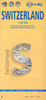

Switzerland Big Travel Map
Switzerland at 1:200, 000 on a detailed, indexed touring map from Hallwag, with large clear print and presenting the country on two separate double-sided maps in a convenient concertina size, easy to use when travelling.Nesting under one cover are two separate maps, each only 50 cm wide and folded in a handy concertina format - easy to open and view when travelling in a car or by public transport. The country is presented on them divided into four overlapping panels. The cartography is an enlargement of Hallwag’s mapping of the country used in their Distoguide version, enlarged here to 1:200, 000, so with large, easy to read print. Detailed road network shows toll roads, restricted or prohibited roads, opening months of mountain passes, motorway facilities, etc. Railway
network includes mountain railways, cable cars and chair lifts, etc. Symbols indicate places of interest and various facilities including secluded hotels, campsites, youth hostels, sport and recreational facilities, etc. Topography is presented by relief shading with plenty of names of mountain chains, peaks passes, valleys, etc. The map has latitude lines at intervals of 10’ and longitude at 15’. Map legend includes English. The index is in a separate 45-page booklet, lists locations with postcodes and access to public transport and sport facilities, and includes separate lists rivers and lakes, mountain passes, natural curiosities, excursion points, etc. The booklet also provides enlargements showing road access to Basel, Bern, Biel/Bienne, Geneva, Lausanne,
Lucerne, Lugano, St. Gallen and Zurich. Additionally, on the map panels are: an overview map of Switzerland with the network of motorways and main roads for route planning, an administrative map with division into cantons, a map showing mountain passes, a distance table, plus driving regulations and other useful tourist information.
Product Description
Reviews/Comments
Add New
Intelligent Comparison
Archived Product

Switzerland Insight Travel Map Stanfords
£6.99
Archived Product
Switzerland Administrative Map Stanfords
£12.50
Archived Product

Netherlands Insight Travel Map Stanfords
£6.99
Archived Product
Switzerland Cycling Map Stanfords
£19.99
Archived Product

Ireland Insight Travel Map Stanfords
£6.99
Archived Product
Switzerland Traveler Guide Stanfords
£19.99
Archived Product

Iceland Insight Travel Map Stanfords
£6.99
Archived Product
Switzerland Physical Wall Map Stanfords
£47.95
Vouchers
No voucher codes found.
Do you know a voucher code for this product or supplier? Add it to Insights for others to use.
Do you know a voucher code for this product or supplier? Add it to Insights for others to use.
 Denmark