
 United Kingdom
 France
 Germany
 Netherlands
 Sweden
 USA
USA
 Italy
Italy
 Spain
Spain
More From Contributor

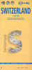
Switzerland ACS Road Map 2018
Road map of Switzerland at 1:275, 000 from the country’s Automobile Club, with index on the reverse, town centre street plans of 10 main cities, a distance table, plus a list of road tunnels. This title is one of two road maps published by Kümmerly + Frey for Switzerland’s two motoring organizations: the Automobile Club (ACS) and the Touring Club (TCS).Both maps show the same, very detailed road information, including toll roads, restricted or prohibited roads, opening months of mountain passes, etc. Railway network includes mountain railways, cable cars and chair lifts, etc. Names of picturesque localities are highlighted and symbols indicate other places of interest and various facilities. Only the TCS map shows latitude and longitude at 15’ intervals. Both map legends
include English.The ACS map (this title) at 1:275, 000, lighter and easier to handle, includes on the reverse an index of towns and villages, street plans of 10 main cities, a distance table, and a list of road tunnels. The street plans show Basle, Bern, Geneva, Lausanne, Locarno, Lugano, Lucerne, St. Gallen, Winterthur, and Zurich.The alternative TCS version at 1:301, 000 is surrounded by transit maps showing main through roads in Basel, Bern, Biel/Bienne, Fribourg/Freiburg Geneva, Lausanne, Locarno, Lugano, Lucerne, Neuchâtel, St. Gallen, Winterthur and Zurich. Its index is in a separate booklet attached to the map cover and includes geographical features such as mountains, mountain passes, lakes and rivers, as well as road tunnels, places of interest, etc.
The booklet also includes plenty of additional in information: all motorway services areas listing the facilities available there, car parks in the main cities, TCS camping sites, small maps of the country highlighting theme parks, zoos, museums, natural curiosities, etc.
Product Description
Reviews/Comments
Add New
Vouchers
No voucher codes found.
Do you know a voucher code for this product or supplier? Add it to Insights for others to use.
Do you know a voucher code for this product or supplier? Add it to Insights for others to use.
 Denmark