More From Contributor

£13.50
Switzerland on a large, double-sided map at 1:275, 000 from the Swiss Hallwag/Kümmerly + Frey cartographic house, printed on durable, waterproof & tear-resistant synthetic paper & highlighting the country’s 100 best sights, each with a brief description & a photo. The map is double-sided with a generous overlap between the sides; Interlaken & the main peaks of the Bernese Oberland are included on both sides. Road network, with small local roads & selected country tracks, is clearly laid out on a base showing topography by relief shading with plenty of names of mountain ranges, peaks, passes, etc. Motorway junctions are named & numbered, & the map shows sections due to open in 2015 & 2016. Also indicated are toll roads, roads open according to timetable, roads closed to motorized traffic, steep gradients, locations of SOS phones, & opening months of mountain passes. Scenic routes are highlighted & driving distances are marked on main & secondary routes. The map has no geographical coordinates but is indexed. Symbols indicate various facilities & places of interest, including campsites & youth hostels. Switzerland’s 100 best tourist sights are prominently highlighted & cross-referenced to brief descriptions & photos surrounding the map. Map legend & the text include English. PLEASE NOTE: unlike on most country road maps, coverage here does not extend beyond Switzerland’s international borders; border closings are marked but with only minimal coverage beyond them. ...
Archived Product
£12.99
Switzerland at 1:500, 000 with excellent shading & graphic relief for which the Swiss survey organization is renowned providing an overview of the country’s topography, clearly showing the valleys with their names & the mountain ridges with peaks & spot heights. Roads are classified according to their width, railway lines are shown with main tunnels, & mountain cable car lines are marked. Towns & villages classified according to the number of inhabitants. The map shows Swiss national grid lines & has margin ticks for latitude & longitude at 30’ intervals. There is no index. Map legend is in French, German & Italian only. An inset shows the division of the country into cantons. In view of the very large amount of detail shown on it, the map is more suitable for reference & general planning rather than for navigating whilst driving. ...
Archived Product
£11.99
Road map of Switzerland at 1:275, 000 from the country’s Automobile Club, with index on the reverse, town centre street plans of 10 main cities, a distance table, plus a list of road tunnels. This title is one of two road maps published by Kümmerly + Frey for Switzerland’s two motoring organizations: the Automobile Club (ACS) & the Touring Club (TCS). Both maps show the same, very detailed road information, including toll roads, restricted or prohibited roads, opening months of mountain passes, etc. Railway network

Includes::
mountain railways, cable cars & chair lifts, etc. Names of picturesque localities are highlighted & symbols indicate other places of interest & various facilities. Only the TCS map shows latitude & longitude at 15’ intervals. Both map legends include English. The ACS map (this title) at 1:275, 000, lighter & easier to handle,

Includes::
on the reverse an index of towns & villages, street plans of 10 main cities, a distance table, & a list of road tunnels. The street plans show Basle, Bern, Geneva, Lausanne, Locarno, Lugano, Lucerne, St. Gallen, Winterthur, & Zurich. The alternative TCS version at 1:301, 000 is surrounded by transit maps showing main through roads in Basel, Bern, Biel/ Bienne, Fribourg/ Freiburg Geneva, Lausanne, Locarno, Lugano, Lucerne, Neuchâtel, St. Gallen, Winterthur & Zurich. Its index is in a separate booklet attached to the map cover &

Includes::
geographical features such as mountains, mountain passes, lakes & rivers, as well as road tunnels, places of interest, etc. The booklet also

Includes::
plenty of additional in information: all motorway services areas listing the facilities available there, car parks in the main cities, TCS camping sites, small maps of the country highlighting theme parks, zoos, museums, natural curiosities, etc.


...
Archived Product
£14.50
Activity Map of Switzerland from Kümmerly + Frey on light, waterproof & tear-resistant plastic paper, highlighting national & regional long-distance hiking, cycling, mountain biking, roller skating & canoeing routes, plus rafting sites. The map provides essential information for anyone planning an outdoor leisure holiday in Switzerl&, with its extensive overprint distinguishing between the national & the regional routes, all shown with their official numbers. The publishers’ road map of the country used as a base has relief shading to show the topography, with plenty of names of mountain ranges, peaks, glaciers, valleys, etc. The map has latitude & longitude lines drawn at 10’ & 15’ respectively. Map legend

Includes::
English. On the reverse is an index showing all the localities with postcodes, plus a list of all the national & regional hiking, cycling, mountain biking, roller skating & canoeing routes highlighted on the map.

...
Archived Product
£14.95
A very large sheet with an attractive & informative combination of two maps: administrative & postcode. On one side is an administrative map of the country, with a road map as its base. The map has plenty of geographical information: names of valleys, rivers, lakes, & glaciers, plus spot heights for numerous peaks. Each canton is shown in a different colour & subdivided into districts. Around the map are information panels giving essential facts about each canton: date of joining the Swiss Confederation, area, population, population density, number of districts & communes, & the highest & lowest points. A separate booklet attached to the cover provides an index which also

Includes::
lists of mountains, rives, lakes, mountain passes, etc. On the reverse side is a postcode map of Switzerl&, with its base map showing both roads & the full rail network, including mountain railways, cable car lines, & chair lifts. Names of all towns & villages are annotated with their post codes, & are also listed in an index placed around the map. Map legends are in French, German, Italian & Romansh only.

...
Archived Product
£15.50
Switzerland at 1:200, 000 on a detailed, indexed touring map from Hallwag, with large clear print & presenting the country on two separate double-sided maps in a convenient concertina size, easy to use when travelling. Nesting under one cover are two separate maps, each only 50 cm wide & folded in a handy concertina format
- easy to open & view when travelling in a car or by public transport. The country is presented on them divided into four overlapping panels. The cartography is an enlargement of Hallwag’s mapping of the country used in their Distoguide version, enlarged here to 1:200, 000, so with large, easy to read print. Detailed road network shows toll roads, restricted or prohibited roads, opening months of mountain passes, motorway facilities, etc. Railway network

Includes::
mountain railways, cable cars & chair lifts, etc. Symbols indicate places of interest & various facilities including secluded hotels, campsites, youth hostels, sport & recreational facilities, etc. Topography is presented by relief shading with plenty of names of mountain chains, peaks passes, valleys, etc. The map has latitude lines at intervals of 10’ & longitude at 15’. Map legend

Includes::
English. The index is in a separate 45-page booklet, lists locations with postcodes & access to public transport & sport facilities, &

Includes::
separate lists rivers & lakes, mountain passes, natural curiosities, excursion points, etc. The booklet also provides enlargements showing road access to Basel, Bern, Biel/ Bienne, Geneva, Lausanne, Lucerne, Lugano, St. Gallen & Zurich. in addition, on the map panels are: an overview map of Switzerland with the network of motorways & main roads for route planning, an administrative map with division into cantons, a map showing mountain passes, a distance table, plus driving regulations & other useful tourist information.


...
Archived Product
£9.99
Laminated & waterproof, double-sided, indexed road map of Switzerl&, with an inset showing the cantons. Relief shading with names of Alpine ranges & numerous peaks with heights shows the country’s topography. Mountain passes indicate seasonal closures. Road network shows roads closed to motorized traffic, tolls & motorway services. Railways & ferry connections on the main lakes are marked (although the railway lines are not always easy to see against the background). The map highlights town & villages worth visiting & various interesting sights. No geographical coordinates are provided. Also included is an administrative map showing the division of Switzerland into cantons & information on the country’s climate. Multilingual map legend

Includes::
English.

...
Archived Product
£4.99
The railway lines of Switzerland hum with superlatives: the world`s steepest line, the longest metric gauge tunnel, the highest station -- & the slowest Express train. Managed with efficiency, keeping time with the precision of a Swiss watch, the trains transport you effortlessly into the heart of the most spectacular Alpine landscape, through vineyards & green pastures, over breathtaking curving viaducts, past sparkling lakes & glaciers, down into the valleys & high up to the peaks. Now with an additional 36 pages, including more detailed description of items such as the Golden Pass, 3 new maps, & new features such as the Lake of Lucerne, Furka steam train, & medicinal herbs. ...
Archived Product
£33.95
Eastern Switzerland & the neighbouring regions on a Castles Map at 1:200, 000 published by Swisstopo in cooperation with the Swiss Society of Castles, including a booklet with an extensive index plus enlargements and/or street plans of particularly interesting areas. Swisstopo’s two Castle Maps highlight locations of numerous castles, fortified medieval towns, fortified churches & bridges, battlefields, Roman remains, etc, both within Switzerland & in the adjoining areas of the neighbouring countries. The base is the Swiss Survey’s road map with relief shading & spot heights plus colouring for forested areas. Also shown are the rail network with stations & the country’s administrative boundaries. The maps are overprinted with the Swiss national grid & have legends in German, French & Italian only. Each map comes in a plastic wallet, accompanied by a thick booklet listing all the monuments alphabetically by canton within Switzerland & departments/regions abroad. Information about each place is given in the main language of the locality. The booklet also

Includes::
enlargements & town plans showing in greater detail particularly interesting areas.

...
Archived Product
£33.95
Western Switzerland & the neighbouring regions on a Castles Map at 1:200, 000 published by Swisstopo in cooperation with the Swiss Society of Castles, including a booklet with an extensive index plus enlargements and/or street plans of Aarau, Basel & the north-western corner of Switzerl&, Berne, Fribourg, Geneva plus its environs, the coast of Lake Geneva around Gland & Rolle, Lausanne, Murten, Neuchâtel, Rheinfelden, Sierre, Sion, Solothurn & Thun, Swisstopo’s two Castle Maps highlight locations of numerous castles, fortified medieval towns, fortified churches & bridges, battlefields, Roman remains, etc, both within Switzerland & in the adjoining areas of the neighbouring countries. The base is the Swiss Survey’s road map with relief shading & spot heights plus colouring for forested areas. Also shown are the rail network with stations & the country’s administrative boundaries. The maps are overprinted with the Swiss national grid & have legends in German, French & Italian only. Each map comes in a plastic wallet, accompanied by a thick booklet listing all the monuments alphabetically by canton within Switzerland & departments/regions abroad. Information about each place is given in the main language of the locality. The booklet also

Includes::
enlargements & town plans showing in greater detail particularly interesting areas as listed above.

...
Archived Product

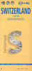
Switzerland Administrative Map

General road map of Switzerland with cantons in pleasant pastel colours. Names and boundaries of districts into which each canton is subdivided are also shown. Panels surrounding the map give details of each canton: area, number of inhabitants, population density, number of districts and communes, date of joining the Swiss Fereration, etc. Map legend is in French, German, Italian, and Romansch only.
RIP - This product is no longer available on our network. It was last seen on 25.09.2019

This page now acts as a permanent archive for this product. Add more information using the comments box below to ensure it can still be found by future generations.

Use our search facility to see if it is available from an alternative contributor.
  • External links may include paid for promotion
  • Availability: Out Of Stock
  • Supplier: Stanfords
  • SKU: 9783828301016
Availability: In Stock
£12.50

Product Description

General road map of Switzerland with cantons in pleasant pastel colours. Names & boundaries of districts into which each canton is subdivided are also shown. Panels surrounding the map give details of each canton: area, number of inhabitants, population density, number of districts & communes, date of joining the Swiss Fereration, etc. Map legend is in French, German, Italian, & Romansch only.

Reviews/Comments

Add New

Price History

Vouchers

No voucher codes found.
Do you know a voucher code for this product or supplier? Add it to Insights for others to use.

Facebook

Jargon Buster

Italian - A word used ot descibe something from Italy
Date - A day on a calendar
Date - A social activity whith a current or potential partner
swiss - Short for Switzerland, one of the richest countries in the world
switzerland - A landlocked country in western Europe. One of the richest countries in the world
Road - a manmade lane or a path that is used to speed up travel.

Supplier Information

Stanfords
Stanfords was established in 1853 and opened their iconic Covent Garden flagship store in 1901. They have become the top retailer of maps, travel books and accessories in the UK and arguably offer the largest selection of maps and travel books worldwide. Famous names such as Captain Robert Falcon Scott, Ranulph Fiennes and Michael Palin have purchased from Stanfords. They now have a shop in Bristol and both stores together with other venues operate a calendar of events including talks, book signings and exhibitions. As a specialist map retailer, the map selection is comprehensive and includes road maps, street maps and walking maps from worldwide destinations, as well as a selection of world atlases and wall maps. Books include travel guides and travel literature. Stanfords also stock globes, from miniatures made of blue marble to magnificent floor-standing globes. The website features a selection of interesting articles on travel topics.
Page Updated: 2023-11-12 20:15:36

Community Generated Product Tags

Oh No! The productWIKI community hasn't generated any tags for this product yet!
Menu