
 United Kingdom
 France
 Germany
 Netherlands
 Sweden
 USA
USA
 Italy
Italy
 Spain
Spain
More From Contributor

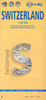

Switzerland Administrative And Postcode Map
A very large sheet with an attractive and informative combination of two maps: administrative and postcode. On one side is an administrative map of the country, with a road map as its base. The map has plenty of geographical information: names of valleys, rivers, lakes, and glaciers, plus spot heights for numerous peaks. Each canton is shown in a different colour and subdivided into districts. Around the map are information panels giving essential facts about each canton: date of joining the Swiss Confederation, area, population, population density, number of districts and communes, and the highest and lowest points. A separate booklet attached to the cover provides an index which also includes lists of mountains, rives, lakes, mountain passes, etc.On the reverse side is a
postcode map of Switzerland, with its base map showing both roads and the full rail network, including mountain railways, cable car lines, and chair lifts. Names of all towns and villages are annotated with their post codes, and are also listed in an index placed around the map. Map legends are in French, German, Italian and Romansh only.
postcode map of Switzerland, with its base map showing both roads and the full rail network, including mountain railways, cable car lines, and chair lifts. Names of all towns and villages are annotated with their post codes, and are also listed in an index placed around the map. Map legends are in French, German, Italian and Romansh only.
Product Description
Reviews/Comments
Add New
Intelligent Comparison
Archived Product
Switzerland Administrative Map Stanfords
£12.50
Archived Product
Switzerland K+F Administrative Map Stanfords
£12.99
Archived Product
Switzerland Postcode Map Stanfords
£14.50
Vouchers
No voucher codes found.
Do you know a voucher code for this product or supplier? Add it to Insights for others to use.
Do you know a voucher code for this product or supplier? Add it to Insights for others to use.
 Denmark