More From Contributor

£10.99
Detailed road map of the Netherlands, with index & city centre street enlargements of Amsterdam & the Hague. Clearly shows the national road network & selected provincial & local roads, with each class of road clearly indicated & road numbers shown. Intermediate driving distances between locations are shown in kilometres alongside the road, motorway filling stations are shown & motorway junctions are indicated. Colour shading is used to indicate land types such as forests or marshl&. International & provincial boundaries are clearly marked, as are nature reserves & restricted military areas. Symbols indicate various sights & locations of tourist interest, such as churches, leisure & sports destinations, panoramas & viewing points, monuments & historic sites. Some hotels & campsites are marked. Railway lines, airports, ports & marinas are also shown. A grid divides the map at 30’ increments, & is also grid-referenced for the accompanying index booklet.* Multilingual map legend

Includes::
English.*

...
Archived Product
£18.99
Road atlas of the Netherlands at 1:200, 000 from Falk BV, in a spiral-bound format slightly smaller than A4, providing exceptionally quick access to the coverage of different parts of the country & its index through cleverly-designed presentation, plus city-centre street plans & access maps for eight town & ‘insiders tips’ for the four main cities. The division of the country into individual atlas pages is printed on the cover – next to it are thumb-tabs for individual map pages & sections of the index. Each spread of two pages has on one side the road map & opposite it the grid for the whole atlas, so adjoining pages can also be quickly found. The mapping provides detail presentation of the road network, with names & number of motorway exits, services, driving distances on main routes, etc. Railway lines are included & local airports are marked. Landscape is indicated by colouring for woodlands. Symbols mark various places of interest. The maps have no geographical coordinates. Map legend, conveniently placed on the back cover,

Includes::
English. Central Amsterdam, The Hague, Rotterdam & Utrecht have page-size street plans highlighting main sights for which brief descriptions are provided (in Dutch only), plus a road map showing access to the centre from the surrounding motorways & main roads. Street plans & access maps are also provided for central Arnhem, Breda, Eindhoven, Groningen, Den Bosch (s’ Hertogenbosch), Maastricht, Middelburg & Nijmegen. All the street plans indicate one-way streets, car parks & tourist information offices. Also provided is a distance table between 26 cities.PLEASE NOTE: this title is also available in a smaller glovebox format with main mapping reduced to 1:300, 000. All the information on the road maps & on the accompanying street plans is the same but with place names in reduced print size.

...
Archived Product
£19.99
We are able to source a wide range of courtesy flags. Flags are available in many sizes & can be sewn or printed on 100% Ministry Of Defence Standard Woven & Knitted Polyester. Flags are supplied with rope & toggle. If you would like more information, have a custom size request or cannot find a desired product, please email us at maritime@stanfords.co.uk. We will be glad to help! ...
Archived Product
£25.00
We are able to source a wide range of courtesy flags. Flags are available in many sizes & can be sewn or printed on 100% Ministry Of Defence Standard Woven & Knitted Polyester. Flags are supplied with rope & toggle. If you would like more information, have a custom size request or cannot find a desired product, please email us at maritime@stanfords.co.uk. We will be glad to help! ...
Archived Product
£12.99
Double-sided & detailed touring map of the Netherlands showing seven different kind of roads, with road names & junction numbers, intermediate driving distances in km, petrol stations, restaurants, parkings & motels along main roads. Tourist routes, railways, airports, administrative boundaries & restricted areas are also marked alongside national parks, natural curiosities, woods & heath lands. A number of symbols also indicates places of interests, viewpoints, notable buildings & ruins, monuments & churches, campsites, beaches, glasshouses & tulip fields, golf resorts & motor circuits. The map also

Includes::
a special ” Distoguide” incorporated into the map cover, showing at a glance road distances between several Dutch cities. Map index is in a separate booklet attached to the cover. All texts are in six different European languages including English.

...
Archived Product
£6.99
Netherlands at 1:300, 000 on a large road map from Marco Polo Travel Publishing with prominent highlighting of interesting locations, 5 more detailed enlargements, plus an index booklet with 9 city maps & brief descriptions of 15 selected top sights, etc. Coverage extends south to include Brussels, Gent & Bruges. Cartography is from the renowned German publishers Mair Dumont. Road network

Includes::
selected minor roads & local tracks, highlights scenic roads & special tourist routes, shows intermediate driving distances on main roads, & indicates motorway services, toll stations, caravan & vehicle restrictions, etc. Railway lines, ferry routes & local airports are included, as well as administrative divisions with names of the provinces. Locations of interest are prominently highlighted, with separate colouring for towns or villages & for natural sites. National parks & other protected areas are marked. Symbols highlight locations of campsites, youth hostels, etc. Multilingual map legend

Includes::
English. Surrounding the map are enlargements showing in greater detail the environs of Amsterdam, Eindhoven, Rotterdam, The Hague & Utrecht. A separate booklet attached to the map cover

Includes::
an index which also lists national parks, UNESCO World Heritage sites, airports & amusement parks. The booklet also contains brief descriptions of 15 most interesting locations prominently highlighted on the map, plus street plans of central Amsterdam, Arnhem, The Hague, Eindhoven, Groningen, Den Bosch (‘s-Hertogenbosch), Maastricht, Rotterdam & Utrecht. A fold-out flap in the cover shows for route planning an overview of the whole area covered by the map plus the adjacent regions, prominently highlighting main places of interest, with the grid reference system in the margins making it easier to find locations on the main map. Also included are a distance/driving times table & basic driving regulations.


...
Archived Product
£5.99
Netherlands at 1:400, 000 from Michelin, with information on driving regulations, a distance & journey time table, plus enlargements showing in greater detail road access to Amsterdam, The Hague & Rotterdam with the Europoort & Hoek Van Holl&. Roads network

Includes::
local roads & is graded according to the number of lanes. Junctions show full or partial interchanges. Steep gradients (!), level crossings & restricted entry sections are marked; scenic routes are highlighted. Railway lines & ferry routes are included. Relief shading is used to indicate the topography, with colouring for forested areas. National parks are also marked. Small symbols indicate various landmarks or places of interest including campsites & youth hostels, but the map is not primarily designed to highlight tourist sights. The map also indicates locations with street plans in Michelin’s Red Guides to Hotels & Restaurants in the Netherlands. Latitude & longitude lines are drawn at 20’ intervals. Multilingual map legend

Includes::
English. The index is next to the map. Enlargements at 1:100, 000 show in greater detail road access to Amsterdam including the Schiphol Airport, The Hague & the area around Rotterdam including the Europoort, Hoek van Holland & Delft. Also provided is basic information on the country’s driving regulations, plus a table showing driving distances & journey times between 26 main cities PLEASE NOTE: the same cartography is used in Michelin’s road map of Benelux.


...
Archived Product
£16.99
Enjoy the best of hotels & restaurants Netherlands has to offer, from tiny bistros to luxury hotels, with MICHELIN Netherl&. ...
Archived Product
£5.99
Northern Netherlands at 1:200, 000 in a series of regional road maps of the Benelux countries from Michelin. Insets show enlargements of the Amsterdam
- Schiphol Airport area, Groningen, Leeuwarden & Zwolle, plus street plans of central Leeuwarden & Zwolle. Michelin’s regional coverage of the Benelux is available either on indexed road maps at 1:200, 000 or as a Road Atlas of Benelux with the North of France, presented with the same mapping but enlarged for greater clarity to 1:150, 000; Luxembourg is in addition covered on a similarly enlarged map. The mapping has Michelin’s traditional detailed presentation of the road network, with full or limited motorway interchanges, road width of smaller roads, height & load restrictions, tolls, gradients on steep roads, swing bridges, etc. Scenic routes are highlighted. Ferry routes indicate connections for car transport or pedestrians/cycles only. Railway lines are shown with stations. Symbols mark various places of interest including campsites, bungalow parks & selected other accommodation, sport & recreational facilities, bulb fields & windmills, etc. Also indicated are locations with street plans in the publishers’ Red Guides to hotels & restaurants in Belgium & Luxembourg & in the Netherlands. Topography is presented by relief shading & colouring for woodlands; national parks & other protected areas are highlighted. Latitude & longitude lines are drawn at 10’ intervals (maps only, not in the atlas). In maps, the index is next to the map. Map legend

Includes::
English. To see the list of the titles in this series please click on the series link.


...
Archived Product
£14.99
The northern half of the Netherlands on a Super-Durable Cycling Map at 1:200, 000 from Buijten & Schipperheijn, showing the country’s extensive network of signposted cycling routes, with highlighting for the LF long-distance paths & recommended other trails, plus locations of campsites. The map is double-sided & coverage in this title extends south to the line Hoek van Holland – Delft – Arnhem – Winterwikj. Netherland’s extensive network of sign-posted cycling routes, including the LF long-distance cycle paths, consists of numbered junctions joined by sign-posted connecting routes in either direction. At each junction there is an information panel showing an overview map of the whole network with the junction numbers. A second panel shows all the intersections directly connected to that junction. The system enables cyclists to plan their own routes by preparing a list of junction numbers through which they want to travel. In addition to showing all the junctions with their numbers & connecting routes, the map highlights sections which are part of the LF long-distance network (also presented separately on a small inset), recommended unmarked NF routes & long cycling tours. The background map has the country’s road & rail networks, with colouring showing different terrain (forest, heath, dunes, etc). Symbols indicate campsites & ferries across rivers. The map has the lines of Netherlands’ national grid & the index of all the junctions gives their coordinates. Map legend

Includes::
English. More panels show & list with phone numbers 112 cycle hire locations, including railway stations, & other information for cyclists; the text/legends for them are in Dutch only.

...
Archived Product

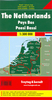
Netherlands Insight Travel Map

This detailed travel map is all you need to plan your route and navigate your way around The Netherlands, and also includes area highlights, top attractions, places of interest, streetplans, and a fabulous free app.· Travel Map The Netherlands is drawn to a scale of 1:300 000 and shows the entire country, complete with a comprehensive index· Ideal for planning your route, and on-the-road-exploring· Includes free app, with top travel tips, and additional area highlights· Features detailed street plans of Amsterdam, the Hague and Rotterdam· Outlines Top Attractions and places ofinterest, including national parks, nature reserves and heritage sites· Handy distance indicators, located in the margin, give distances to the nearest town and major locations· Shows roads, rail
networks and ferry routes· Pictorial symbols allow for instant, easy recognition· Detailed topography, through the use of relief shading, with mountain ranges named, and peak heights given· Legend shown in four languages
RIP - This product is no longer available on our network. It was last seen on 25.09.2019

This page now acts as a permanent archive for this product. Add more information using the comments box below to ensure it can still be found by future generations.

Use our search facility to see if it is available from an alternative contributor.
  • External links may include paid for promotion
  • Availability: Out Of Stock
  • Supplier: Stanfords
  • SKU: 9781786719362
Availability: In Stock
£6.99

Product Description

This detailed travel map is all you need to plan your route & navigate your way around The Netherlands, & also

Includes::
area highlights, top attractions, places of interest, streetplans, & a fabulous free app.· Travel Map The Netherlands is drawn to a scale of 1:300 000 & shows the entire country, complete with a comprehensive index· Ideal for planning your route, & on-the-road-exploring·

Includes::
free app, with top travel tips, & additional area highlights· Features detailed street plans of Amsterdam, the Hague & Rotterdam· Outlines Top Attractions & places ofinterest, including national parks, nature reserves & heritage sites· Handy distance indicators, located in the margin, give distances to the nearest town & major locations· Shows roads, rail networks & ferry routes· Pictorial symbols allow for instant, easy recognition· Detailed topography, through the use of relief shading, with mountain ranges named, & peak heights given· Legend shown in four languages

Reviews/Comments

Add New

Intelligent Comparison

Oooops!
We couldn't find anything!
Perhaps this product's unique.... Or perhaps we are still looking for comparisons!
Click to bump this page and we'll hurry up.

Price History

Vouchers

No voucher codes found.
Do you know a voucher code for this product or supplier? Add it to Insights for others to use.

Facebook

Jargon Buster

Road - a manmade lane or a path that is used to speed up travel.
Ideal - Something that satisfies a perfect criteria.

Supplier Information

Stanfords
Stanfords was established in 1853 and opened their iconic Covent Garden flagship store in 1901. They have become the top retailer of maps, travel books and accessories in the UK and arguably offer the largest selection of maps and travel books worldwide. Famous names such as Captain Robert Falcon Scott, Ranulph Fiennes and Michael Palin have purchased from Stanfords. They now have a shop in Bristol and both stores together with other venues operate a calendar of events including talks, book signings and exhibitions. As a specialist map retailer, the map selection is comprehensive and includes road maps, street maps and walking maps from worldwide destinations, as well as a selection of world atlases and wall maps. Books include travel guides and travel literature. Stanfords also stock globes, from miniatures made of blue marble to magnificent floor-standing globes. The website features a selection of interesting articles on travel topics.
Page Updated: 2023-11-12 20:15:36

Community Generated Product Tags

Oh No! The productWIKI community hasn't generated any tags for this product yet!
Menu