
 United Kingdom
 France
 Germany
 Netherlands
 Sweden
 USA
USA
 Italy
Italy
 Spain
Spain
More From Contributor

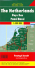


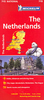


Netherlands Hallwag Road Map
Double-sided and detailed touring map of the Netherlands showing seven different kind of roads, with road names and junction numbers, intermediate driving distances in km, petrol stations, restaurants, parkings and motels along main roads.Tourist routes, railways, airports, administrative boundaries and restricted areas are also marked alongside national parks, natural curiosities, woods and heath lands. A number of symbols also indicates places of interests, viewpoints, notable buildings and ruins, monuments and churches, campsites, beaches, glasshouses and tulip fields, golf resorts and motor circuits.The map also includes a special ”Distoguide” incorporated into the map cover, showing at a glance road distances between several Dutch cities.Map index is in a
separate booklet attached to the cover.All texts are in six different European languages including English.
separate booklet attached to the cover.All texts are in six different European languages including English.

Product Description
Reviews/Comments
Add New
Intelligent Comparison
Archived Product

Ireland Hallwag Road Map Stanfords
£12.99
Archived Product

Germany Hallwag Road Map Stanfords
£12.99
Archived Product

Finland Hallwag Road Map Stanfords
£12.99
Archived Product

France Hallwag Road Map Stanfords
£12.99
Archived Product

Canada Hallwag Road Map Stanfords
£13.99
Archived Product

Sweden Hallwag Road Map Stanfords
£12.99
Archived Product

Norway Hallwag Road Map Stanfords
£12.99
Archived Product
Austria Hallwag Road Map Stanfords
£12.99
Vouchers
No voucher codes found.
Do you know a voucher code for this product or supplier? Add it to Insights for others to use.
Do you know a voucher code for this product or supplier? Add it to Insights for others to use.
 Denmark