More From Contributor

£12.99
Sweden in Marshall Cavendish`s Culture Shock! Series; comprising a range of guides that inform visitors of the finer points & details relating to social etiquette, traditions & customs; bringing visitors to a sensitive yet substantial understanding of the country or city in question. The series targets those who are planning long stays in the destination or extended periods of residence. The guides are written by authors who have experienced the joys & pitfalls of cultural adaptation, & so are ideally placed to provide informative & relevant advice. Each title contains insights into local culture & traditions, guidance on adapting to the local environment, linguistic help & lots of general advice about local culture & idiosyncrasies to help prepare readers for their visit. Each title is structured similarly, beginning with the first impressions a visitor might expect to have. The guides aim to help readers understand the local culture through first appreciating the motivations, beliefs & attitudes of the local people. Practical advice on settling in is provided, with focused sections on accommodation, utilities, health, education & telecommunications. There is also extensive information on the destination’s culture, food & leisure, in addition to a specific section addressing the concerns of those travelling on business. ...
Archived Product
£15.99
Sweden Eyewitness travel guide from Dorling Kindersley is a lavishly illustrated book concerned with providing the visitor with detailed background information to sightseeing in the country & a broad cultural introduction. Popular historical buildings & museums are often described with cutaway diagrams allowing you to view ...
Archived Product
£15.99
The DK Eyewitness Sweden Travel Guide is your indispensable guide to this beautiful part of the world. The fully updated guide


...
Archived Product
£10.99
Sweden at 1;600, 000 on a large, double-sided map from Freytag & Berndt, with a separate index booklet listing all localities with their postcodes & providing street plans of central areas in six main cities, including Stockholm & Gothenburg. The country’s topography is shown by bold relief shading, with additional spot heights. National parks & other protected areas are highlighted. Road information

Includes::
driving distances on many secondary roads & steep gradients. Car & passenger ferries are marked & railways, rack railways & cable railways are shown. Also indicated are provincial administrative boundaries. Symbols mark various places of interest, including isolated hotels, campsites, etc. Latitude & longitude lines are drawn at 30` intervals. Map legend

Includes::
English.A separate booklet attached to the map cover contains an index & street plans of central Stockholm, Gothenburg/Götebog, Linköping, Sundsvall, Umea & Uppsala.


...
Archived Product
£18.50
Sweden Road Atlas at 1:400, 000 combining Freytag & Berndt’s regional road maps of the country into one 15 x 26cm, spiral-bound volume with seven street plans including Stockholm, Gothenburg & Malmö, an index with postal codes, plus mapping of Europe at 1:3, 500, 000. Road network

Includes::
what is often described on maps of Sweden as “private” roads: unsurfaced local roads open to the general public but simply privately maintained. Toll routes, restrictions & winter closures, steep gradients, motorway services, etc are shown & scenic roads & special tourist routes are highlighted. Railways with stations, ferry services, & local administrative boundaries are marked. National parks & prohibited areas are highlighted & symbols show places of interest, campsites, mountain shelters, youth hostels, etc. The maps have latitude & longitude lines at intervals of 30’. The index lists localities with their post codes. Multilingual map legend

Includes::
English. Also included are street plans of city centres in Stockholm, Gothenburg, Linköping, Malmö, Sundsvall, Umeå & Uppsala. In common with many road atlases produced by Central European publishers, this atlas also

Includes::
an indexed section showing Europe at 1:3, 500, 000 for general route planning.


...
Archived Product
£9.99
Sweden at 1:900, 000 on an indexed, double-sided map from ITMB showing its network of roads & main railway lines on a base with altitude colouring to indicate the topography, plus highlighting for main places of interest. Latitude & longitude lines are drawn at 1º & 2º intervals respectively. Each side has a separate index. Also included is a street plan of Stockholm’s historic Gamla Stan district, highlighting its sights & selected accommodation. ...
Archived Product
£6.99
Sweden at 1:800, 000 on a large, double-sided road map from Marco Polo Travel Publishing with prominent highlighting of interesting locations, enlargements for the environs of Stockholm & Gothenburg, plus an index booklet with 5 city maps & brief descriptions of 15 selected top sights, etc. Sweden is divided between the two sides of the map with a generous overlap & coverage

Includes::
the whole of Norway & Denmark, extending south to Hamburg & the Baltic coast of Germany. Cartography is from the renowned German publishers Mair Dumont. Road network

Includes::
minor roads, highlights scenic roads & special tourist routes, shows intermediate driving distances on main roads, & indicates motorway services, toll stations, caravan & vehicle restrictions, seasonal closures of mountain roads, etc. Railway lines & local airports are included, as well as administrative divisions with names of the provinces. Locations of interest are highlighted, with separate colouring for towns or villages & for natural sites; 15 most interesting sights are cross-referenced to their descriptions in a booklet attached to the map cover. Symbols show locations of campsites, youth hostels, etc. National parks & other protected areas are marked & topography is presented by relief shading with plenty of names of mountain ranges, valleys, etc. Latitude & longitude lines are drawn at 1º intervals. The index is in the booklet. Enlargements show in greater detail the environs of Stockholm & Gothenburg & the booklet also provides street plans of town centres in these two cities plus in Malmö, Helsingborg & Uppsala, plus lists of airports, UNESCO World Heritage sites, & amusement parks. Multilingual map legend & all the text include English.A fold-out flap in the cover shows for route planning an overview of the whole area covered by the map plus the adjacent regions, prominently highlighting main places of interest, with the grid reference system in the margins making it easier to find locations on the main map. Also included are a distance/driving times table & basic driving regulations.


...
Archived Product
£5.99
The Michelin National road map of Sweden at 1:1, 200, 000 scale is ideal for route planning. The map gives comprehensive coverage of national road networks showing all major motorways, dual carriageways, national & regional main roads & some single-lane roads. Also shows unsurfaced roads & tracks & major footpaths. The map is divided by grid showing latitude & longitude. Distances between major locations are marked along roads, with total distance & several intermediate distances shown. A quick-reference chart of distances & driving times between major locations is also included. The map also

Includes::
a grid-referenced index of principal place names. Clear, easy-to read cartography shows roads in reds, yellows & white with black outlines. Major topography is indicated with relief shading. Woodland & forest is marked with green shading. Built-up urban areas are clearly marked in yellow. Airports, ferries, railways are also marked. National divisions are marked. Places of interest Also

Includes::
a quick reference panel giving national driving regulations, including speed limits, equipment requirements (e.g. bulb kits, warning triangles) & seatbelt rules. Town plans & regional enlargements:- Stockholm at 1:300, 000 scale- Gothenburg at 1:300, 000 scale- Malmo at 1:300, 000 scale


...
Archived Product
£10.99
Sweden North: -stersund area in a series of detailed, indexed touring maps from Freytag & Berndt with the southern & central part of the country at 1:250, 000 & the north at 1:400, 000. Relief shading & spot heights show the topography. Road network

Includes::
what is confusingly described in the map legend as “private” roads, unsurfaced roads open to the general public but simply privately maintained, & indicates toll routes, restrictions & winter closures, steep gradients, motorway services, etc. Scenic roads & special tourist routes are highlighted. Railways with stations, ferry services, & local administrative boundaries are marked. National parks & prohibited areas are highlighted & symbols show places of interest, campsites, mountain shelters, youth hostels, etc. The maps of southern & central Sweden have latitude & longitude lines drawn at 10` intervals, with 30` on the two northern sheets. Multilingual map legend

Includes::
English. A place name index, with post codes, is provided in a booklet attached to the map cover.


...
Archived Product
£4.99
Sweden in the Pocket Guide series from Berlitz; a collection of handy, pocket-sized guides dedicated to an extensive range of cities, regions & countries worldwide. Written in narrative form, individual guides explore the history, main sights & attractions, food & drink, accommodation & local culture of the destination in detail. Each Berlitz pocket guide has a similar format, with colour-coded sections helping readers locate information quickly in addition to distinctive chapters exploring the city or region. An introduction outlines the destination for visitors & a section dedicated to 'A Brief History' actually explores the area in relative depth. A where to go chapter is organized by region & city & is written in prose form with references to individual sites highlighted in bold for clarity. There are also further suggestions on where & when to eat. Recommendations for leisure activities in the region, including sport, nightlife & shopping, are also provided & tailored accordingly for each destination. Handy travel tips are listed alphabetically in a dedicated section, providing practical guidance & helping visitors make the most of their stay. The main hotels, particularly for cities, are also listed in an accommodation section, offering a brief overview with approximate price bandings & relevant contact details. ...
Archived Product

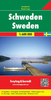
Sweden Hallwag Road Map

Sweden on one of two map from the Swiss publishing house Hallwag - Kümmerly + Frey, presenting the whole country on one side but in two separate panels, the southern half at 1:800, 000, with the north at 1:900, 000.Both maps, published under their separate imprint: Hallwag or Kümmerly + Frey, have identical cartographic content: roads, railways, towns and villages, etc, and vary only in the colouring of the base map and of the road network, plus in the additional features provided with the maps.*Hallwag map* has very light relief shading and colouring for forested areas. Motorways are presented in green. Symbols used to indicate various places of interest are slightly larger than on the K+F map.*Kümmerly + Frey map* has bolder relief shading with no additional colouring.
Motorways are in orange. Unlike the Hallwag map, it highlights towns and other locations of particular interest.*On both versions* road information includes scenic routes, seasonal closures, restricted entry roads, etc. Railways and ferry routes are marked. National parks and other protected areas are highlighted. Symbols show campsites, secluded hotels, viewpoints, historical and archaeological sites, etc. The maps have lattitude intervals of 30’, with longitude at 1° and both versions have the same index booklet attached to the map cover.*Map legends include English.* Additional features provided by the maps are:*Hallwag* map has the publishers’ special Distoguide incorporated into its cover, providing at a glance road distances between several towns across the whole of
Scandinavia, including Finland. *Kümmerly + Frey map* has an enlargement for the environs of Stockholm.
RIP - This product is no longer available on our network. It was last seen on 25.09.2019

This page now acts as a permanent archive for this product. Add more information using the comments box below to ensure it can still be found by future generations.

Use our search facility to see if it is available from an alternative contributor.
  • External links may include paid for promotion
  • Availability: Out Of Stock
  • Supplier: Stanfords
  • SKU: 9783828300392
Availability: In Stock
£12.99

Product Description

Sweden on one of two map from the Swiss publishing house Hallwag
- Kümmerly + Frey, presenting the whole country on one side but in two separate panels, the southern half at 1:800, 000, with the north at 1:900, 000. Both maps, published under their separate imprint: Hallwag or Kümmerly + Frey, have identical cartographic content: roads, railways, towns & villages, etc, & vary only in the colouring of the base map & of the road network, plus in the additional features provided with the maps.* Hallwag map* has very light relief shading & colouring for forested areas. Motorways are presented in green. Symbols used to indicate various places of interest are slightly larger than on the K+F map.*Kümmerly + Frey map* has bolder relief shading with no additional colouring. Motorways are in orange. Unlike the Hallwag map, it highlights towns & other locations of particular interest.* On both versions* road information

Includes::
scenic routes, seasonal closures, restricted entry roads, etc. Railways & ferry routes are marked. National parks & other protected areas are highlighted. Symbols show campsites, secluded hotels, viewpoints, historical & archaeological sites, etc. The maps have lattitude intervals of 30’, with longitude at 1° & both versions have the same index booklet attached to the map cover.* Map legends include English.* Additional features provided by the maps are:* Hallwag* map has the publishers’ special Distoguide incorporated into its cover, providing at a glance road distances between several towns across the whole of Scandinavia, including Finl&. *Kümmerly + Frey map* has an enlargement for the environs of Stockholm.

Reviews/Comments

Add New

Intelligent Comparison

Oooops!
We couldn't find anything!
Perhaps this product's unique.... Or perhaps we are still looking for comparisons!
Click to bump this page and we'll hurry up.

Price History

Vouchers

No voucher codes found.
Do you know a voucher code for this product or supplier? Add it to Insights for others to use.

Facebook

Jargon Buster

swiss - Short for Switzerland, one of the richest countries in the world
Railways - A set of tracks that have been laid for the purpose of trains to travel up and down them
Network - A link and communication between things. Often computers or people.
Road - a manmade lane or a path that is used to speed up travel.

Supplier Information

Stanfords
Stanfords was established in 1853 and opened their iconic Covent Garden flagship store in 1901. They have become the top retailer of maps, travel books and accessories in the UK and arguably offer the largest selection of maps and travel books worldwide. Famous names such as Captain Robert Falcon Scott, Ranulph Fiennes and Michael Palin have purchased from Stanfords. They now have a shop in Bristol and both stores together with other venues operate a calendar of events including talks, book signings and exhibitions. As a specialist map retailer, the map selection is comprehensive and includes road maps, street maps and walking maps from worldwide destinations, as well as a selection of world atlases and wall maps. Books include travel guides and travel literature. Stanfords also stock globes, from miniatures made of blue marble to magnificent floor-standing globes. The website features a selection of interesting articles on travel topics.
Page Updated: 2023-11-12 20:15:36

Community Generated Product Tags

Oh No! The productWIKI community hasn't generated any tags for this product yet!
Menu