
 United Kingdom
 France
 Germany
 Netherlands
 Sweden
 USA
USA
 Italy
Italy
 Spain
Spain
More From Contributor


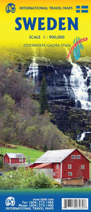
Sweden ITMB
Sweden at 1:900, 000 on an indexed, double-sided map from ITMB showing its network of roads and main railway lines on a base with altitude colouring to indicate the topography, plus highlighting for main places of interest. Latitude and longitude lines are drawn at 1º and 2º intervals respectively. Each side has a separate index.Also included is a street plan of Stockholm’s historic Gamla Stan district, highlighting its sights and selected accommodation.

Product Description
Reviews/Comments
Add New
Vouchers
No voucher codes found.
Do you know a voucher code for this product or supplier? Add it to Insights for others to use.
Do you know a voucher code for this product or supplier? Add it to Insights for others to use.
 Denmark