
 United Kingdom
 France
 Germany
 Netherlands
 Sweden
 USA
USA
 Italy
Italy
 Spain
Spain
More From Contributor


Sowerby Bridge 1905
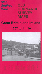
Sowerby Bridge in 1905 in a fascinating series of reproductions of old Ordnance Survey plans in the Alan Godfrey Editions, ideal for anyone interested in the history of their neighbourhood or family. Two versions have been published for this area, extending from Warley Town eastward to King Cross and Queen`s Road, and from Gibbet Street southward to Sowerby Bridge. Features include Rochdale Canal and Calder & Hebble Navigation with Basin; Canal Mills, Wharf Street with Christ Church, Scar Bottom, Octagon Tower, Washer Lane Dye Works, Pye Nest, Thorn Tree area, King Cross, St Paul`s station, Gibraltar area, Dunkirk Mills, Cote Hill, St John`s church, Warley Town, Willow Hall Mills, Albert Woollen Mills, Bairstow, Warley House, Cliff Hill, tramways on the 1905 version,
etc. The 1892 version includes 1889 directory extracts for Sowerby Bridge and Warley and is in colour, taken from the beautiful 1st Edition OS hand-coloured map.About the Alan Godfrey Editions of the 25” OS Series:Selected towns in Great Britain and Ireland are covered by maps showing the extent of urban development in the last decades of the 19th and early 20th century. The plans have been taken from the Ordnance Survey mapping and reprinted at about 15 inches to one mile (1:4, 340). On the reverse most maps have historical notes and many also include extracts from contemporary directories. Most maps cover about one mile (1.6kms) north/south, one and a half miles (2.4kms) across; adjoining sheets can be combined to provide wider coverage.FOR MORE INFORMATION AND A COMPLETE LIST OF ALL
AVAILABLE TITLES PLEASE CLICK ON THE SERIES LINK.

Product Description
Reviews/Comments
Add New
Intelligent Comparison
Archived Product

Hebden Bridge 1905 Stanfords
£3.50
Archived Product
Ferrybridge 1905 Stanfords
£2.95
Archived Product

Ferrybridge 1905 Stanfords
£3.50
Vouchers
No voucher codes found.
Do you know a voucher code for this product or supplier? Add it to Insights for others to use.
Do you know a voucher code for this product or supplier? Add it to Insights for others to use.
 Denmark