
 United Kingdom
 France
 Germany
 Netherlands
 Sweden
 USA
USA
 Italy
Italy
 Spain
Spain
More From Contributor


Soweto
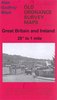
Large double-sided plan covering the region, from the Lenz military base in the south west to Wibsey Dib in the north east. One way streets and traffic lights are marked, with symbols indicating a range of features for the tourist and resident alike: railway lines with stations, shopping centres, petrol stations, various services and municipal buildings, schools, sports grounds, police stations, the tourist information office, hospitals etc. Neighbourhoods are clearly named and the colours distinguish built-up areas, industrial areas and green spaces. The street index, on the reverse, includes a list of the suburbs. The plan has a latitude/longitude grid at intervals of 1
Product Description
Reviews/Comments
Add New
Intelligent Comparison
Archived Product
Sweet Stanfords
£27.00
Archived Product

Sorrento Stanfords
£10.99
Vouchers
No voucher codes found.
Do you know a voucher code for this product or supplier? Add it to Insights for others to use.
Do you know a voucher code for this product or supplier? Add it to Insights for others to use.
 Denmark