More From Contributor

£11.19
Laminated waterproof edition of a detailed topographic map of Southwold & Bungay from the Ordnance Survey Explorer series, covering Halesworth & Kessingl&. Edition A2; Publication date September 2011 About this series: These highly detailed maps show all the administrative boundaries, settlements as small as isolated farms, the road network down to unfenced roads & country tracks, & field boundaries (hedges & drystone walls) which make navigation across the countryside much easier. Steep gradients on roads are indicated. Various landmarks, e.g. powerlines, archaeological sites, windmills, churches & lighthouses are shown & additional graphics indicate natural terrain features such as cliffs, scree, mud & vegetation variations. The contour interval is 5 metres in the lower parts of the country & 10 metres in the uplands, & spot heights are marked. Each map covers an area of 30 x 20km (i.e. approx. 19 x 12 miles), with some double-sided maps covering more, as indicated in the individual descriptions. The maps are fully GPS compatible, with the National Grid shown at 1km intervals & latitude & longitude indicated by margin ticks at 1'. The Explorer series has replaced the earlier, green-cover Pathfinder maps. The Explorer series is now complete & covers all of Engl&, Wales & Scotl&. Some sheets for popular areas like the National Parks are still branded as Outdoor Leisure (OL) maps, but are now included in this series as the cartography is the same as that in the Explorer Maps. The Explorer maps offer a substantial improvement on the Pathfinder series, with greater use of colour, larger area per map, & stronger emphasis on information for ramblers & tourists. This series is ideal for walking & other outdoor pursuits & each map shows a large amount of information for ramblers & tourists. Public rights of way are shown (except in Scotland), together with other routes with public access: National Trails & Recreational Paths, permitted paths & bridleways, & selected cycle routes. Open access land created under the Countryside & Rights of Way Act 2000 is marked. Tourist information

Includes::
caravan & camp sites, Park & Ride locations, recreation/leisure/sport centres, museums, historic buildings, English Heritage & National Trust sites, rural pubs, etc. The map legend is in English only, except for the tourist information content which is also in French & German.

...
Archived Product
£29.50
Southwold is a nostalgic place where childhood memories are made from sunny holidays beside the sea, coloured beach huts lining the shore & the delicate pier straddling the waves of the North Sea. To some it is nothing short of an earthly paradise
- indeed it was Southwold that inspired William Morris to write his epic poem ” The Earthly Paradise”. ” Southwold
- An Earthly Paradise” is a collection of vividly written essays that take the reader through the evolution of the town from a mediaeval fishing community, prosperous enough to build a magnificent church, to its modern identity as a popular, yet unspoilt, holiday town. However its history is a troubled one. The sea, despite its changing moods has been the only constant in a past in which fire, famine & plague have devastated the town. A rich treasure of silver & silver gilt lies on the bottom of the coast of Southwold. It is a reminder of one of the fiercest fights in British history. The Battle of Sole Bay was fought against the Dutch in 1672 & the bloody confrontation is fully described & illustrated with contemporary paintings & drawings. The greatest genius of English literature, William Shakespeare heads an extraordinary cast of writers to have visited Southwold, including Algernon Swinburne, Thomas Hardy, Walter de la Mare, George Orwell, P. D. James & Esther Freud. J. M. W. Turner, one of Britain`s most celebrated artists, is known to have visited Southwold on many occasions & Geoffrey Munn has, for the first time, identified a number of drawings of Southwold by Turner. Whistler, Sickert, Wilson Steer, Spencer, & Damien Hirst have all followed in Turner`s footsteps. The text is lavishly illustrated with their work & all the 160 plates are in colour.

...
Archived Product
£3.50
Southwold in 1927 in a fascinating series of reproductions of old Ordnance Survey plans in the Alan Godfrey Editions, ideal for anyone interested in the history of their neighbourhood or family. The map covers the small seaside resort of Southwold, with a population of around 4, 000 at the time of the survey. Features include the Pier, St Edmund`s church, South Green, East Green, St Edmund`s Green, North Green, Skilman`s Hill, bathing huts, Southwold Common, Southwold Railway & station, Grand Hotel, Buss Creek & Bridgefoot Marshes. On the reverse is a directory of Southwold in 1925. About the Alan Godfrey Editions of the 25” OS Series: Selected towns in Great Britain & Ireland are covered by maps showing the extent of urban development in the last decades of the 19th & early 20th century. The plans have been taken from the Ordnance Survey mapping & reprinted at about 15 inches to one mile (1:4, 340). On the reverse most maps have historical notes & many also include extracts from contemporary directories. Most maps cover about one mile (1.6kms) north/south, one & a half miles (2.4kms) across; adjoining sheets can be combined to provide wider coverage.FOR MORE INFORMATION & A COMPLETE LIST OF ALL AVAILABLE TITLES PLEASE CLICK ON THE SERIES LINK. ...
Archived Product
£7.99
It is autumn, 1541. Following the uncovering of a plot against his throne in Yorkshire, King Henry VIII has set out on a spectacular Progress to the North to overawe his rebellious subjects there. Accompanied by a thousand soldiers, the cream of the nobility, & his fifth wife Catherine Howard, the King is to attend an extravagant submission of the local gentry at York. Already in the city are lawyer Matthew Shardlake & his assistant Jack Barak. As well as assisting with legal work processing petitions to the King, Shardlake has reluctantly undertaken a special mission
- to ensure the welfare of an important but dangerous conspirator being returned to London for interrogation. But the murder of a local glazier involves Shardlake in deeper mysteries, connected not only to the prisoner in York Castle but to the royal family itself. As the Great Progress arrives in the city, Shardlake & Barak stumble upon a cache of secret papers that holds danger for the King's throne, & a chain of events unfolds that will lead Shardlake facing the most terrifying fate of the age.
...
Archived Product
£19.95
Photographer Christopher Herwig presents a curated collection of the most interesting & obscure Soviet bus stops. Travelling over 30, 000km, Herwig discovered & documented these architectural treasures from around Kazakhstan, Turkmenistan, Uzbekistan, Kyrgyzstan, Tajikistan, Ukraine, Moldova, Armenia, Abkhazia, Georgia, Lithuania, Latvia, Estonia & Belarus. ...
Archived Product
£5.99
During the Cold War, the Soviet military embarked on a massive project to create maps of much of the world. As part of this exercise, many towns & cities in the British Isles were mapped in astonishing detail & to great accuracy, providing the Soviet Union with strategic intelligence on key British & Irish locations. These were not simply copies of existing local maps but included much original research. After the collapse of the Soviet Union, news of these previously secret maps started to emerge in the former Soviet Republics
- now newly independent countries
- where they had been stored ready for use. An archive of the maps was subsequently acquired by the Bodleian Library. Little is yet known about why the maps were made or how the information was gathered. In this fascinating volume, John Davies & Alex Kent look at the street plans of over thirty British & Irish towns. The authors examine some of their anomalies & inaccuracies as well as highlighting the surprising wealth of information they contain, including road-widths, bridge-heights, river-depths, street names & every strategic installation of possible significance. Their expert commentary offers suggestions about the sources of the data & what the maps may reveal about the methods used to compile the information during a period of deep mutual suspicion between the Soviet Union & the West.

...
Archived Product
£19.95
This book is dedicated to the Soviet Space Dogs, who played a crucial part in the Soviet Space programme. These homeless dogs, plucked from the streets of Moscow, were selected because they fitted the programmes criteria: weighing no more than 7kg, measuring no more than 35cm in length, robust, photogenic & with a calm temperament. These characteristics enabled the dogs to withstand the extensive training that was needed to prepare them for suborbital, then for orbital space fights. On 3 November 1957, the dog Laika was the first Earth-born creature to enter space, making her instantly famous around the world. She did not return. Her death, a few hours after launching, transformed her into a legendary symbol of sacrifice. Two further strays, Belka & Strelka, were the first beings to make it back from space, & were swiftly immortalized in childrens books & cartoons. Images of the Space Dogs proliferated, reproduced on everyday goods across the Soviet Union: cigarette packets, tins of sweets, badges, stamps & postcards all bore their likeness. This book uses these unique items to illustrate the story (in fact & fiction) of how they became fairy-tale idols. Monuments now commemorate their pioneering role in conquering the final frontier: their heroism will never be forgotten. ...
Archived Product
£3.50
Sowerby Bridge in 1905 in a fascinating series of reproductions of old Ordnance Survey plans in the Alan Godfrey Editions, ideal for anyone interested in the history of their neighbourhood or family. Two versions have been published for this area, extending from Warley Town eastward to King Cross & Queen`s Road, & from Gibbet Street southward to Sowerby Bridge. Features include Rochdale Canal & Calder & Hebble Navigation with Basin; Canal Mills, Wharf Street with Christ Church, Scar Bottom, Octagon Tower, Washer Lane Dye Works, Pye Nest, Thorn Tree area, King Cross, St Paul`s station, Gibraltar area, Dunkirk Mills, Cote Hill, St John`s church, Warley Town, Willow Hall Mills, Albert Woollen Mills, Bairstow, Warley House, Cliff Hill, tramways on the 1905 version, etc. The 1892 version

Includes::
1889 directory extracts for Sowerby Bridge & Warley & is in colour, taken from the beautiful 1st Edition OS h&-coloured map. About the Alan Godfrey Editions of the 25” OS Series: Selected towns in Great Britain & Ireland are covered by maps showing the extent of urban development in the last decades of the 19th & early 20th century. The plans have been taken from the Ordnance Survey mapping & reprinted at about 15 inches to one mile (1:4, 340). On the reverse most maps have historical notes & many also include extracts from contemporary directories. Most maps cover about one mile (1.6kms) north/south, one & a half miles (2.4kms) across; adjoining sheets can be combined to provide wider coverage.FOR MORE INFORMATION & A COMPLETE LIST OF ALL AVAILABLE TITLES PLEASE CLICK ON THE SERIES LINK.

...
Archived Product
£8.95
Large double-sided plan covering the region, from the Lenz military base in the south west to Wibsey Dib in the north east. One way streets & traffic lights are marked, with symbols indicating a range of features for the tourist & resident alike: railway lines with stations, shopping centres, petrol stations, various services & municipal buildings, schools, sports grounds, police stations, the tourist information office, hospitals etc. Neighbourhoods are clearly named & the colours distinguish built-up areas, industrial areas & green spaces. The street index, on the reverse,

Includes::
a list of the suburbs. The plan has a latitude/longitude grid at intervals of 1

...
Archived Product
£59.00
Intricately crafted with timeless tradition, this carefully dyed sisal fiber & sweet grass catch all makes a stunning statement ...
Archived Product

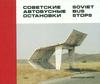
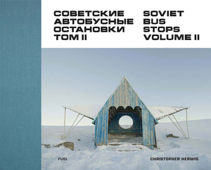
Soviet Bus Stops Volume II

A follow-up to the hugely successful Soviet Bus Stops, with new photographs of bus stops in Russia, Crimea, Georgia and Ukraine. Christopher Herwig has an insatiable appetite for ‘Soviet Bus Stops’. After the popular and critical success of his first book, Herwig has returned to the former Soviet Union to hunt for more. In this second volume, as well as discovering new stops in the remotest areas of Georgia and Ukraine, Herwig turns his camera to Russia itself. Following exhaustive research, he drove 15, 000 km from coast to coast across the largest country in the world, in pursuit of new examples of this singular architectural form. A foreword by renowned architecture and culture critic Owen Hatherley reveals new information on the origins of the Soviet bus stop. Examining the
government policy that allowed these ‘small architectural forms’ to flourish, he explains how they reflected Soviet values, and how ultimately they remained – despite their incredible individuality – far-flung outposts of Soviet ideology. The diversity of architectural approaches is staggering: juxtaposed alongside a slew of audacious modern and brutal designs, there are bus stops shaped as trains, birds, light bulbs, rockets, castles, even a bus stop incorporating a statue of St George slaying the dragon. Essential companion to the first volume, this book provides a valuable document of these important and previously overlooked constructions.
RIP - This product is no longer available on our network. It was last seen on 25.09.2019

This page now acts as a permanent archive for this product. Add more information using the comments box below to ensure it can still be found by future generations.

Use our search facility to see if it is available from an alternative contributor.
  • External links may include paid for promotion
  • Availability: Out Of Stock
  • Supplier: Stanfords
  • SKU: 9780993191183
Availability: In Stock
£19.95

Product Description

A follow-up to the hugely successful Soviet Bus Stops, with new photographs of bus stops in Russia, Crimea, Georgia & Ukraine. Christopher Herwig has an insatiable appetite for ‘ Soviet Bus Stops’. After the popular & critical success of his first book, Herwig has returned to the former Soviet Union to hunt for more. In this second volume, as well as discovering new stops in the remotest areas of Georgia & Ukraine, Herwig turns his camera to Russia itself. Following exhaustive research, he drove 15, 000 km from coast to coast across the largest country in the world, in pursuit of new examples of this singular architectural form. A foreword by renowned architecture & culture critic Owen Hatherley reveals new information on the origins of the Soviet bus stop. Examining the government policy that allowed these ‘small architectural forms’ to flourish, he explains how they reflected Soviet values, & how ultimately they remained – despite their incredible individuality – far-flung outposts of Soviet ideology. The diversity of architectural approaches is staggering: juxtaposed alongside a slew of audacious modern & brutal designs, there are bus stops shaped as trains, birds, light bulbs, rockets, castles, even a bus stop incorporating a statue of St George slaying the dragon. Essential companion to the first volume, this book provides a valuable document of these important & previously overlooked constructions.

Reviews/Comments

Add New

Intelligent Comparison

Oooops!
We couldn't find anything!
Perhaps this product's unique.... Or perhaps we are still looking for comparisons!
Click to bump this page and we'll hurry up.

Price History

Vouchers

No voucher codes found.
Do you know a voucher code for this product or supplier? Add it to Insights for others to use.

Facebook

Jargon Buster

Camera - An electronic device used for taking photographs
World - A physical grouping, commonly used to describe earth and everything associated with ti
Km - Kilometre. A unit of measurement equal to 1000 metres.
Small - something that takes up less space than normal.
Popular - Something that is admired and liked by many people.

Supplier Information

Stanfords
Stanfords was established in 1853 and opened their iconic Covent Garden flagship store in 1901. They have become the top retailer of maps, travel books and accessories in the UK and arguably offer the largest selection of maps and travel books worldwide. Famous names such as Captain Robert Falcon Scott, Ranulph Fiennes and Michael Palin have purchased from Stanfords. They now have a shop in Bristol and both stores together with other venues operate a calendar of events including talks, book signings and exhibitions. As a specialist map retailer, the map selection is comprehensive and includes road maps, street maps and walking maps from worldwide destinations, as well as a selection of world atlases and wall maps. Books include travel guides and travel literature. Stanfords also stock globes, from miniatures made of blue marble to magnificent floor-standing globes. The website features a selection of interesting articles on travel topics.
Page Updated: 2023-11-12 20:15:36

Community Generated Product Tags

Oh No! The productWIKI community hasn't generated any tags for this product yet!
Menu