
 United Kingdom
 France
 Germany
 Netherlands
 Sweden
 USA
USA
 Italy
Italy
 Spain
Spain
More From Contributor


Hebden Bridge 1905
Hebden Bridge in 1905 in a fascinating series of reproductions of old Ordnance Survey plans in the Alan Godfrey Editions, ideal for anyone interested in the history of their neighbourhood or family. The map covers Hebden Bridge and continues north-east to the hamlet of Chisley. Most of Hebden Bridge town is shown and features here include railway station, Rochdale Canal, Calder Mill, Bank Foot Bridge, Hanging Royd House, Nutclough Works, Machpelah, Birchcliffe, Foster Mill, Fairfield, May Royd Mill, Wood End, Owler Bank, Hebden Water, etc. The village of Heptonstall is in the top left corner, with St Thomas church. Eastward is Chisley, with Acre Mill, and south of this is Little Moor, with scattered cottages and the Mount Skip Inn. On the reverse is a commercial
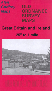
directory of the town in 1901.About the Alan Godfrey Editions of the 25” OS Series:Selected towns in Great Britain and Ireland are covered by maps showing the extent of urban development in the last decades of the 19th and early 20th century. The plans have been taken from the Ordnance Survey mapping and reprinted at about 15 inches to one mile (1:4, 340). On the reverse most maps have historical notes and many also include extracts from contemporary directories. Most maps cover about one mile (1.6kms) north/south, one and a half miles (2.4kms) across; adjoining sheets can be combined to provide wider coverage.FOR MORE INFORMATION AND A COMPLETE LIST OF ALL AVAILABLE TITLES PLEASE CLICK ON THE SERIES LINK.
directory of the town in 1901.About the Alan Godfrey Editions of the 25” OS Series:Selected towns in Great Britain and Ireland are covered by maps showing the extent of urban development in the last decades of the 19th and early 20th century. The plans have been taken from the Ordnance Survey mapping and reprinted at about 15 inches to one mile (1:4, 340). On the reverse most maps have historical notes and many also include extracts from contemporary directories. Most maps cover about one mile (1.6kms) north/south, one and a half miles (2.4kms) across; adjoining sheets can be combined to provide wider coverage.FOR MORE INFORMATION AND A COMPLETE LIST OF ALL AVAILABLE TITLES PLEASE CLICK ON THE SERIES LINK.

Product Description
Reviews/Comments
Add New
Intelligent Comparison
Archived Product
Heap Bridge 1908 Stanfords
£2.95
Archived Product
Heap Bridge 1908 Stanfords
£3.50
Archived Product
Sowerby Bridge 1905 Stanfords
£3.50
Archived Product
Three Bridges 1909 Stanfords
£3.50
Archived Product

Tame Bridge 1901 Stanfords
£3.50
Archived Product
Ferrybridge 1905 Stanfords
£2.95
Archived Product

Ferrybridge 1905 Stanfords
£3.50
Vouchers
No voucher codes found.
Do you know a voucher code for this product or supplier? Add it to Insights for others to use.
Do you know a voucher code for this product or supplier? Add it to Insights for others to use.
 Denmark