More From Contributor
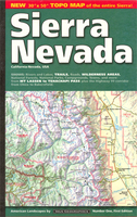
£17.99
This new, thoroughly updated third edition of Bradt`s Sierra Leone remains the only English-language guide dedicated to this unique West African destination, one of only three countries where the uber-elusive pygmy hippo can be found & where coastal mountains & sheltered beaches are the stuff of daydreams & postcards. With Bradt`s Sierra Leone you can explore the infamous diamond mines & rainforest-covered mountains; go in search of pygmy hippos or relax on the country`s beaches & islands. Offering significantly more coverage than any other guide, it is an ideal companion for tourists, volunteers & international workers alike, & also covers newly declared eco-tourist sites as well as the trans-boundary `peace park` of Gola Forest National Park, shared with neighbouring Liberia. This new edition also covers Freetown`s new beach music festival & the Sierra Leone Marathon, shortlisted for `best marathon` in the 2017 Running Awards, as well as details of everything from where to visit rescued chimpanzees to touring the traditional wooden-board homes of the Krio people, descendants of repatriated slaves from the Americas & Europe. Sierra Leone continues to be one of the best beach destinations in West Africa, & also one of the region`s best trekking destinations, given the varied topography & the presence of Mount Bintumani, West Africa`s highest peak. The country has seen a heartening recovery since emerging from civil war a decade ago & the Bradt guide is the first to take stock of the country`s post-Ebola travel situation. Sierra Leone is proudly back on the tourism map for the adventurous, beach-loving, jungle-exploring, mountain-scaling & curious of heart traveller. ...
Archived Product
£16.50
”A Dirty War in West Africa” charts in gripping detail
- based on first-band experience
- the decade long civil war that brought

...
Archived Product
£16.99
Sierra Leone in the Travel Guide series from Bradt; encompassing a comprehensive range of titles to destinations worldwide, with a particular focus on Africa, Central & South America. Bradt are one of the country’s leading independent publishers & have an ethos that focuses on responsible travel, in alliance with a philosophy of sustainability; both in the destinations the guides cover but also in encouraging tourists to limit the impact they have on the local environment. Bradt guides have a reputation for appealing to more independent travelers & often cover destinations that are not available from other publishers. Each guide opens with two comprehensive chapters on Background & Practical Information, covering details of the country’s geography, culture, natural history, government & politics, economy, people, language, religion, education & culture. Important practical advice

Includes::
when to visit, highlights, suggested itineraries, tour operators, red tape, embassies & consulates, getting there & away, health, safety, what to take, money, budgeting, getting around, accommodation, eating & drinking, public holidays, shopping, arts & entertainment, media & communications, business, travel culture & cultural etiquette. Individual sections are organized geographically by region & typically open with information on practicalities & orientation, before focusing on what to see & where to go. Information on what to see, where to stay, where to eat & how to find your way around is provided, with a range of budgets catered for. Simple black & white maps locate key visitor sites & places of accommodation. Bradt Travel Guides include appendices that provide an in-depth introduction to the language of each country, a glossary of terms & a listing of books & internet resources providing further information on the destination.

...
Archived Product
£9.99
General, indexed road map of the country with a basic Freetown street plan & brief notes on the country’s history & places of interest. Altitude colouring & spot heights indicate the relief, & swamp areas are also are indicated. Road detail

Includes::
selected minor roads & tracks. The map also shows both the railway from Freetown into the interior & the mineral railway between Pepel & Lunsar. Administrative boundaries are not marked but towns which are district or provincial centres are indicated as such. Symbols denote airports, ports, ferries, petrol stations, post offices, hospitals, missions, antiquities, places of interest, various types of accommodation, etc. National parks & reserves are marked. Latitude & longitude lines are at 30` intervals. The central Freetpown streetplan is not indexed & indicates only a few landmarks, eg. the Connaught Hopstal & the US Embassy.

...
Archived Product
£17.99
Topographic mapping from Mexico’s national survey agency, Instituto Nacional de Estadística, Geografía e Informática. The maps have contours at 20m intervals with relief shading & indicate various types of terrain & vegetation, e.g. dense vegetation, cultivated areas, swamps, sand dunes, salt pans, etc. UTM grid is at 10km intervals, with latitude & longitude shown by margin ticks at intervals of 5`. Map legend is in Spanish only. To see the other titles in this series please click on the series link. ...
Archived Product
£6.99
Sierra Nevada Mountain, southern Spain’s most popular national park, on GPS compatible map at 1:100, 000 from IGN/CNIG with cartography based on their civilian topographic survey of Spain, plus a panorama drawing of the mountains as seen from the coast. The map covers a large area, extending from Granada in the west to beyond Gérgal in the east, with Almería in the south-eastern corner, & from Berja.in the south northwards to Guadix. Contour lines are at 100m intervals but still provides a vivid representation of the topography through very effective relief shading & altitude colouring based on satellite imagery & has plenty of names of topographic features. PR & GR hiking trails are highlighted & small symbols indicate various landmarks. The map has a 5km UTM grid & margin ticks showing latitude & longitude at 5` intervals. Map legend is in Spanish only. Below the map is a panoramic view of the mountains & the adjacent coast on which numerous peaks are identified. To see other titles in this series please click on the series link. ...
Archived Product
£14.99
Sierra Nevada in Spain on a contoured, GPS compatible map at 1:40, 000 from Editorial Penibetica, double-sided to provide coverage of its main trekking area on one map. Accompanying English language booklet provides descriptions of over 40 walks, details of campsites & huts, etc. The map covers Alpujarras & Marquesado del Zenete, the western & central parts of the Sierra Nevada range, from just east of Granada to the A337 road crossing the mountains over the Puerto de la Ragua Pass, & shows both the southern & the northern approaches to the peaks including popular holiday bases of Lanjarón & Orgiva. Contours are at 20m intervals enhanced by relief shading. The overprint highlights hiking trails, including the GR & PR routes, as well as cycling routes & cross-country or Nordic ski routes. Symbols indicate areas for climbing, canyoning & canoeing, refuges & mountain shelters, petrol stations on local roads, etc. The map has a 1-km UTM grid, plus latitude & longitude margin ticks. Map legend

Includes::
English. The map comes with a 56-page booklet in English, providing descriptions of over 40 recommended hiking trails, including more challenging itineraries in higher altitudes, as well as notes about the GR7, recommendations for car tours, contact details for mountain huts & campsites, etc. To see a list of other titles in this series please click on the series link.

...
Archived Product
£35.00
Ansel Adams, at the age of 36, was commissioned to prepare a book of his photographs taken along the world famous John Muir Trail as a tribute to Walter A. Starr, Jr., a young American mountaineer killed in a climbing accident. Comprised of fifty photographs of the Sierra Nevada
- many never published in book form again
- the book is a most exquisite portrait of the mountain world of the High Sierra in California. Included is Adams` foreword to the 1938 edition, an introductory essay by William Turnage telling the touching story behind the original book
- & brief excerpts from the Sierra Club`s current edition of the classic STARR`S GUIDE TO THE JOHN MUIR TRAIL further illuminate this story. A map of the entire length of the Trail is printed on the endpapers.


...
Archived Product
£11.50
Sierra Nevada: The Traverse at 3000m Altitude map at 1:25, 000 in a series of GPS compatible maps from Editorial Piolet with cartography based on Spain’s civilian topographic survey overprinted with hiking routes & other tourist information. The map highlights the course of “ La Integral de los 3000” route across the highest part of the Sierra Nevada including Mulhacén & several other peaks over 3000m. Also marked are the GR long-distance routes & 13 shorter routes. Symbols indicate areas for rock climbing, campsites, refuges, hotels, & other places of interest. The map has a 1-km UTM grid. Hiking maps in the Editorial Piolet series, unless indicated to the contrary in the individual description, have contours at 10m intervals, enhanced by relief shading and/or altitude colouring, & provide very detailed presentation of the terrain & local road network. An overprint highlights hiking routes, distinguishing between short local routes, longer PR paths & long-distance GR routes. Symbols mark campsites & mountain huts or refuges, various places of interest, climbing or other recreational areas, etc. Each title has a UTM grid. Map legend

Includes::
English. To see other titles in this series please click on the series link.

...
Archived Product
£9.99
Sierra Nevada on a double-sided road map at 1:543, 000 from the National Geographic, highlighting numerous places of interest & printed on light, waterproof & tear resistant synthetic paper. On one side coverage extends from the California/ Oregon border to Sacramento &

Includes::
the region of Nevada around Lake Tahoe & Pyramid Lake. On the reverse the map shows the most visited part of the Sierra Nevada from Lake Tahoe, across the Yosemite National Park & the Sequoia Range, to Tehachapi Pass. The base map is taken from satellite imagery & has plenty of names of topographic features, including peaks with heights given both in feet & metres. Borders of national parks, forests & the region’s other numerous protected areas, as well as of Indian Reservations, are prominently highlighted. Road network

Includes::
unpaved roads & indicates national & other Scenic Byways. Also marked is the course of the Pacific Crest hiking trail. Symbols indicate visitor centres, ski resorts & places of interest, many annotated with brief notes. Latitude & longitude lines are drawn at 1° intervals. Also provided is a table listing facilities & outdoor opportunities in the region’s national parks, & more general notes about the Sierra Nevada, its culture & heritage, etc.


...
Archived Product

Sierra Nevada

Large attractive map providing an overview of the whole range and its eastern and western approaches, eg the San Joaquin Valley and the desert ranges of Nevada. Coverage extends from California City in the south east to Chico, CA in the west and Eagle Lake, CA in the north. Relief and terrain are depicted by intricate shading, with colours distinguishing, for example, forests, cultivated land, pasture and desert. Many valleys and ranges are named, and other physical features shown include seasonal and perennial rivers and lakes, springs and snowfields. Various protected areas eg. national parks, national forests and wilderness areas are indicated. Spot heights are marked in feet, and symbols depict airports, camp sites, ranger stations, visitor centres, alpine ski areas and
wildlife refuges. Railways are omitted but road detail includes many minor roads and makes a distinction between paved and unsurfaced routes. Although this is not intended as a walking map, the major hiking routes such as the John Muir Trail are also marked. Latitude and longitude margin ticks are set at 1° intervals.
RIP - This product is no longer available on our network. It was last seen on 25.09.2019

This page now acts as a permanent archive for this product. Add more information using the comments box below to ensure it can still be found by future generations.

Use our search facility to see if it is available from an alternative contributor.
  • External links may include paid for promotion
  • Availability: Out Of Stock
  • Supplier: Stanfords
  • SKU: 9780966534528
Availability: In Stock
£10.99

Product Description

Large attractive map providing an overview of the whole range & its eastern & western approaches, eg the San Joaquin Valley & the desert ranges of Nevada. Coverage extends from California City in the south east to Chico, CA in the west & Eagle Lake, CA in the north. Relief & terrain are depicted by intricate shading, with colours distinguishing, for example, forests, cultivated l&, pasture & desert. Many valleys & ranges are named, & other physical features shown include seasonal & perennial rivers & lakes, springs & snowfields. Various protected areas eg. national parks, national forests & wilderness areas are indicated. Spot heights are marked in feet, & symbols depict airports, camp sites, ranger stations, visitor centres, alpine ski areas & wildlife refuges. Railways are omitted but road detail

Includes::
many minor roads & makes a distinction between paved & unsurfaced routes. Although this is not intended as a walking map, the major hiking routes such as the John Muir Trail are also marked. Latitude & longitude margin ticks are set at 1° intervals.

Reviews/Comments

Add New

Price History

Vouchers

No voucher codes found.
Do you know a voucher code for this product or supplier? Add it to Insights for others to use.

Facebook

Jargon Buster

Hiking - An outdoor activity envolving walking in nature
Physical - Used to describe strength or visual properties of an item
Railways - A set of tracks that have been laid for the purpose of trains to travel up and down them
Set - a group of items usually related to one another. Some objects cannot function without the complete set of items.
Large - something that takes up more space than normal.
Road - a manmade lane or a path that is used to speed up travel.
perennial - A plant that lives for more than two years. Tending to bloom during spring and summer to die back to root over winter.

Supplier Information

Stanfords
Stanfords was established in 1853 and opened their iconic Covent Garden flagship store in 1901. They have become the top retailer of maps, travel books and accessories in the UK and arguably offer the largest selection of maps and travel books worldwide. Famous names such as Captain Robert Falcon Scott, Ranulph Fiennes and Michael Palin have purchased from Stanfords. They now have a shop in Bristol and both stores together with other venues operate a calendar of events including talks, book signings and exhibitions. As a specialist map retailer, the map selection is comprehensive and includes road maps, street maps and walking maps from worldwide destinations, as well as a selection of world atlases and wall maps. Books include travel guides and travel literature. Stanfords also stock globes, from miniatures made of blue marble to magnificent floor-standing globes. The website features a selection of interesting articles on travel topics.
Page Updated: 2023-11-12 20:15:36

Community Generated Product Tags

Oh No! The productWIKI community hasn't generated any tags for this product yet!
Menu