More From Contributor
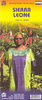
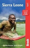
£12.99
Sierra de Leire east of Pamplona on a map at 1:25, 000 from Sua Edizioak with vivid presentation of the topography, highlighting for walking trails, refuges, places of interest, etc. The accompanying 47-page guide, in Spanish only, list several local walks & provides descriptions of 15 routes recommended by the publishers. Also included are contact details for local refuges, campsites, hotels, etc. Map in this series from the Bilbao-based Sua Edizioak provide an excellent presentation of the topography with contours at 20m intervals enhanced by bold relief shading plus colouring for forested areas. The shading is darker than found on most topographic mapping but at the same time is much more subtle, to give a very vivid picture of the terrain without obscuring contour lines or other information. An overprint highlights local hiking trails, indicating routes described in the accompanying guide, as well as other local trails, with or without waymarking, long-distance GR routes, & Via Verde trails. Small icons indicate various types of tourist accommodation including campsites & mountain refuges, areas for different recreational pursuits (mountaineering, canyoning, horse riding, etc.), interesting natural & cultural sites, etc. The maps have a 1km UTM margin ticks. Map legend is Spanish & local languages only, but most of the beautifully drawn little icons are self-explanatory. Accompanying guides, in Spanish only, provide descriptions of recommended hiking trails, & include brief descriptions and/or contact details for various types of local accommodation & useful organizations. ...
Archived Product
£11.50
Sierra de María – Los Vélez Natural Park at 1:40, 000 on a detailed, GPS compatible topographic map from the Instituto de Cartografia de Andalucía, the region’s official survey organization, printed on light, waterproof & tear-resistant synthetic paper. The map has contours at 20m intervals plus relief shading, with colours & symbols providing large amount of information on different types of local vegetation, & shows waymarked hiking trails & other local footpaths. Symbols indicate information centres, campsites, mountain refuges, accessible caves, etc. Latitude/longitude & UTM values are shown by margin ticks. Map legend is in Spanish only.PLEASE NOTE: deliveries of all publications by the Instituto de Cartografia de Andalucia are very irregular & we cannot, unfortunately, stipulate any firm delivery time for maps currently out of stock. It is advisable in such cases to choose titles from other publishers. ...
Archived Product
£19.99
Sierra de Segura on a detailed hiking map from Editorial Penibetica at 1:40, 000 scale, with a guide providing descriptions of recommended walks & general information about the area. This map has contours at 20m intervals with additional shading & altitude colouring, & provides GPS coordinates either as a grid or as margin ticks. Hiking trails are highlighted, indicating long-distance GR routes & walks recommended by publishers in the accompanying guides. Map legends include English. ...
Archived Product
£12.99
Sierra de Urbasa west of Pamplona on a map at 1:25, 000 from Sua Edizioak with vivid presentation of the topography, highlighting for walking trails, refuges, places of interest, etc. The map covers the whole of the Parque Natural de Urbasa & Andia & the surrounding area. The accompanying 48-page guide, in Spanish only, list several local walks & provides descriptions of 15 routes recommended by the publishers. Also included are contact details for local refuges, campsites, hotels, etc. Map in this series from the Bilbao-based Sua Edizioak provide an excellent presentation of the topography with contours at 20m intervals enhanced by bold relief shading plus colouring for forested areas. The shading is darker than found on most topographic mapping but at the same time is much more subtle, to give a very vivid picture of the terrain without obscuring contour lines or other information. An overprint highlights local hiking trails, indicating routes described in the accompanying guide, as well as other local trails, with or without waymarking, long-distance GR routes, & Via Verde trails. Small icons indicate various types of tourist accommodation including campsites & mountain refuges, areas for different recreational pursuits (mountaineering, canyoning, horse riding, etc.), interesting natural & cultural sites, etc. The maps have a 1km UTM margin ticks. Map legend is Spanish & local languages only, but most of the beautifully drawn little icons are self-explanatory. Accompanying guides, in Spanish only, provide descriptions of recommended hiking trails, & include brief descriptions and/or contact details for various types of local accommodation & useful organizations. ...
Archived Product
£11.50
Sierra Espuña
- Barrancos de Gebas
- La Muela area west of Murcia on a contoured & GPS compatible map from Editorial Piolet.

...
Archived Product
£16.50
”A Dirty War in West Africa” charts in gripping detail
- based on first-band experience
- the decade long civil war that brought

...
Archived Product
£16.99
Sierra Leone in the Travel Guide series from Bradt; encompassing a comprehensive range of titles to destinations worldwide, with a particular focus on Africa, Central & South America. Bradt are one of the country’s leading independent publishers & have an ethos that focuses on responsible travel, in alliance with a philosophy of sustainability; both in the destinations the guides cover but also in encouraging tourists to limit the impact they have on the local environment. Bradt guides have a reputation for appealing to more independent travelers & often cover destinations that are not available from other publishers. Each guide opens with two comprehensive chapters on Background & Practical Information, covering details of the country’s geography, culture, natural history, government & politics, economy, people, language, religion, education & culture. Important practical advice

Includes::
when to visit, highlights, suggested itineraries, tour operators, red tape, embassies & consulates, getting there & away, health, safety, what to take, money, budgeting, getting around, accommodation, eating & drinking, public holidays, shopping, arts & entertainment, media & communications, business, travel culture & cultural etiquette. Individual sections are organized geographically by region & typically open with information on practicalities & orientation, before focusing on what to see & where to go. Information on what to see, where to stay, where to eat & how to find your way around is provided, with a range of budgets catered for. Simple black & white maps locate key visitor sites & places of accommodation. Bradt Travel Guides include appendices that provide an in-depth introduction to the language of each country, a glossary of terms & a listing of books & internet resources providing further information on the destination.

...
Archived Product
£9.99
General, indexed road map of the country with a basic Freetown street plan & brief notes on the country’s history & places of interest. Altitude colouring & spot heights indicate the relief, & swamp areas are also are indicated. Road detail

Includes::
selected minor roads & tracks. The map also shows both the railway from Freetown into the interior & the mineral railway between Pepel & Lunsar. Administrative boundaries are not marked but towns which are district or provincial centres are indicated as such. Symbols denote airports, ports, ferries, petrol stations, post offices, hospitals, missions, antiquities, places of interest, various types of accommodation, etc. National parks & reserves are marked. Latitude & longitude lines are at 30` intervals. The central Freetpown streetplan is not indexed & indicates only a few landmarks, eg. the Connaught Hopstal & the US Embassy.

...
Archived Product
£17.99
Topographic mapping from Mexico’s national survey agency, Instituto Nacional de Estadística, Geografía e Informática. The maps have contours at 20m intervals with relief shading & indicate various types of terrain & vegetation, e.g. dense vegetation, cultivated areas, swamps, sand dunes, salt pans, etc. UTM grid is at 10km intervals, with latitude & longitude shown by margin ticks at intervals of 5`. Map legend is in Spanish only. To see the other titles in this series please click on the series link. ...
Archived Product
£10.99
Large attractive map providing an overview of the whole range & its eastern & western approaches, eg the San Joaquin Valley & the desert ranges of Nevada. Coverage extends from California City in the south east to Chico, CA in the west & Eagle Lake, CA in the north. Relief & terrain are depicted by intricate shading, with colours distinguishing, for example, forests, cultivated l&, pasture & desert. Many valleys & ranges are named, & other physical features shown include seasonal & perennial rivers & lakes, springs & snowfields. Various protected areas eg. national parks, national forests & wilderness areas are indicated. Spot heights are marked in feet, & symbols depict airports, camp sites, ranger stations, visitor centres, alpine ski areas & wildlife refuges. Railways are omitted but road detail

Includes::
many minor roads & makes a distinction between paved & unsurfaced routes. Although this is not intended as a walking map, the major hiking routes such as the John Muir Trail are also marked. Latitude & longitude margin ticks are set at 1° intervals.

...
Archived Product

Sierra Leone

This new, thoroughly updated third edition of Bradt`s Sierra Leone remains the only English-language guide dedicated to this unique West African destination, one of only three countries where the uber-elusive pygmy hippo can be found and where coastal mountains and sheltered beaches are the stuff of daydreams and postcards. With Bradt`s Sierra Leone you can explore the infamous diamond mines and rainforest-covered mountains; go in search of pygmy hippos or relax on the country`s beaches and islands. Offering significantly more coverage than any other guide, it is an ideal companion for tourists, volunteers and international workers alike, and also covers newly declared eco-tourist sites as well as the trans-boundary `peace park` of Gola Forest National Park, shared with neighbouring
Liberia.This new edition also covers Freetown`s new beach music festival and the Sierra Leone Marathon, shortlisted for `best marathon` in the 2017 Running Awards, as well as details of everything from where to visit rescued chimpanzees to touring the traditional wooden-board homes of the Krio people, descendants of repatriated slaves from the Americas and Europe.Sierra Leone continues to be one of the best beach destinations in West Africa, and also one of the region`s best trekking destinations, given the varied topography and the presence of Mount Bintumani, West Africa`s highest peak. The country has seen a heartening recovery since emerging from civil war a decade ago and the Bradt guide is the first to take stock of the country`s post-Ebola travel situation. Sierra Leone is
proudly back on the tourism map for the adventurous, beach-loving, jungle-exploring, mountain-scaling and curious of heart traveller.
RIP - This product is no longer available on our network. It was last seen on 25.09.2019

This page now acts as a permanent archive for this product. Add more information using the comments box below to ensure it can still be found by future generations.

Use our search facility to see if it is available from an alternative contributor.
  • External links may include paid for promotion
  • Availability: Out Of Stock
  • Supplier: Stanfords
  • SKU: 9781784770631
Availability: In Stock
£17.99

Product Description

This new, thoroughly updated third edition of Bradt`s Sierra Leone remains the only English-language guide dedicated to this unique West African destination, one of only three countries where the uber-elusive pygmy hippo can be found & where coastal mountains & sheltered beaches are the stuff of daydreams & postcards. With Bradt`s Sierra Leone you can explore the infamous diamond mines & rainforest-covered mountains; go in search of pygmy hippos or relax on the country`s beaches & islands. Offering significantly more coverage than any other guide, it is an ideal companion for tourists, volunteers & international workers alike, & also covers newly declared eco-tourist sites as well as the trans-boundary `peace park` of Gola Forest National Park, shared with neighbouring Liberia. This new edition also covers Freetown`s new beach music festival & the Sierra Leone Marathon, shortlisted for `best marathon` in the 2017 Running Awards, as well as details of everything from where to visit rescued chimpanzees to touring the traditional wooden-board homes of the Krio people, descendants of repatriated slaves from the Americas & Europe. Sierra Leone continues to be one of the best beach destinations in West Africa, & also one of the region`s best trekking destinations, given the varied topography & the presence of Mount Bintumani, West Africa`s highest peak. The country has seen a heartening recovery since emerging from civil war a decade ago & the Bradt guide is the first to take stock of the country`s post-Ebola travel situation. Sierra Leone is proudly back on the tourism map for the adventurous, beach-loving, jungle-exploring, mountain-scaling & curious of heart traveller.

Reviews/Comments

Add New

Intelligent Comparison

Oooops!
We couldn't find anything!
Perhaps this product's unique.... Or perhaps we are still looking for comparisons!
Click to bump this page and we'll hurry up.

Price History

Vouchers

No voucher codes found.
Do you know a voucher code for this product or supplier? Add it to Insights for others to use.

Facebook

Jargon Buster

Forest - A area with a high density of trees
Wooden - Something that is made from wood, from trees
Beach - An area on the coast consisting of a sandy or pebbled area
running - A sport or hobbie of moving rapidly on foot. Can also refer to the running of equipment or run time refering to the length of time an applicance can run or the quiet running of an applicance.
Heart - An organ that pumps blood around the body. Usually related to love.
Language - the method of communication used in different areas. Humans and computers have many different languages.
Traditional - Something that has become the same through a period of time and thus repeated.
Traditional - Something that has been around for a while and is repeated regularly.
Festival - A period usually occurring once a year for celebration, typically for religious reasons.
Ideal - Something that satisfies a perfect criteria.
Language - The way humans communicate either written and spoken.

Supplier Information

Stanfords
Stanfords was established in 1853 and opened their iconic Covent Garden flagship store in 1901. They have become the top retailer of maps, travel books and accessories in the UK and arguably offer the largest selection of maps and travel books worldwide. Famous names such as Captain Robert Falcon Scott, Ranulph Fiennes and Michael Palin have purchased from Stanfords. They now have a shop in Bristol and both stores together with other venues operate a calendar of events including talks, book signings and exhibitions. As a specialist map retailer, the map selection is comprehensive and includes road maps, street maps and walking maps from worldwide destinations, as well as a selection of world atlases and wall maps. Books include travel guides and travel literature. Stanfords also stock globes, from miniatures made of blue marble to magnificent floor-standing globes. The website features a selection of interesting articles on travel topics.
Page Updated: 2023-11-12 20:15:36

Community Generated Product Tags

Oh No! The productWIKI community hasn't generated any tags for this product yet!
Menu