
 United Kingdom
 France
 Germany
 Netherlands
 Sweden
 USA
USA
 Italy
Italy
 Spain
Spain
More From Contributor
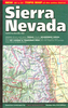


Sierra Nevada Destination Map
Sierra Nevada on a double-sided road map at 1:543, 000 from the National Geographic, highlighting numerous places of interest and printed on light, waterproof and tear resistant synthetic paper. On one side coverage extends from the California/Oregon border to Sacramento and includes the region of Nevada around Lake Tahoe and Pyramid Lake. On the reverse the map shows the most visited part of the Sierra Nevada from Lake Tahoe, across the Yosemite National Park and the Sequoia Range, to Tehachapi Pass.The base map is taken from satellite imagery and has plenty of names of topographic features, including peaks with heights given both in feet and metres. Borders of national parks, forests and the region’s other numerous protected areas, as well as of Indian Reservations, are
prominently highlighted. Road network includes unpaved roads and indicates national and other Scenic Byways. Also marked is the course of the Pacific Crest hiking trail. Symbols indicate visitor centres, ski resorts and places of interest, many annotated with brief notes. Latitude and longitude lines are drawn at 1° intervals. Also provided is a table listing facilities and outdoor opportunities in the region’s national parks, and more general notes about the Sierra Nevada, its culture and heritage, etc.
prominently highlighted. Road network includes unpaved roads and indicates national and other Scenic Byways. Also marked is the course of the Pacific Crest hiking trail. Symbols indicate visitor centres, ski resorts and places of interest, many annotated with brief notes. Latitude and longitude lines are drawn at 1° intervals. Also provided is a table listing facilities and outdoor opportunities in the region’s national parks, and more general notes about the Sierra Nevada, its culture and heritage, etc.

Product Description
Reviews/Comments
Add New
Vouchers
No voucher codes found.
Do you know a voucher code for this product or supplier? Add it to Insights for others to use.
Do you know a voucher code for this product or supplier? Add it to Insights for others to use.
 Denmark