
 United Kingdom
 France
 Germany
 Netherlands
 Sweden
 USA
USA
 Italy
Italy
 Spain
Spain
More From Contributor


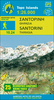

Santorini
Contoured map of Santorini and the nearby islands of Thirasia and Nea Kameni, with very detailed street plans of Fira, Ia, Imerovigli, Kamari and Perissa, plus plans of archaeological sites at Akrotiri and Old Thira.The main map of Santorini and the islands is contoured, with colouring and graphics indicating different types of vegetation and terrain: rocky or barren land, beaches, olive groves, vinyards, etc. Symbols highlight various places of interest including archaeological sites, viewpoints, selected accommodation, petrol stations, etc. The map has latitude and longitude lines at interval of 1
Product Description
Reviews/Comments
Add New
Intelligent Comparison
Archived Product
Santorini Stanfords
£9.50
Archived Product
Santorini Stanfords
£8.50
Archived Product
Santorini Stanfords
£7.50
Archived Product
Sardinia Stanfords
£4.99
Archived Product
Sardinia Stanfords
£11.19
Archived Product
Sardinia Stanfords
£11.19
Archived Product
Sardinia Stanfords
£12.99
Archived Product

Sardinia Stanfords
£13.99
Vouchers
No voucher codes found.
Do you know a voucher code for this product or supplier? Add it to Insights for others to use.
Do you know a voucher code for this product or supplier? Add it to Insights for others to use.
 Denmark