
 United Kingdom
 France
 Germany
 Netherlands
 Sweden
 USA
USA
 Italy
Italy
 Spain
Spain
More From Contributor

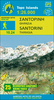
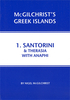


Santorini Pocket Guide
This vibrant series spans over 170 destinations worldwide. It contains the most comprehensive list of UK guides currently available. It offers practical listings to suit varied budgets and tastes. Compact format quickly locates the top must see and do attractions. Imaginative suggestions reveal each destination's hidden gems. This title is organised by recognisable areas, making orientation easy.
Product Description
Reviews/Comments
Add New
Vouchers
No voucher codes found.
Do you know a voucher code for this product or supplier? Add it to Insights for others to use.
Do you know a voucher code for this product or supplier? Add it to Insights for others to use.
 Denmark