
 United Kingdom
 France
 Germany
 Netherlands
 Sweden
 USA
USA
 Italy
Italy
 Spain
Spain
More From Contributor


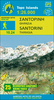
Santorini
Santorini on clear, waterproof and tear-resistant, indexed map with topographic and tourist information, five large street plans, maps of archaeological sites, and a map of the whole of the Cyclades. The map is published by Reise Know-How as part of their highly acclaimed World Mapping Project. Topography is shown by altitude and bathymetric colouring with contours and spot heights. Road network shows local roads and tracks, gives driving distances on main and secondary roads and indicates scenic routes and locations of petrol stations. Ferry routes along the coast and to the nearby islands of Kameni and Thisaria are also marked. A separate inset of the whole of the Cyclades (1:1, 000, 000) shows ferry connections to Athens and between various islands.The map shows locations of
isolated hotels, campsites, youth hostels, restaurants and tavernas, beaches and harbours, viewpoints, archaeological sites, wineries, windmills, etc. Place names are given in both scripts. The map has a latitude and longitude grid at intervals of 1
isolated hotels, campsites, youth hostels, restaurants and tavernas, beaches and harbours, viewpoints, archaeological sites, wineries, windmills, etc. Place names are given in both scripts. The map has a latitude and longitude grid at intervals of 1
Product Description
Reviews/Comments
Add New
Intelligent Comparison
Archived Product
Santorini Stanfords
£8.50
Archived Product
Santorini Stanfords
£12.95
Archived Product
Santorini Stanfords
£7.50
Archived Product
Sardinia Stanfords
£4.99
Archived Product
Sardinia Stanfords
£11.19
Archived Product
Sardinia Stanfords
£11.19
Archived Product
Sardinia Stanfords
£12.99
Archived Product

Sardinia Stanfords
£13.99
Vouchers
No voucher codes found.
Do you know a voucher code for this product or supplier? Add it to Insights for others to use.
Do you know a voucher code for this product or supplier? Add it to Insights for others to use.
 Denmark