More From Contributor
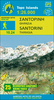
£6.50
Topographic coverage of mainland Spain at 1:25, 000 published by the Centro Nacional de Información Geograficá, the country’s civilian survey organization. The maps have contours at 10m intervals & colouring and/or graphics to show different types of vegetation or land use. Boundaries of national parks & other protected areas are marked. In addition to all the usual information shown on topographic maps at this scale, detailed presentation of the road & rail networks, rural tracks & paths, etc, the maps also show campsites. The maps have a 1-km UTM grid, with margin ticks for latitude & longitude at 1` intervals. Map legend is in Spanish only.PLEASE NOTE: our grid for the whole of Spain is in preparation
- in the meantime, for areas other than those shown on the attached grid please use CNIG’s topographic survey at 1:50, 000 by searching for ‘SI00000832’. Each 25K map covers one quarter of the corresponding 50K map, with the numbering system: I = NW quarter, II = NE quarter, III = SW quarter & IV = SE quarter. CNIG maps in the Provincial Road Maps series at 1:200, 000 are overprinted with the grid for the 1:50, 000 survey & can be used to see the area covered by each 50K or 25K title in more detail. To see the list of titles in this series please click on the series grid
- for map numbers not yet listed on our website please contact us by email.

...
Archived Product
£17.99
Topographic survey of Portugal at 1:50, 000 from the Instituto Geográfico do Exército, the country’s military survey organisation. The maps have contours at 20m intervals & in addition to the standard features shown on topographic mapping at this scale also indicate various types of terrain or vegetation (s&, terraces, rocks, woodlands, vineyards, etc). Each sheet covers an area of 32 x 20km (20 x 12.5 miles approx). The maps have a 1-km UTM grid plus latitude & longitude coordinates for the map corners. Map legend & a glossary of terms used on the maps include English.EDITION DATES: most titles in this series date from 1990s or later. To see all the titles in this series please click on the series link. ...
Archived Product
£17.99
Topographic survey of Portugal at 1:50, 000 from the Instituto Geográfico Português, the country’s civilian survey organisation. The maps have contours at 25m intervals & in addition to the standard features shown on topographic mapping at this scale also indicate various types of vegetation (vineyards, olive groves, etc). Each sheet covers an area of 32 x 20km (20 x 12.5miles approx). The maps have latitude & longitude margin ticks at 1’ intervals & UTM coordinates for the map corners – each sheet also shows conversion details from BBLx (Bessel-Bonnie system, Datum Lisbon) to UTM. Map legend is in Portuguese only.EDITION DATES: most titles in this series have now been updated in the 1990s or later. To see all the titles in this series please click on the series link. ...
Archived Product
£9.50
Santorini on clear, waterproof & tear-resistant, indexed map with topographic & tourist information, five large street plans, maps of archaeological sites, & a map of the whole of the Cyclades. The map is published by Reise Know-How as part of their highly acclaimed World Mapping Project. Topography is shown by altitude & bathymetric colouring with contours & spot heights. Road network shows local roads & tracks, gives driving distances on main & secondary roads & indicates scenic routes & locations of petrol stations. Ferry routes along the coast & to the nearby islands of Kameni & Thisaria are also marked. A separate inset of the whole of the Cyclades (1:1, 000, 000) shows ferry connections to Athens & between various islands. The map shows locations of isolated hotels, campsites, youth hostels, restaurants & tavernas, beaches & harbours, viewpoints, archaeological sites, wineries, windmills, etc. Place names are given in both scripts. The map has a latitude & longitude grid at intervals of 1 ...
Archived Product
£12.95
Contoured map of Santorini & the nearby islands of Thirasia & Nea Kameni, with very detailed street plans of Fira, Ia, Imerovigli, Kamari & Perissa, plus plans of archaeological sites at Akrotiri & Old Thira. The main map of Santorini & the islands is contoured, with colouring & graphics indicating different types of vegetation & terrain: rocky or barren l&, beaches, olive groves, vinyards, etc. Symbols highlight various places of interest including archaeological sites, viewpoints, selected accommodation, petrol stations, etc. The map has latitude & longitude lines at interval of 1 ...
Archived Product
£7.50
Road Edition maps are produced in co-operation with the Hellenic Army Geographical Service, the national survey organisation. The maps have contours with colour altitude tints. All the place names are shown in both Greek & Latin script. Road classification distinguishes between unsurfaced roads of good & poor quality. Tourist information

Includes::
scenic routes, petrol stations, archaeological sites, campsites, beaches, etc. Brief descriptions, in Greek & English, illustrate some of the interesting aspects of each isl&. Map legend

Includes::
English. On the reverse, there are lists of various types of accommodation from hotels to private rooms. The map of Santorini

Includes::
a plan of the archaeological site at Akrotiri & an inset showing vineyards & wineries on the isl&. The map also shows roads on the neighbouring island of Thirasia. Please note: deliveries from Road Editions are not very reliable. For titles currently not in stock it may be advisable to choose a map from another publisher.


...
Archived Product
£7.50
Santorini with the nearby Thirasia at 1:26, 000 on light, waterproof & tear-resistant, contoured & GPS compatible map from Anavasi, with on the reverse special maps of the two islands highlighting numerous hiking paths. On one side the two islands, with Nea Kameni, Palea Kameni & Aspronisi, are presented with contours at 20 metre intervals with additional altitude colouring. Road network indicates dirt roads in poor condition, gives distances on most small local roads, & shows locations of petrol stations. Symbols highlight various places of interest, including beaches & scuba diving sites, campsites, archaeological remains, etc. Place names are in both Greek & Latin alphabet. The map has a 1-km UTM grid plus latitude & longitude crosshairs at 1’ intervals. On the reverse are slightly simplified maps of the two islands highlighting numerous hiking options, 19 on Santorini & 6 on Thirasia, each accompanied by a brief description. Map legend & all the text include English. To see which other Greek islands are covered by maps from Anavasi, please click on the series link. ...
Archived Product
£9.95
Santorini & Therasia with Anaphi in the Mc Gilchrist’s Greek Islands series focuses primarily on cultural tourism for the visitor who wishes to understand more about the art, history & architecture of the islands. The series contains no photographs, but has specially drawn maps for each island (66 in total) & site plans for every major site (57 in total), together with thoroughly comprehensive textual information. Each guide also recommends a small number of places to stay & eat selected for their simplicity & unpretentiousness. ...
Archived Product
£7.99
Marco Polo Pocket Guide Santorini: the Travel Guide with Insider Tips. Explore Santorini with this handy, pocket-sized, authoritative guide, packed with Insider Tips. Discover boutique hotels, authentic restaurants, the island`s trendiest places, & get tips on shopping & what to do on a limited budget. There are plenty of ideas for travel with kids, & a summary of all the festivals & events that take place. Let Marco Polo show you all this idyllic Greek island has to offer... From the picturesque, white-washed villages to the glorious crystal clear, turquoise waters of the Aegean to the ancient ruins of Akrotiri, a unique Bronze Age town, Santorini has everything you need for a wonderful, relaxing holiday. This practical, pocket-sized guide will help you discover where to see the most breath-taking sunsets & in which tavernas you can enjoy excellent dishes & fresh fish at fair prices. This is Santorini! Your Marco Polo Santorini Pocket Guide
Includes:: Insider Tips
- we show you the hidden gems & little known secrets that offer a real insight into this heavenly isl&. Best of
- find the best things to do for free, the best `only in` Santorini experiences, the best things to do if it rains & the best places to relax & spoil yourself. Sightseeing
- all of the top sights are organised by areas of the island so you can easily plan your trip. Discovery Tours
- specially tailored tours that will get you to the heart of Santorini. Here are inspirational itineraries that will help you enjoy authentic Santorini. Santorini in full-colour
- Marco Polo Pocket Guide Santorini

Includes::
full-colour photos throughout the guide bringing the island to life offering you a real taste of what you can see & enjoy on your trip. Touring App
- you can download any of the Discovery Tours to your smartphone, complete with the detailed route description & map exactly as featured in the guide, free of charge. The maps can be used offline too, so no roaming charges. The perfect navigational tool with distance indicators & landmarks highlighting the correct direction to travel in as well as GPS coordinates along the way. Enjoy stress-free sightseeing & never get lost again! Road Atlas & pull-out map
- we`ve included a detailed road atlas & a handy, pull-out map so you can pop the guide in your bag for a full-on sightseeing day or head out with just the map to enjoy your Discovery Tour. Useful Greek phrases
- the essential words & phrases are included to help you get by. Trust Marco Polo Pocket Guide Santorini to show you around this iconic Greek isl&. The comprehensive coverage & unique insights will ensure you experience everything Santorini has to offer & more. The special tips, personal insights & unusual experiences will help you make the most of your trip
- just arrive & enjoy.


...
Archived Product

Santorini

Santorini and the nearby islands of Thirasia and Kameni at 1:30, 000 on a clear and simple map which shows the network of main roads and highlights various places of interest, but overall presents less information than most of its competitors.Place names are shown in both scripts. Latitude and longitude lines are at 5
RIP - This product is no longer available on our network. It was last seen on 25.09.2019

This page now acts as a permanent archive for this product. Add more information using the comments box below to ensure it can still be found by future generations.

Use our search facility to see if it is available from an alternative contributor.
  • Availability: Out Of Stock
  • Supplier: Stanfords
  • SKU: 9783850845908
Availability: In Stock
£8.50

Product Description

Santorini & the nearby islands of Thirasia & Kameni at 1:30, 000 on a clear & simple map which shows the network of main roads & highlights various places of interest, but overall presents less information than most of its competitors. Place names are shown in both scripts. Latitude & longitude lines are at 5

Reviews/Comments

Add New

Price History

Vouchers

No voucher codes found.
Do you know a voucher code for this product or supplier? Add it to Insights for others to use.

Facebook

Jargon Buster

Network - A link and communication between things. Often computers or people.
Simple - Basic, easy no difficulty in understanding.

Supplier Information

Stanfords
Stanfords was established in 1853 and opened their iconic Covent Garden flagship store in 1901. They have become the top retailer of maps, travel books and accessories in the UK and arguably offer the largest selection of maps and travel books worldwide. Famous names such as Captain Robert Falcon Scott, Ranulph Fiennes and Michael Palin have purchased from Stanfords. They now have a shop in Bristol and both stores together with other venues operate a calendar of events including talks, book signings and exhibitions. As a specialist map retailer, the map selection is comprehensive and includes road maps, street maps and walking maps from worldwide destinations, as well as a selection of world atlases and wall maps. Books include travel guides and travel literature. Stanfords also stock globes, from miniatures made of blue marble to magnificent floor-standing globes. The website features a selection of interesting articles on travel topics.
Page Updated: 2023-11-12 20:15:36

Community Generated Product Tags

Oh No! The productWIKI community hasn't generated any tags for this product yet!
Menu