More From Contributor
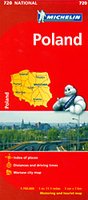
£15.99
Poland Insight Guide is dedicated to exploring the destination in detail with a selection of glossy illustrations. Extensive introductory sections explore the region’s history & culture & there are also short articles written by locals about distinctive local issues, whilst selective photo-features illustrate the variety of the place. The ‘ Places’ section is grouped geographically & provides details of the area including places to visit, suggestions for tours & other activities. Each section has its own listings of the best restaurants, bars & cafes. Essential practical information is provided in the Travel Tips chapter on accommodation, shopping & local activities. A useful location finder & travel tip index with relevant page numbers are given on the inside covers. Overview street plans are also provided for the main cities in the region or country. ...
Archived Product
£6.99
Poland on a double-sided, indexed road map at 1:800, 000 from Insight. This large map

Includes::
many places

...
Archived Product
£9.99
Large, indexed road map of Poland with street plans of central Warsaw, Kraków, Poznan & Wroclaw. The map shows the country’s road & rail networks, indicating scenic routes, roads with restricted access or closed to caravans, steep gradients, winter closures, etc. Towns or villages & other places of special interest are highlighted & graded. National & regional landscape parks are prominently marked. The map has no geographical coordinates. Map legend

Includes::
English. Index of localities is on the reverse. Also included are street plan of central Warsaw, Kraków, Poznan & Wroclaw.

...
Archived Product
£6.99
Poland at 1:800, 000 on an indexed road map from Marco Polo Travel Publishing with special features to aid route planning, plus street plans of the central areas in the country’s five main cities: Warsaw, Kraków, Gdansk, Wroclaw & Szczecin.A fold-out flap in the jacket shows an overview of the whole area covered by the map plus the adjoining regions & highlights main places of interest, with the grid reference system in the margins making it easier to find locations on the main map. A set of seven peel-on/peel-off stickers, removable without damaging the map surface, is provided for making selected locations more prominent when navigating. Cartography is from the renowned German publishers Mair Dumont. Road network

Includes::
minor local roads & selected unsurfaced tracks, indicates motorway services, truck shops, toll stations, traffic or seasonal restrictions, etc. & gives driving distances on main & most secondary routes. Scenic roads, special tourist routes & viewpoints are highlighted. Railway lines, ferry routes & local airports are included. Locations of interest are prominently highlighted, with separate colouring for towns or villages & for natural sites. National parks & other protected areas are marked. Symbols highlight locations of campsites, youth hostels & other tourist accommodation, plus various places of interest. Topography is shown by relief shading with names of mountain ranges & peaks & additional spot heights. The map has latitude & longitude lines at intervals of 30’. The index is in a separate booklet attached to the map cover. Map legend

Includes::
English. Street plans show the centres of Warsaw, Kraków, Gdansk, Wroclaw & Szczecin, highlighting principal traffic arteries & naming important buildings. The map also

Includes::
a distance/driving times table & basic driving regulations.


...
Archived Product
£14.99
Fully updated for 2017...and now with ZOOM system for even better orientation! Unique spiral binding with wrap-around spine. High quality cartography with distance indicators & scale converters to aid route planning. Comprehensive index & inset street plans of major cities. ...
Archived Product
£9.50
Northern Poland at 1:350, 000 on an indexed, waterproof & tear-resistant road map with topographic & tourist information & historical German names for main towns, published by Reise Know-How as part of their highly acclaimed World Mapping Project. The map is double-sided to provide the best balance between a good scale & a convenient size sheet. The map divides northern Poland east/west, with a small overlap between the sides. Coverage extends south to the Bydgoszcz ...
Archived Product
£9.99
Poland at 1:800, 000 on an indexed road map from Mair Dumont with special features to aid route planning, plus street plans of the central areas in the country’s five main cities: Warsaw, Kraków, Gdansk, Wroclaw & Szczecin. A fold-out flap in the jacket shows an overview of the whole area covered by the map plus the adjoining regions & highlights main places of interest, with the grid reference system in the margins making it easier to find places on the main map. A set of seven peel-on/peel-off stickers, removable without damaging the map surface, is provided for making selected locations more prominent when navigating. Road network

Includes::
minor local roads & selected unsurfaced tracks, indicates motorway services, truck shops, toll stations, traffic or seasonal restrictions, etc. & gives driving distances on main & most secondary routes. Scenic roads, special tourist routes & viewpoints are highlighted. Railway lines, ferry routes & local airports are included. Locations of interest are prominently highlighted, with separate colouring for towns or villages & for natural sites. National parks & other protected areas are marked. Symbols highlight locations of campsites, youth hostels & other tourist accommodation, plus various places of interest. Topography is shown by relief shading with names of mountain ranges & peaks & additional spot heights. The map has latitude & longitude lines at intervals of 30’. * Map legend

Includes::
English.*A booklet attached to the map cover has an extensive index of place names, a distance/driving times table, & basic driving regulations.


...
Archived Product
£9.50
North-eastern Poland in a series of large, detailed roads map with an index, street plans of main cities & stickers to highlight on the maps your selected locations. A fold-out flap in the jacket shows an overview of the whole area covered by the map plus the adjoining regions & highlights main places of interest, with the grid reference system in the margins making it easier to find places on the main map. A set of seven peel-on/peel-off stickers, removable without damaging the map surface, is provided for making selected locations more prominent when navigating. Road network

Includes::
selected minor roads & tracks, & shows intermediate driving distances on many roads. Many useful additional details are included e.g. motorway filling stations, truck stops, toll stations, pass closures, caravan & vehicle restrictions, gradients, scenic & tourist routes, border crossings. Railways with stations, cable lifts, rack railways, chair lifts, airports & local airfields, & car ferries are marked. Locations & objects of interest are highlighted & symbols show numerous landmarks & tourist features, e.g. churches, ruins, towers, antiquities, campsites, hostels, motels, spas, viewpoints, etc. There is some subtle hill-shading in mountainous areas to show general relief, plus spot heights. Terrain variations are marked by colours, e.g. forests, heaths, tidal flats & s&. Administrative boundaries, prohibited areas & national parks are indicated. The maps have no geographical coordinates. Multilingual map legend included English. A booklet attached to the map cover has an extensive index of place names, a distance/driving times table, & basic driving regulations. In this title: an inset with a street plan of central Warsaw at 1:20, 000

...
Archived Product
£5.99
North-Eastern Poland at 1:300, 000 in a series of four large indexed touring maps at 1:300, 000 from Michelin, with coverage extending south to Kielce & Lublin. On the reverse are city maps highlighting principal traffic arteries & naming main streets in Warsaw & Lublin. Also provided is a distance table for the whole country. Michelin’s touring maps of Poland show road network graded into seven types, indicate road width, give driving distances on national & regional roads, & show locations of fixed speed radars. Railway lines are shown with stations & local airports are marked. Topography is indicated by names of mountain ranges & peaks with heights, plus colouring for national parks or regional landscape parks & forested areas. Small symbols mark various places of interest, although the maps are designed primarily for driving rather than for planning sightseeing trips. The maps have latitude & longitude lines at intervals of 15’. The index is on the reverse, together with city maps of main towns. Map legend

Includes::
English. To see the list of all the titles in this series please click on the series link.

...
Archived Product
£11.50
Northern Poland at 1:350, 000 on an indexed, waterproof & tear-resistant road map with topographic & tourist information & historical German names for main towns, published by Reise Know-How as part of their highly acclaimed World Mapping Project. The map is double-sided to provide the best balance between a good scale & a convenient size sheet. The map divides northern Poland east/west, with a small overlap between the sides. Coverage extends south to the Bydgoszcz – Pultusk line. Names of many towns within areas which during the 19th & part of the 20th century were in Germany are shown with their German equivalents. Road & rail networks are easy to see on a clear base which shows the area’s topography by altitude colouring with contours & spot heights. Names of the region’s numerous national or regional parks & lake districts are clearly marked. Road network

Includes::
unsurfaced local roads & indicates locations of border crossings. Internal administrative boundaries are shown with names of the provinces. Symbols highlight various places of interest, including campsites, castles, churches, viewpoints, etc. Names of some sights are shown in German. The map has a latitude & longitude grid at intervals of 20’ & an index of place names. Map legend

Includes::
English. PLEASE NOTE: there is no overlap between this title & the publishers’ map of Southern Poland – a large band across central Poland is not covered by either title. To see the other titles in this series please click on the series link.


...
Archived Product

Poland Michelin

The Michelin National road map of Poland at 1:700, 000 scale is ideal for route planning. The map gives comprehensive coverage of national road networks showing all major motorways, dual carriageways, national & regional main roads and some single-lane roads.Distances between major locations are marked along roads, with total distance and several intermediate distances shown. A quick-reference chart of distances & driving times between major locations is also included. The map also includes a grid-referenced index of principal place names.Clear, easy-to read cartography shows roads in reds, yellows and white with black outlines. Major topography is indicated with relief shading. Woodland & forest is marked with green shading. Built-up urban areas are clearly marked in yellow.
Airports, ferries, railways, bridges, are also marked. Administrative divisions are marked, as are sights of special interest.Also includes a quick reference panel giving national driving regulations, including speed limits, equipment requirements (e.g. bulb kits, warning triangles) and seatbelt rules, for all countries principally shown.City plans & regional enlargements:- Warsaw at 1:100, 000 scale
RIP - This product is no longer available on our network. It was last seen on 25.09.2019

This page now acts as a permanent archive for this product. Add more information using the comments box below to ensure it can still be found by future generations.

Use our search facility to see if it is available from an alternative contributor.
  • External links may include paid for promotion
  • Availability: Out Of Stock
  • Supplier: Stanfords
  • SKU: 9782067171596
Availability: In Stock
£5.99

Product Description

The Michelin National road map of Poland at 1:700, 000 scale is ideal for route planning. The map gives comprehensive coverage of national road networks showing all major motorways, dual carriageways, national & regional main roads & some single-lane roads. Distances between major locations are marked along roads, with total distance & several intermediate distances shown. A quick-reference chart of distances & driving times between major locations is also included. The map also

Includes::
a grid-referenced index of principal place names. Clear, easy-to read cartography shows roads in reds, yellows & white with black outlines. Major topography is indicated with relief shading. Woodland & forest is marked with green shading. Built-up urban areas are clearly marked in yellow. Airports, ferries, railways, bridges, are also marked. Administrative divisions are marked, as are sights of special interest. Also

Includes::
a quick reference panel giving national driving regulations, including speed limits, equipment requirements (e.g. bulb kits, warning triangles) & seatbelt rules, for all countries principally shown. City plans & regional enlargements:- Warsaw at 1:100, 000 scale

Reviews/Comments

Add New

Price History

Vouchers

No voucher codes found.
Do you know a voucher code for this product or supplier? Add it to Insights for others to use.

Facebook

Jargon Buster

Black - A colour which does not emit any colour of the spectrum. Black absorbs all frequencies of the spectrum.
Forest - A area with a high density of trees
White - A colour combining all colours
Yellow - A primary colour. The sun is often described as yellow
Railways - A set of tracks that have been laid for the purpose of trains to travel up and down them
speed - A measurement of how fast an object travels between two points
Quick - Something that is fast
Road - a manmade lane or a path that is used to speed up travel.
Equipment - A product or good that is tactile.
Regional - An adjective to describe a set geographic area.
Reference - To prove evidence with a back up source.
Ideal - Something that satisfies a perfect criteria.

Supplier Information

Stanfords
Stanfords was established in 1853 and opened their iconic Covent Garden flagship store in 1901. They have become the top retailer of maps, travel books and accessories in the UK and arguably offer the largest selection of maps and travel books worldwide. Famous names such as Captain Robert Falcon Scott, Ranulph Fiennes and Michael Palin have purchased from Stanfords. They now have a shop in Bristol and both stores together with other venues operate a calendar of events including talks, book signings and exhibitions. As a specialist map retailer, the map selection is comprehensive and includes road maps, street maps and walking maps from worldwide destinations, as well as a selection of world atlases and wall maps. Books include travel guides and travel literature. Stanfords also stock globes, from miniatures made of blue marble to magnificent floor-standing globes. The website features a selection of interesting articles on travel topics.
Page Updated: 2023-11-12 20:15:36

Community Generated Product Tags

Oh No! The productWIKI community hasn't generated any tags for this product yet!
Menu