
 United Kingdom
 France
 Germany
 Netherlands
 Sweden
 USA
USA
 Italy
Italy
 Spain
Spain
More From Contributor


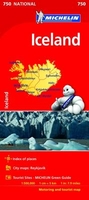
Iceland Michelin
Iceland on an indexed road map at 1:500, 000 from Michelin with special panels highlighting places of interest and recommended sightseeing routes in the country’s six most visited regions; plus street maps of Reykjavik and Akureyri and a distance table.Iceland’s road network is shown on a base with relief shading to present the country’s landscape, with spot heights, plenty of names of topographic features and highlighting for it national parks and other protected areas. The map indicates unsurfaced roads and includes selected country tracks, highlights scenic routes, and gives distances on main and connecting routes. Also marked are vehicle ferry routes. Symbols indicate various facilities and places of interest, including campsites and mountain shelters, visitor centres, hot
springs, etc. The map has latitude lines at 30’ and longitude at 1º intervals. The index is next to the map. Map legend includes English.A special feature of this title are six panels highlighting and grading best sights and showing recommended sightseeing routes in: 1) the Reykjanes Peninsula, accompanied by a street plan of Reykjavik; 2) South Iceland around Hekla, Eyjafjallajökull, þórsmörk, Skaftafell, etc; 3) the Highlands, including Askja; 4) East Iceland, including Berufjördur; 5) Northern Iceland, accompanied by a street plan of central Akureyri: 6) North-west Iceland, including Snæfellsjökull. Also provided is a distance table.
springs, etc. The map has latitude lines at 30’ and longitude at 1º intervals. The index is next to the map. Map legend includes English.A special feature of this title are six panels highlighting and grading best sights and showing recommended sightseeing routes in: 1) the Reykjanes Peninsula, accompanied by a street plan of Reykjavik; 2) South Iceland around Hekla, Eyjafjallajökull, þórsmörk, Skaftafell, etc; 3) the Highlands, including Askja; 4) East Iceland, including Berufjördur; 5) Northern Iceland, accompanied by a street plan of central Akureyri: 6) North-west Iceland, including Snæfellsjökull. Also provided is a distance table.

Product Description
Reviews/Comments
Add New
Vouchers
No voucher codes found.
Do you know a voucher code for this product or supplier? Add it to Insights for others to use.
Do you know a voucher code for this product or supplier? Add it to Insights for others to use.
 Denmark