More From Contributor

£5.99
Iceland in the Compact Guide series from Insight is an accessible & handy reference guide, describing main sites & cultural highlights. Each illustrated guide

Includes::
an introductory chapter with a selection of the top ten things to do & gives visitors an insight into history, culture & geography. An extensive

...
Archived Product
£16.99
Iceland in the Insight Guide series is dedicated to exploring the destination in detail with a selection of glossy illustrations. Extensive introductory sections explore the region’s history & culture & there are also short articles written by locals about distinctive local issues. Selective photo-features illustrate the variety of the region. The ‘ Places’ section is organised by geographically & provides details of the area including places to visit, suggestions for tours & other activities. Each regional section has its own listings of the best restaurants, bars & cafes. Essential practical information is provided in the Travel Tips chapter on accommodation, shopping & local activities. A useful location finder & travel tip index with relevant page numbers are given on the inside covers. Overview street plans are also provided for the main cities in the region or country. ...
Archived Product
£6.99
Insight Guides Travel Map: has a fold up map of the country ideal for planning routes or taking on holiday. This Iceland Travel Map is drawn to a scale of 1:4 million & shows the entire country complete with a comprehensive index. This is an ideal on-the-move companion when you`re exploring Iceland It

Includes::
detailed street plan of Reykjavik, with its own separate index Outlines Top Attractions & places of interest Pictorial symbols for instant recognition Shows countries roads, rail networks & ferry routes
Includes: distance indicators Detailed topography Legend shown in eight languages


...
Archived Product
£9.99
Iceland at 1:425, 000 on a double-sided indexed road map from ITMB, printed on light waterproof & tear-resistant plastic paper, with a large street plan of central Reykjavik. The map divides the country east/west with a very small overlap between the sides. Altitude colouring with spot heights & plenty of names of various geographical features shows Iceland’s topography. Glaciers & national parks or other protected areas are clearly marked. Road network distinguishes between paved, unpaved & gravel road. Locations of petrol stations are marked & intermediate distances are given on main routes & selected secondary or local roads. Symbols highlight local airfields, tourist lodges & emergency huts, campsites, hot springs & geysers, golf courses, fishing & skiing areas, viewpoints, etc. The map is indexed & has a latitude & longitude grid at intervals of 30’. A large panel provides a street plan of central Reykjavik annotated with selected accommodation & various places of interest. Also included are photos with brief descriptions of interesting sites. ...
Archived Product
£37.99
Road Atlas of Iceland at 1:300, 000 from Mál og menning in a spiral-bound glovebox format, with 35 street plans, several thematic maps, & cartography derived from the company’s outstanding mapping at 1:100, 000. The representation of country’s topography is particularly vivid, with excellent relief shading based on satellite imagery supplemented by contours at 100m intervals plus colouring and/or graphics for different types of terrain & vegetation: heath, grassl&, wetlands, s&, lava, glaciers, etc. The degree of detail

Includes::
even names of individual farms, all listed in a comprehensive index. Road network distinguishes between surfaced or gravel roads & other tracks, indicating ford crossings. Ferry connections & local airfields are also shown. Symbols indicate locations of emergency shelters, tourist huts & shelters, campsites, swimming pools, lighthouses, thermal or hydroelectric power stations, etc. Margin ticks give latitude & longitude at intervals 10’ & 20’ respectively. Map legend

Includes::
English. The atlas provides 35 indexed street plans, indicating one way streets & highlighting various facilities. Reykjavik, spread over 9 pages, is shown on with its outer suburbs plus & enlargement of the city centre. Also included are: a list of museums with a map showing their locations; thematic maps showing campsites, swimming pools, golf courses & interesting bird-watching sites; plus a comprehensive distance table.


...
Archived Product
£9.99
Beautiful laminated map & guide of Iceland including:- Unique combination of map & guide book- Durable, laminated, easy to use- Easy navigation: each attraction is numbered & marked on the map- Descriptions of 30 of the most interesting places to visit- Useful, practical information: opening days & hours of facilities & tips on transport- Tourist friendly map scales: Iceland (1:615 000), Reykjavik (1:16 000) Akureyri (1:16 000) ...
Archived Product
£6.99
With this up-to-date, authoritative guide you can experience all the sights & ” Best Of” recommendations for Icel&. You can discover hotels & restaurants, trendy spots, & also pick up tips on what to do on a limited budget, ideas for shopping as well as suggestions for travel with kids & sport & activities. Also contains: Festivals & Events, In a Nutshell, Travel Tips, Links, Blogs, Apps & More, Useful Phrases in Icelandic & a comprehensive index. Iceland is a land full of contrasts, surprises & secrets. In the ancient volcanic landscape you feel you`ve been transported back to the time when the earth was first created. The country`s greatest treasure is its unique natural world, & medieval sagas are part of the national cultural heritage. With Marco Polo Iceland nature lovers can experience a veritable El Dorado. This practical guide book, small enough to slip into your pocket, takes you to thunderous geysers, massive glaciers, fascinating deserts of lava, black beaches, steep cliffs & breathtaking waterfalls. Become an adventurer & set off on a riding or glacier tour. Unwind in hot pots, warm baths. Experience the midnight sun weaving its magic & the beguiling enchantment of the polar lights. Or go shopping in the lively mini-metropolis of Reykjavik. The Insider Tips tell you where it`s good value to camp & where you can go diving between continental plates. The ” Best Of” pages succinctly tell you what`s unique to Icel&, where there are great places for free, where`s nice on rainy days & where you can relax & chill out. On the ” Perfect Tour” you`ll get to know Iceland in all its glory. The tips on what to do on a limited budget in each chapter show how you can experience a great deal with very little money & snap up some real bargains. Get to know the cultural monuments & experience the highlands. Trips & Tours take you to glaciers & geysers, through wasteland & to waterfalls. On water & on l&, on glaciers & on lakes: there are possibilities for outdoor activities everywhere in Icel&. You`ll find the most important suggestions in the Sport & Activities chapter. The Dos & Don`ts advise you know why you should wear swimwear in the shower & why you should not mock the myths. Marco Polo Iceland gives comprehensive coverage of all the islands regions. To help you find your way around there`s a detailed road atlas with street atlas of Reykjavik inside the back cover & additional, removable pull-out map. Don`t go on holiday without a Marco Polo guide! ...
Archived Product
£9.99
Marco Polo Spiral Guides are for travelers who have little time to prepare for a trip, don`t want to miss anything, like to be inspired by great ideas for exciting days out & love all things ultra-practical & easy to use. Top 10 sights: From the top down to make it easy to prioritise! Don t miss: Each chapter highlights the absolute must-sees for each area. ...
Archived Product
£12.99
Marco Polo Handbooks offer expert advice & are aimed at travellers looking for in-depth coverage of a destination
- from detailed
...
Archived Product
£5.99
Iceland on an indexed road map at 1:500, 000 from Michelin with special panels highlighting places of interest & recommended sightseeing routes in the country’s six most visited regions; plus street maps of Reykjavik & Akureyri & a distance table. Iceland’s road network is shown on a base with relief shading to present the country’s landscape, with spot heights, plenty of names of topographic features & highlighting for it national parks & other protected areas. The map indicates unsurfaced roads &

Includes::
selected country tracks, highlights scenic routes, & gives distances on main & connecting routes. Also marked are vehicle ferry routes. Symbols indicate various facilities & places of interest, including campsites & mountain shelters, visitor centres, hot springs, etc. The map has latitude lines at 30’ & longitude at 1º intervals. The index is next to the map. Map legend

Includes::
English.A special feature of this title are six panels highlighting & grading best sights & showing recommended sightseeing routes in: 1) the Reykjanes Peninsula, accompanied by a street plan of Reykjavik; 2) South Iceland around Hekla, Eyjafjallajökull, þórsmörk, Skaftafell, etc; 3) the Highlands, including Askja; 4) East Icel&, including Berufjördur; 5) Northern Icel&, accompanied by a street plan of central Akureyri: 6) North-west Icel&, including Snæfellsjökull. Also provided is a distance table.


...
Archived Product

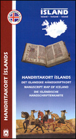
Iceland Manuscript Map

The Manuscript Map of Iceland from Mál og menning with 43 panels providing pictures and brief descriptions of the oldest Icelandic manuscripts, each accompanied by a small map indicating its association with a specific location, whilst a larger map of the whole country is cross-referenced to the individual entries. The accompanying text is in Icelandic, Danish, English and German., The manuscripts have been chosen to illustrate a variety of appearances and subject matter and selected with the collections held in the Árni Magnússon Institute for Icelandic Studies in Reykjavik, The Arnamagnæan Collection at the University of Copenhagen and at the Royal Library in Stockholm.
RIP - This product is no longer available on our network. It was last seen on 25.09.2019

This page now acts as a permanent archive for this product. Add more information using the comments box below to ensure it can still be found by future generations.

Use our search facility to see if it is available from an alternative contributor.
  • External links may include paid for promotion
  • Availability: Out Of Stock
  • Supplier: Stanfords
  • SKU: 9789979333869
Availability: In Stock
£15.99

Product Description

The Manuscript Map of Iceland from Mál og menning with 43 panels providing pictures & brief descriptions of the oldest Icelandic manuscripts, each accompanied by a small map indicating its association with a specific location, whilst a larger map of the whole country is cross-referenced to the individual entries. The accompanying text is in Icelandic, Danish, English & German., The manuscripts have been chosen to illustrate a variety of appearances & subject matter & selected with the collections held in the Árni Magnússon Institute for Icelandic Studies in Reykjavik, The Arnamagnæan Collection at the University of Copenhagen & at the Royal Library in Stockholm.

Reviews/Comments

Add New

Intelligent Comparison

Oooops!
We couldn't find anything!
Perhaps this product's unique.... Or perhaps we are still looking for comparisons!
Click to bump this page and we'll hurry up.

Price History

Vouchers

No voucher codes found.
Do you know a voucher code for this product or supplier? Add it to Insights for others to use.

Facebook

Jargon Buster

Small - something that takes up less space than normal.
Danish - a language, often spoken in the Scandinavian countries, primarily Denmark
Individual - A single separate item or person.

Supplier Information

Stanfords
Stanfords was established in 1853 and opened their iconic Covent Garden flagship store in 1901. They have become the top retailer of maps, travel books and accessories in the UK and arguably offer the largest selection of maps and travel books worldwide. Famous names such as Captain Robert Falcon Scott, Ranulph Fiennes and Michael Palin have purchased from Stanfords. They now have a shop in Bristol and both stores together with other venues operate a calendar of events including talks, book signings and exhibitions. As a specialist map retailer, the map selection is comprehensive and includes road maps, street maps and walking maps from worldwide destinations, as well as a selection of world atlases and wall maps. Books include travel guides and travel literature. Stanfords also stock globes, from miniatures made of blue marble to magnificent floor-standing globes. The website features a selection of interesting articles on travel topics.
Page Updated: 2023-11-12 20:15:36

Community Generated Product Tags

Oh No! The productWIKI community hasn't generated any tags for this product yet!
Menu