
 United Kingdom
 France
 Germany
 Netherlands
 Sweden
 USA
USA
 Italy
Italy
 Spain
Spain
More From Contributor


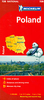

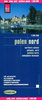
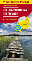
Poland North
Poland at 1:800, 000 on an indexed road map from MairDumont with special features to aid route planning, plus street plans of the central areas in the country’s five main cities: Warsaw, Kraków, Gdansk, Wroclaw and Szczecin. A fold-out flap in the jacket shows an overview of the whole area covered by the map plus the adjoining regions and highlights main places of interest, with the grid reference system in the margins making it easier to find places on the main map. A set of seven peel-on/peel-off stickers, removable without damaging the map surface, is provided for making selected locations more prominent when navigating.Road network includes minor local roads and selected unsurfaced tracks, indicates motorway services, truck shops, toll stations, traffic or seasonal
restrictions, etc. and gives driving distances on main and most secondary routes. Scenic roads, special tourist routes and viewpoints are highlighted. Railway lines, ferry routes and local airports are included.Locations of interest are prominently highlighted, with separate colouring for towns or villages and for natural sites. National parks and other protected areas are marked. Symbols highlight locations of campsites, youth hostels and other tourist accommodation, plus various places of interest. Topography is shown by relief shading with names of mountain ranges and peaks and additional spot heights. The map has latitude and longitude lines at intervals of 30’. *Map legend includes English.*A booklet attached to the map cover has an extensive index of place names, a
distance/driving times table, and basic driving regulations.

Product Description
Reviews/Comments
Add New
Vouchers
No voucher codes found.
Do you know a voucher code for this product or supplier? Add it to Insights for others to use.
Do you know a voucher code for this product or supplier? Add it to Insights for others to use.
 Denmark