More From Contributor
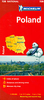
£15.99
The DK Eyewitness Poland Travel Guide is your indispensable guide to this beautiful part of the world. The fully updated guide


...
Archived Product
£13.99
Postcode map of Poland from Freytag & Berndt showing postal zones in different colours, with subdivisions into regions, both with zonal or regional code numbers, plus all locations with their individual postcodes. The base map shows the country’s road & rail network & the boundaries of voivodships (województwa). The map has a latitude & longitude grid at intervals of 30’ & comes with a separate index booklet listing all locations with their postcodes. Multilingual map legend

Includes::
English.

...
Archived Product
£9.99
Poland Compact Road Atlas from Freytag & Berndt, presenting their mapping of the country at 1:500, 000 in an A4, paperback format with street plans of Warsaw & Kraków, plus coverage of the whole of Europe at 1:3, 500, 000. The atlas uses the same cartography as the publisher’s folded map of the country at 1:500, 000. Relief shading with spot heights & colouring for forested areas shows the terrain, with plenty of names of geographical features such as lake districts, large forests, hill & mountain ranges, etc. National parks are marked. Road network

Includes::
selected small local roads, many with intermediate driving distances. Gradient markings are shown on steep roads, scenic routes are marked & border crossings indicated. The mapping also shows railway lines & the internal administrative boundaries with names of the voivodeships. Symbols highlight various places of interest, including campsites. Latitude & longitude lines at intervals of 30’ are shown here but, unlike on the folded map, no coordinates are provided in the atlas. Multilingual map legend

Includes::
English. The index lists all locations with their postcodes &

Includes::
a separate section with Polish/ German & German/ Polish lists of places which used to be part of Germany or the Austro-Hungarian Empire. Indexed street plans at 1:15, 000 show central Warsaw & Kraków, plus the environs of the capital at 1:100, 000. In common with many atlases published in Central European countries, this title also

Includes::
road mapping of the whole of Europe, here at 1:3, 500, 000 & with an index.


...
Archived Product
£15.99
Poland Insight Guide is dedicated to exploring the destination in detail with a selection of glossy illustrations. Extensive introductory sections explore the region’s history & culture & there are also short articles written by locals about distinctive local issues, whilst selective photo-features illustrate the variety of the place. The ‘ Places’ section is grouped geographically & provides details of the area including places to visit, suggestions for tours & other activities. Each section has its own listings of the best restaurants, bars & cafes. Essential practical information is provided in the Travel Tips chapter on accommodation, shopping & local activities. A useful location finder & travel tip index with relevant page numbers are given on the inside covers. Overview street plans are also provided for the main cities in the region or country. ...
Archived Product
£6.99
Poland on a double-sided, indexed road map at 1:800, 000 from Insight. This large map

Includes::
many places

...
Archived Product
£6.99
Poland at 1:800, 000 on an indexed road map from Marco Polo Travel Publishing with special features to aid route planning, plus street plans of the central areas in the country’s five main cities: Warsaw, Kraków, Gdansk, Wroclaw & Szczecin.A fold-out flap in the jacket shows an overview of the whole area covered by the map plus the adjoining regions & highlights main places of interest, with the grid reference system in the margins making it easier to find locations on the main map. A set of seven peel-on/peel-off stickers, removable without damaging the map surface, is provided for making selected locations more prominent when navigating. Cartography is from the renowned German publishers Mair Dumont. Road network

Includes::
minor local roads & selected unsurfaced tracks, indicates motorway services, truck shops, toll stations, traffic or seasonal restrictions, etc. & gives driving distances on main & most secondary routes. Scenic roads, special tourist routes & viewpoints are highlighted. Railway lines, ferry routes & local airports are included. Locations of interest are prominently highlighted, with separate colouring for towns or villages & for natural sites. National parks & other protected areas are marked. Symbols highlight locations of campsites, youth hostels & other tourist accommodation, plus various places of interest. Topography is shown by relief shading with names of mountain ranges & peaks & additional spot heights. The map has latitude & longitude lines at intervals of 30’. The index is in a separate booklet attached to the map cover. Map legend

Includes::
English. Street plans show the centres of Warsaw, Kraków, Gdansk, Wroclaw & Szczecin, highlighting principal traffic arteries & naming important buildings. The map also

Includes::
a distance/driving times table & basic driving regulations.


...
Archived Product
£14.99
Fully updated for 2017...and now with ZOOM system for even better orientation! Unique spiral binding with wrap-around spine. High quality cartography with distance indicators & scale converters to aid route planning. Comprehensive index & inset street plans of major cities. ...
Archived Product
£5.99
The Michelin National road map of Poland at 1:700, 000 scale is ideal for route planning. The map gives comprehensive coverage of national road networks showing all major motorways, dual carriageways, national & regional main roads & some single-lane roads. Distances between major locations are marked along roads, with total distance & several intermediate distances shown. A quick-reference chart of distances & driving times between major locations is also included. The map also

Includes::
a grid-referenced index of principal place names. Clear, easy-to read cartography shows roads in reds, yellows & white with black outlines. Major topography is indicated with relief shading. Woodland & forest is marked with green shading. Built-up urban areas are clearly marked in yellow. Airports, ferries, railways, bridges, are also marked. Administrative divisions are marked, as are sights of special interest. Also

Includes::
a quick reference panel giving national driving regulations, including speed limits, equipment requirements (e.g. bulb kits, warning triangles) & seatbelt rules, for all countries principally shown. City plans & regional enlargements:- Warsaw at 1:100, 000 scale


...
Archived Product
£9.50
Northern Poland at 1:350, 000 on an indexed, waterproof & tear-resistant road map with topographic & tourist information & historical German names for main towns, published by Reise Know-How as part of their highly acclaimed World Mapping Project. The map is double-sided to provide the best balance between a good scale & a convenient size sheet. The map divides northern Poland east/west, with a small overlap between the sides. Coverage extends south to the Bydgoszcz ...
Archived Product
£9.99
Poland at 1:800, 000 on an indexed road map from Mair Dumont with special features to aid route planning, plus street plans of the central areas in the country’s five main cities: Warsaw, Kraków, Gdansk, Wroclaw & Szczecin. A fold-out flap in the jacket shows an overview of the whole area covered by the map plus the adjoining regions & highlights main places of interest, with the grid reference system in the margins making it easier to find places on the main map. A set of seven peel-on/peel-off stickers, removable without damaging the map surface, is provided for making selected locations more prominent when navigating. Road network

Includes::
minor local roads & selected unsurfaced tracks, indicates motorway services, truck shops, toll stations, traffic or seasonal restrictions, etc. & gives driving distances on main & most secondary routes. Scenic roads, special tourist routes & viewpoints are highlighted. Railway lines, ferry routes & local airports are included. Locations of interest are prominently highlighted, with separate colouring for towns or villages & for natural sites. National parks & other protected areas are marked. Symbols highlight locations of campsites, youth hostels & other tourist accommodation, plus various places of interest. Topography is shown by relief shading with names of mountain ranges & peaks & additional spot heights. The map has latitude & longitude lines at intervals of 30’. * Map legend

Includes::
English.*A booklet attached to the map cover has an extensive index of place names, a distance/driving times table, & basic driving regulations.


...
Archived Product

Poland ITMB

Large, indexed road map of Poland with street plans of central Warsaw, Kraków, Poznan and Wroclaw. The map shows the country’s road and rail networks, indicating scenic routes, roads with restricted access or closed to caravans, steep gradients, winter closures, etc. Towns or villages and other places of special interest are highlighted and graded. National and regional landscape parks are prominently marked. The map has no geographical coordinates. Map legend includes English.Index of localities is on the reverse. Also included are street plan of central Warsaw, Kraków, Poznan and Wroclaw.
RIP - This product is no longer available on our network. It was last seen on 25.09.2019

This page now acts as a permanent archive for this product. Add more information using the comments box below to ensure it can still be found by future generations.

Use our search facility to see if it is available from an alternative contributor.
  • External links may include paid for promotion
  • Availability: Out Of Stock
  • Supplier: Stanfords
  • SKU: 9781771296175
Availability: In Stock
£9.99

Product Description

Large, indexed road map of Poland with street plans of central Warsaw, Kraków, Poznan & Wroclaw. The map shows the country’s road & rail networks, indicating scenic routes, roads with restricted access or closed to caravans, steep gradients, winter closures, etc. Towns or villages & other places of special interest are highlighted & graded. National & regional landscape parks are prominently marked. The map has no geographical coordinates. Map legend

Includes::
English. Index of localities is on the reverse. Also included are street plan of central Warsaw, Kraków, Poznan & Wroclaw.

Reviews/Comments

Add New

Intelligent Comparison

Oooops!
We couldn't find anything!
Perhaps this product's unique.... Or perhaps we are still looking for comparisons!
Click to bump this page and we'll hurry up.

Price History

Vouchers

No voucher codes found.
Do you know a voucher code for this product or supplier? Add it to Insights for others to use.

Facebook

Jargon Buster

Large - something that takes up more space than normal.
Road - a manmade lane or a path that is used to speed up travel.
Winter - The fourth season of a year that comes between Spring and Autumn
Regional - An adjective to describe a set geographic area.

Supplier Information

Stanfords
Stanfords was established in 1853 and opened their iconic Covent Garden flagship store in 1901. They have become the top retailer of maps, travel books and accessories in the UK and arguably offer the largest selection of maps and travel books worldwide. Famous names such as Captain Robert Falcon Scott, Ranulph Fiennes and Michael Palin have purchased from Stanfords. They now have a shop in Bristol and both stores together with other venues operate a calendar of events including talks, book signings and exhibitions. As a specialist map retailer, the map selection is comprehensive and includes road maps, street maps and walking maps from worldwide destinations, as well as a selection of world atlases and wall maps. Books include travel guides and travel literature. Stanfords also stock globes, from miniatures made of blue marble to magnificent floor-standing globes. The website features a selection of interesting articles on travel topics.
Page Updated: 2023-11-12 20:15:36

Community Generated Product Tags

Oh No! The productWIKI community hasn't generated any tags for this product yet!
Menu