
 United Kingdom
 France
 Germany
 Netherlands
 Sweden
 USA
USA
 Italy
Italy
 Spain
Spain
More From Contributor


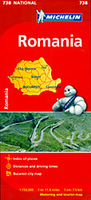
Romania Michelin
The Michelin national road map of Romania at 1:750, 000 scale is best suited to trip & route planning. The map gives comprehensive coverage of national road networks showing major motorways, dual carriageways, national & regional main roads and some smaller local roads. Unsurfaced roads and tracks and some major footpaths are also shown. The map shows useful motoring information for motorways and major roads - including toll sections, numbered interchanges and rest stops. Michelin`s selected scenic routes are also highlighted.Distances between major locations are marked along roads, with total distance and several intermediate distances shown. A quick-reference chart of distances & driving times between major locations is also given, as well as a grid-referenced index of principal
place names. The map shows latitude and longitude on a WGS84 grid (30` intervals for latitude, 20` for longitude).Clear, easy-to read cartography clearly differentiates different classes of road. Major topography is indicated with slight 3D relief shading, but no contours or other topographic information is shown except mountain peaks. Woodland & forest is marked with green shading, and national parks are highlighted. Built-up urban areas are clearly marked in yellow. Airports, ferries, & motorails are also marked. National borders and administrative divisions are marked. Selected sights, including historic houses, castles & ruins, religious buildings and other places of tourist interest, are shown with symbolsThis map includes two inset city plans of Bucharest - an overview plan
showing main roads at 1;62, 000 and a high-scale street plan of the centre at 1:20, 000. Another inset map shows Romania`s administrative distracts with their names and abbreviations. The map also includes a quick reference panel giving national driving regulations, including speed limits, equipment requirements (e.g. bulb kits, warning triangles) and seatbelt rules.

Product Description
Reviews/Comments
Add New
Intelligent Comparison
Archived Product

Croatia Michelin Stanfords
£5.99
Archived Product
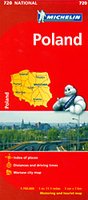
Poland Michelin Stanfords
£5.99
Archived Product
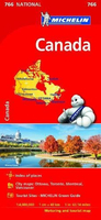
Canada Michelin Stanfords
£5.99
Archived Product
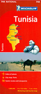
Tunisia Michelin Stanfords
£5.99
Archived Product

Bulgaria Michelin Stanfords
£5.99
Archived Product
Norway Michelin Stanfords
£5.99
Archived Product

Brazil Michelin Stanfords
£5.99
Archived Product
Australia Michelin Stanfords
£5.99
Vouchers
No voucher codes found.
Do you know a voucher code for this product or supplier? Add it to Insights for others to use.
Do you know a voucher code for this product or supplier? Add it to Insights for others to use.
 Denmark