
 United Kingdom
 France
 Germany
 Netherlands
 Sweden
 USA
USA
 Italy
Italy
 Spain
Spain
More From Contributor


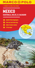
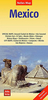

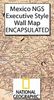
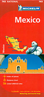
Mexico Michelin
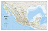
Mexico at 1:2, 250, 000 from Michelin on an indexed road map, with a street plan of central Mexico City and a more general map of the capital, a distance table, a comprehensive index, plus basic rules for motorists.Coverage extends south-east to include the whole of Guatemala, Belize and San Salvador, with Honduras shown to east of Tegucigalpa including Ceiba. The map covers, therefore, all the Maya archaeological sites of Central America, as well as the remains of the Aztec culture. Coverage in the US includes San Diego, Tucson, and Dallas.Topography is presented by relief shading, with peak heights, names of mountain ranges, colouring for the main forested areas and boundaries of national parks or other protected zones. In coastal waters major coral reefs are also
indicatedRoad network is graded into five types, including selected local dirt roads. Driving distances are shown on main and many secondary roads. Railway lines are included and local airports are marked. The map also shows the country administrative boundaries with names of the provinces. Symbols highlight various places of interest, including UNESCO World Heritage sites and other archaeological remains. The map has latitude and longitude lines at intervals of 2° and a comprehensive index of localities. Map legend includes English.Also provided is a distance table, a list of main motoring regulations, plus two street plans of Mexico City: a more detailed street plan of the city centre highlighting its main sights and places of interest, plus a map of a larger part of the capital
including the international airport, the Olympic stadium and Ciudad Universitaria with names of main streets and motorway access.

Product Description
Reviews/Comments
Add New
Intelligent Comparison
Archived Product
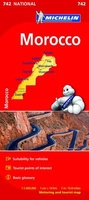
Morocco Michelin Stanfords
£5.99
Archived Product
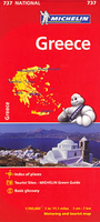
Greece Michelin Stanfords
£5.99
Archived Product
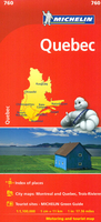
Quebec Michelin Stanfords
£5.99
Archived Product
Peru Michelin Stanfords
£5.99
Archived Product
Benelux Michelin Stanfords
£5.99
Vouchers
No voucher codes found.
Do you know a voucher code for this product or supplier? Add it to Insights for others to use.
Do you know a voucher code for this product or supplier? Add it to Insights for others to use.
 Denmark