
 United Kingdom
 France
 Germany
 Netherlands
 Sweden
 USA
USA
 Italy
Italy
 Spain
Spain
More From Contributor


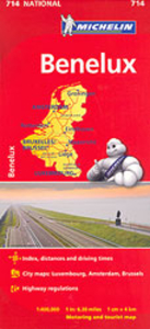
Benelux Michelin
Benelux at 1:400, 000 from Michelin, with information on driving regulations in each country, a distance and journey time table, plus enlargements showing in greater detail road access to Amsterdam, Brussels and Luxembourg City. Coverage extends east to include the Ruhr and the Eifel in Germany.Roads network includes local roads and is graded according to the number of lanes. Junctions show full or partial interchanges. Steep gradients, level crossings and restricted entry sections are marked; scenic routes are highlighted. Railway lines and ferry routes are included.Relief shading is used to indicate the topography, with colouring for forested areas. National parks are also marked. Small symbols indicate various landmarks or places of interest including campsites and youth hostels,
but the map is not primarily designed to highlight tourist sights. The map also indicates locations with street plans in Michelin’s Red Guides to Hotels and Restaurants in Belgium and Luxembourg and in the Netherlands. Latitude and longitude lines are drawn at 20’ intervals. Multilingual map legend includes English. The index, arranged by country, is on the reverse of the map.Also provided is basic information on each country’s driving regulations, plus a table showing driving distances and journey times between 26 main cities* Please note: the same cartography but slightly enlarged to 1:350, 000 is used in Michelin’s road map of Belgium and Luxembourg, and at the same scale of 1:400, 000 in their road map of the Netherlands.
but the map is not primarily designed to highlight tourist sights. The map also indicates locations with street plans in Michelin’s Red Guides to Hotels and Restaurants in Belgium and Luxembourg and in the Netherlands. Latitude and longitude lines are drawn at 20’ intervals. Multilingual map legend includes English. The index, arranged by country, is on the reverse of the map.Also provided is basic information on each country’s driving regulations, plus a table showing driving distances and journey times between 26 main cities* Please note: the same cartography but slightly enlarged to 1:350, 000 is used in Michelin’s road map of Belgium and Luxembourg, and at the same scale of 1:400, 000 in their road map of the Netherlands.

Product Description
Reviews/Comments
Add New
Intelligent Comparison
Archived Product
Peru Michelin Stanfords
£5.99
Archived Product
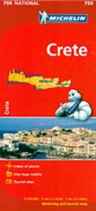
Crete Michelin Stanfords
£5.99
Archived Product
Greece Michelin Stanfords
£5.99
Archived Product
Sweden Michelin Stanfords
£5.99
Archived Product
Mexico Michelin Stanfords
£5.99
Archived Product

Brazil Michelin Stanfords
£5.99
Archived Product
Quebec Michelin Stanfords
£5.99
Vouchers
No voucher codes found.
Do you know a voucher code for this product or supplier? Add it to Insights for others to use.
Do you know a voucher code for this product or supplier? Add it to Insights for others to use.
 Denmark