
 United Kingdom
 France
 Germany
 Netherlands
 Sweden
 USA
USA
 Italy
Italy
 Spain
Spain
More From Contributor


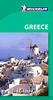


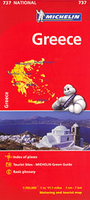
Greece Michelin
Indexed road map of Greece at 1:700, 000 from Michelin for route-planning. Clear and easy-to-read cartography shows motorways, junctions and interchanges, dual carriageways, with distances (total and intermediate) marked; some local roads are also displayed, as are steep slopes and toll sections. Railways, cable-cars, airports, ferry and boat lines are also highlighted, with seasonal services in bold red colouring. Major towns, cities, and seas are marked with names in both Latin and Greek alphabets.Major topography is indicated with simple relief shading and selected spot heights. Woodland & forest is marked with green shading. National and administrative divisions are marked, as are administrative capitals. Selected sights such as historic castles, religious buildings and
ruins are shown, as well as national parks.A quick-reference chart of distances & driving times between major locations is also included, as well as a quick reference panel giving national driving regulations, including speed limits, equipment requirements (e.g. bulb kits, warning triangles) and seatbelt rules, for all countries principally shown.There is also an index of principal place names grid-referenced to the map.
ruins are shown, as well as national parks.A quick-reference chart of distances & driving times between major locations is also included, as well as a quick reference panel giving national driving regulations, including speed limits, equipment requirements (e.g. bulb kits, warning triangles) and seatbelt rules, for all countries principally shown.There is also an index of principal place names grid-referenced to the map.

Product Description
Reviews/Comments
Add New
Intelligent Comparison
Archived Product
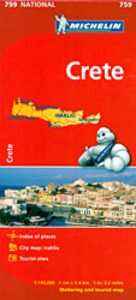
Crete Michelin Stanfords
£5.99
Archived Product
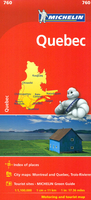
Quebec Michelin Stanfords
£5.99
Archived Product
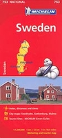
Sweden Michelin Stanfords
£5.99
Archived Product
Turkey Michelin Stanfords
£5.99
Archived Product
Mexico Michelin Stanfords
£5.99
Archived Product
Peru Michelin Stanfords
£5.99
Archived Product

Greece Michelin Green Guide Stanfords
£14.99
Archived Product

Greece Michelin Green Guide Stanfords
£16.99
Vouchers
No voucher codes found.
Do you know a voucher code for this product or supplier? Add it to Insights for others to use.
Do you know a voucher code for this product or supplier? Add it to Insights for others to use.
 Denmark