
 United Kingdom
 France
 Germany
 Netherlands
 Sweden
 USA
USA
 Italy
Italy
 Spain
Spain
More From Contributor


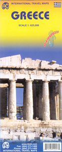
Greece ITMB
Greece on an indexed road map from ITMB, printed in light, waterproof and tear-resistant plastic paper, with a street plan of central Athens. The map is double-sided, with Athens and Attika shown only on the southern half with the Peloponnese, southern Aegean and Crete. Eastern Dodecanese islands, from Tilos to Rhodes, are shown as an inset.Altitude colouring in feet shows the topography, with spot heights both in feet and metres, plus names of main peaks and mountain ranges. All place names are in Latin alphabet only. Road network distinguishes toll roads, highways, primary and secondary roads, narrow roads and trails, although in many areas fewer small local roads are shown than on maps with less detailed scales. Railways, local airports and ferry routes are included. Also
shown are the internal administrative and names of the provinces.Symbols mark locations of UNESCO World Heritage monuments and other archaeological sites, national parks, beaches, campsites, viewpoints, etc. The map is indexed and has a latitude and longitude grid at intervals of 30’.Also included is a street plan of central Athens showing metro stations and one way streets, and highlighting main places of interest and numerous hotels. Coverage includes the new Acropolis Museum, but does not extend beyond the Omonia Square to include the National Archaeological Museum.
shown are the internal administrative and names of the provinces.Symbols mark locations of UNESCO World Heritage monuments and other archaeological sites, national parks, beaches, campsites, viewpoints, etc. The map is indexed and has a latitude and longitude grid at intervals of 30’.Also included is a street plan of central Athens showing metro stations and one way streets, and highlighting main places of interest and numerous hotels. Coverage includes the new Acropolis Museum, but does not extend beyond the Omonia Square to include the National Archaeological Museum.

Product Description
Reviews/Comments
Add New
Intelligent Comparison
Archived Product
Greece F&B Stanfords
£10.99
Archived Product
France ITMB Stanfords
£9.99
Archived Product
Greece Stanfords
£12.50
Archived Product
Greece Stanfords
£10.95
Archived Product
Greece Stanfords
£9.50
Archived Product
Greece Stanfords
£13.59
Archived Product
Greece Stanfords
£12.79
Archived Product
Greece Stanfords
£15.99
Vouchers
No voucher codes found.
Do you know a voucher code for this product or supplier? Add it to Insights for others to use.
Do you know a voucher code for this product or supplier? Add it to Insights for others to use.
 Denmark