More From Contributor
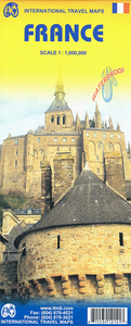
£9.50
Greenways & Cycle Routes of France map from the IGN highlighting numerous international, national & regional cycling routes, indicating their official number & the type of road surface. The map

Includes::
a QR code for downloading descriptions of individual routes, plus a list of the Euro Velo & the Grand Itinéraires Nationaux with their downloading code numbers. Colouring of the overprint indicates the official designation plus the surface of each route. The base map is IGN’s general road map of France with additions information indicating railway stations. Map legend & a general description of the Greenways (Voies vertes) network include English. The map also provides brief descriptions in French of the Euro Velo routes & selected National Trails. Current edition of this map was published in spring 2015. To see the list of currently available titles in this series please click on the series link.

...
Archived Product
£3.99
France Mini Road Map at 1:1, 500, 000
- a double-sided, 8x 12cm mini version of IGN’s road maps of France with the clearest
...
Archived Product
£14.99
Road Atlas of France 2018- 2019 edition at 1:320, 000 from the IGN in a handy size spiral-bound format, with a vivid presentation of the country’s topography, plus a route planning section, street plans & enlargements for environs of 14 main cities, & distance/journey time table. Please note: the same atlas but without the city enlargements & street plans is also available in a similar size paperback format. Colouring of the road network highlights the motorways, clearly distinguishing between the toll & free sections & showing junction numbers, toll gates, services & rest areas, plus driving distances which are also indicated on main connecting regional routes. Road numbers are clearly marked on secondary & minor roads. Railway lines are shown with stations; local airports are also marked. Symbols highlight numerous places of interest. Topography is indicated by very effective relief shading, with colouring for woodlands, boundaries of national/regional parks, & plenty of names of mountain ranges, valleys, peaks & other topographic features. The maps have no geographical coordinates. The atlas has a comprehensive index. Map legend

Includes::
English language. Additional features include: an overview of the whole country for route planning on 17 pages of mapping at 1:1, 250, 000, plus a distance/travelling times table between 39 main cities. This spiral-bound version also provides city centre street plans & enlargements for the environs of Bordeaux, Clermont-Ferr&, Grenoble, Lille, Lyon, Marseille, Montpellier, Nantes, Nice, Rennes, Rouen, Strasbourg & Toulouse. For Paris the atlas has an enlargement of the environs & a street plan of the capital showing main traffic arteries leading to the Boulevard Péripherique & within the city itself.

...
Archived Product
£9.50
France on a colourful & informative wine map from the IGN, using a road map of the country as a base for highlighting wine growing areas, all annotated with names & extensive lists of individual appellations, etc. The base map shows the road network from motorways to country roads to guide visitors to the various the vineyards from Champagne to Bordeaux, Roussillon & Provence. Many of the country’s less famous wine growing areas are also highlighted. Map legend & all the accompanying text about grape varieties, etc, include English. Current edition of this map was published in 2006, so not all road information may be up to date. To see the list of currently available titles in this series please click on the series link. ...
Archived Product
£6.99
This detailed travel map is all you need to planyour route & navigate your way around France, and also

Includes::


...
Archived Product
£12.99
Double-sided touring map clearly presenting the country`s motorway network & major roads. The map highlights France`s numerous national & regional parks, as well as places of interest & natural features worth seeing. Special enlargements show the Paris area & road access to Lyon, Marseille & Nice in greater detail. The map provides good coverage of the neighbouring countries: southern England from Bristol to London & the Channel ports, all of Belgium, southern Netherlands, Germany from the Ruhr to Frankfurt & the Black Forest, Switzerland as far as Zurich & Lucerne, Italy to east of Milan & Genoa, & Spain as far as Barcelona & Zaragoza. A separate index, attached to the map cover,

Includes::
a distance table. Map legend

Includes::
English. This map is also available with a CD route planner for ten European countries.


...
Archived Product
£14.99
France in the Key Guide series from AA Publishing; exploring a range of international destinations & recently been re-launched with full colour pages. Thorough & detailed in style, the guides are targeted at an older audience, exploring the principal sights, walks, activities, restaurants & accommodation of the destination. A detailed introductory section provides comprehensive information about the destination, including the economy, politics, heritage & language. There are also specific sections unique to each destination, covering society, the urban & rural, sports & leisure, art media & culture, history & science & technology. Each title is organised in the same way with destinations grouped by region or district & colour-coded to help readers navigate around the guide. An On the Move section provides details on transport, with important information on arriving, getting around (including distinctive local transport features such as metro & underground networks) & for visitors with a disability. Individual regional sections cover Sights, driving & walking opportunities, what to do, eating & accommodation. Local listings are accompanied by addresses, opening times, prices, directions & local transport options, though options for younger travellers & those with children are more limited. Extensive colour photography accompanies the text, with a range of pictures illustrations the main sites of the city, region or country. An extensive Practicalities chapter at the back of each guide carries essential information on weather, documents & customs, money, health, communication, tourist information, useful websites, finding help, opening times & entrance fees, media & books, films & maps. There is also basic information on entertainment & nightlife, sports & activities, film & music & festivals & events. ...
Archived Product
£9.50
France: Long-Distance Footpaths Map from the IGN presents the entire network of the Sentiers de Grande Randonnée, the long distance GR walking routes. Each route is shown with its official number. Major trails which are part of the pan-European network of E-routes (e.g. GR5/E2 or GR65/E3) are in different colour. The map also shows numerous shorter GR de Pays routes & circuits which form part of the overall network of trails waymarked by the Fédération Française de la Randonnée Pédestre. The map has as its base IGN’s general road map of France highlighting the country’s motorway network & connecting routes, but also showing many of the local D-roads, all with their numbers. National parks & other protected areas are marked. An enlargement presents the environs of Paris in greater detail. The legend for the road map

Includes::
English. Additional text, in French only, explains the waymarking & various activities of the FFRP, including their series of topo-guides (currently available titles are listed on our website). To see the list of currently available titles in this series please click on the series link.

...
Archived Product
£3.25
This is a beautiful & unique wrapping paper featuring a map of France circa 1830 from Cavallini & Co. measuring 51x 71 cm (20”x 28”). It is printed on thick acid free Italian paper. Please note that this is not an up to date map of France. Perfect for wrapping special presents. Its decorative & historical qualities make it also ideal for framing & other creative purposes. ...
Archived Product
£6.99
France at 1:800, 000 on a double-sided road map from Marco Polo Travel Publishing with prominent highlighting of interesting locations, 10 more detailed enlargements, plus an index booklet with town centre plans 18 cities, brief descriptions of 15 selected top sights, etc. The map has a good overlap between the sides & coverage extends north to Antwerp, Bruges & Ghent, north-west to Cologne to include Luxembourg & the Eifel, & within Italy past Milan to Parma & along the Italian Riviera to Pisa. Cartography is from the renowned German publishers Mair Dumont. Road network

Includes::
minor roads, highlights scenic roads & shows intermediate driving distances on main roads. Railway lines & local airports are included, as well as administrative divisions with names of the departments. Locations of interest are highlighted, with separate colouring for towns or villages & for natural sites; 15 most interesting sights are cross-referenced to their descriptions in a booklet attached to the map cover. Symbols show locations of selected campsites, youth hostels, etc. National parks & other protected areas are marked & topography is presented by relief shading. Latitude & longitude lines are drawn at 1º intervals. The index listing locations with their postcodes is in the booklet. Enlargements show in greater detail the environs of Paris, Bordeaux, Lille, Lyon, Marseille, Nantes, Strasbourg & Toulouse, plus the French Riviera between Cannes & Nice, & Andorra. Town centres street plans cover these cities plus of Ajaccio, Avignon, Brest, Grenoble, Le Havre, Monaco/ Monte Carlo, Nîmes & Reims. In addition to the brief descriptions of 15 top sites, booklet also

Includes::
plans of the Channel Tunnel terminals in Folkestone & Calais; a list of mountain passes & tunnels indicating likely seasonal opening, suitability for caravans, etc; lists of UNESCO World Heritage sites, national parks, airports, & amusement parks. Multilingual map legend & all the text include English.A fold-out flap in the cover shows for route planning an overview of the whole area covered by the map plus the adjacent regions, prominently highlighting main places of interest, with the grid reference system in the margins making it easier to find locations on the main map. Also included are a distance/driving times table & basic driving regulations.


...
Archived Product

France ITMB

France on a double-sided indexed road map from ITMB, printed on light, waterproof and tear-resistant plastic paper, with its altitude colouring providing a useful overview of the country for anyone not familiar with is geography, particularly of the southern half of the country. The map presents the motorways network, indicating service facilities and names of selected junctions and shows connection routes plus a selection of secondary and local roads. Overprint highlights approximate locations of various places of interest, including World Heritage sites.In addition to the altitude colouring, the map has names of numerous mountain chains, peaks, plateaux, etc. National parks and a large selection of France’s regional parks are marked. The map is indexed but has no geographical
coordinates.
RIP - This product is no longer available on our network. It was last seen on 25.09.2019

This page now acts as a permanent archive for this product. Add more information using the comments box below to ensure it can still be found by future generations.

Use our search facility to see if it is available from an alternative contributor.
  • External links may include paid for promotion
  • Availability: Out Of Stock
  • Supplier: Stanfords
  • SKU: 9781553412144
Availability: In Stock
£9.99

Product Description

France on a double-sided indexed road map from ITMB, printed on light, waterproof & tear-resistant plastic paper, with its altitude colouring providing a useful overview of the country for anyone not familiar with is geography, particularly of the southern half of the country. The map presents the motorways network, indicating service facilities & names of selected junctions & shows connection routes plus a selection of secondary & local roads. Overprint highlights approximate locations of various places of interest, including World Heritage sites. In addition to the altitude colouring, the map has names of numerous mountain chains, peaks, plateaux, etc. National parks & a large selection of France’s regional parks are marked. The map is indexed but has no geographical coordinates.

Reviews/Comments

Add New

Price History

Vouchers

No voucher codes found.
Do you know a voucher code for this product or supplier? Add it to Insights for others to use.

Facebook

Jargon Buster

Paper - A thin sheet mainly used for writing. Available in a variety of colours. Made mainly from wood pulp.
Plastic - A generic term for a synthetic product used in the manufacture of products
France - A state situated in Western Europe with several overseas territories.
Waterproof - Resistant to water, usualy specified by depth in metres
World - A physical grouping, commonly used to describe earth and everything associated with ti
Network - A link and communication between things. Often computers or people.
Large - something that takes up more space than normal.
Road - a manmade lane or a path that is used to speed up travel.
Resistant - Something that can repel against something.
Altitude - Something that can be quite high in relation to sea or ground level.
Regional - An adjective to describe a set geographic area.

Supplier Information

Stanfords
Stanfords was established in 1853 and opened their iconic Covent Garden flagship store in 1901. They have become the top retailer of maps, travel books and accessories in the UK and arguably offer the largest selection of maps and travel books worldwide. Famous names such as Captain Robert Falcon Scott, Ranulph Fiennes and Michael Palin have purchased from Stanfords. They now have a shop in Bristol and both stores together with other venues operate a calendar of events including talks, book signings and exhibitions. As a specialist map retailer, the map selection is comprehensive and includes road maps, street maps and walking maps from worldwide destinations, as well as a selection of world atlases and wall maps. Books include travel guides and travel literature. Stanfords also stock globes, from miniatures made of blue marble to magnificent floor-standing globes. The website features a selection of interesting articles on travel topics.
Page Updated: 2023-11-12 20:15:36

Community Generated Product Tags

Oh No! The productWIKI community hasn't generated any tags for this product yet!
Menu