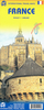
More From Contributor

£12.99
The first water-resistant roadmap with direct access to useful additional information from the Internet France, including Corsica, in a scale of 1:800, 000 shown on a practical map; inclusive of the High 5 Edition app technology for calling up additional travel information & many other benefits:- practical format (11.4 x 23.5 cm)- it is water-resistant (laminated/cellophane coating)- the UNESCO World Heritage Sites are listed on the map- contains a selection of the local index including postal codes; the entire index can be viewed using the QR-code It doesn’t matter what weather it is used in or how often it is folded, the condition of the “ROADMAP France” will not deteriorate. Roads, ascents, woodland & mountain areas are easily recognisable thanks to the clear layout of the map. There is also a brief informative section about France (speed limits, area codes, emergency numbers, etc.) The “ Interactive Mobile ROADMAP France” – a “paper backup” just in case...... & when used in conjunction with a smartphone, it is a great tool for planning trips. What’s not on the map is in the app By scanning the section of the map you want with the High 5 Edition app, you can get a lot of useful additional information about major attractions & cities in France. The app is based on Augmented Reality technology & is available free of charge from the Apple App store & Google Play store. ...
Archived Product
£17.99
Latest 2017 edition, administrative regions of France presented on a large, encapsulated (so damp-proof & crinkle-resistant) wall map at 1:1, 000, 000 from the IGN with each department in a different colour & shown with its divisions into arrondisements & the Métropole areas. Administrative divisions are presented on a base map showing the country’s road network, with light relief shading showing the topography. Town symbols indicate the administrative seat of the region, the department, the arrondisement, plus of the cantons (although cantonal boundaries are not marked on the map). The Métropole areas (e.g. Métropole du Grand Paris, Métropole d’ Aix-Marseille-Provence, Grenoble-Alpes Métropole, Montpellier Méditerranée Métropole, etc) are shown in white, so clearly visible against the colouring of the departments. An enlargement presents the Métropole du Grand Paris (departments 75, 92, 93 & 94) in greater detail. Also included are panels showing the overseas departments (French Guiana, Guadeloupe, Martinique, Réunion & Mayotte), plus a map of the world showing all France’s overseas possessions with colouring indicating their administrative status.LAMINATED & ENCAPSULATED WALL MAPS:- laminated wall maps have a thin layer of plastic usually applied to the printed side only. They can be written on with suitable marker pens without any damage to the map but, unless laminated on both sides, they are not damp-proof.- encapsulated wall maps are sealed between two sheets of plastic. They are more rigid & heavier than laminated maps of the same size. They are damp-proof & do not crinkle in humid conditions. Encapsulation gives the map a shiny surface, similar to being displayed behind glass.- please note: many publishers & retailers often use these two terms interchangeably. Our map titles & descriptions follow the definitions provided above. ...
Archived Product
£9.50
Greenways & Cycle Routes of France map from the IGN highlighting numerous international, national & regional cycling routes, indicating their official number & the type of road surface. The map

Includes::
a QR code for downloading descriptions of individual routes, plus a list of the Euro Velo & the Grand Itinéraires Nationaux with their downloading code numbers. Colouring of the overprint indicates the official designation plus the surface of each route. The base map is IGN’s general road map of France with additions information indicating railway stations. Map legend & a general description of the Greenways (Voies vertes) network include English. The map also provides brief descriptions in French of the Euro Velo routes & selected National Trails. Current edition of this map was published in spring 2015. To see the list of currently available titles in this series please click on the series link.

...
Archived Product
£3.99
France Mini Road Map at 1:1, 500, 000
- a double-sided, 8x 12cm mini version of IGN’s road maps of France with the clearest
...
Archived Product
£14.99
Road Atlas of France 2018- 2019 edition at 1:320, 000 from the IGN in a handy size spiral-bound format, with a vivid presentation of the country’s topography, plus a route planning section, street plans & enlargements for environs of 14 main cities, & distance/journey time table. Please note: the same atlas but without the city enlargements & street plans is also available in a similar size paperback format. Colouring of the road network highlights the motorways, clearly distinguishing between the toll & free sections & showing junction numbers, toll gates, services & rest areas, plus driving distances which are also indicated on main connecting regional routes. Road numbers are clearly marked on secondary & minor roads. Railway lines are shown with stations; local airports are also marked. Symbols highlight numerous places of interest. Topography is indicated by very effective relief shading, with colouring for woodlands, boundaries of national/regional parks, & plenty of names of mountain ranges, valleys, peaks & other topographic features. The maps have no geographical coordinates. The atlas has a comprehensive index. Map legend

Includes::
English language. Additional features include: an overview of the whole country for route planning on 17 pages of mapping at 1:1, 250, 000, plus a distance/travelling times table between 39 main cities. This spiral-bound version also provides city centre street plans & enlargements for the environs of Bordeaux, Clermont-Ferr&, Grenoble, Lille, Lyon, Marseille, Montpellier, Nantes, Nice, Rennes, Rouen, Strasbourg & Toulouse. For Paris the atlas has an enlargement of the environs & a street plan of the capital showing main traffic arteries leading to the Boulevard Péripherique & within the city itself.

...
Archived Product
£6.99
This detailed travel map is all you need to planyour route & navigate your way around France, and also

Includes::


...
Archived Product
£9.99
France on a double-sided indexed road map from ITMB, printed on light, waterproof & tear-resistant plastic paper, with its altitude colouring providing a useful overview of the country for anyone not familiar with is geography, particularly of the southern half of the country. The map presents the motorways network, indicating service facilities & names of selected junctions & shows connection routes plus a selection of secondary & local roads. Overprint highlights approximate locations of various places of interest, including World Heritage sites. In addition to the altitude colouring, the map has names of numerous mountain chains, peaks, plateaux, etc. National parks & a large selection of France’s regional parks are marked. The map is indexed but has no geographical coordinates. ...
Archived Product
£12.99
Double-sided touring map clearly presenting the country`s motorway network & major roads. The map highlights France`s numerous national & regional parks, as well as places of interest & natural features worth seeing. Special enlargements show the Paris area & road access to Lyon, Marseille & Nice in greater detail. The map provides good coverage of the neighbouring countries: southern England from Bristol to London & the Channel ports, all of Belgium, southern Netherlands, Germany from the Ruhr to Frankfurt & the Black Forest, Switzerland as far as Zurich & Lucerne, Italy to east of Milan & Genoa, & Spain as far as Barcelona & Zaragoza. A separate index, attached to the map cover,

Includes::
a distance table. Map legend

Includes::
English. This map is also available with a CD route planner for ten European countries.


...
Archived Product
£14.99
France in the Key Guide series from AA Publishing; exploring a range of international destinations & recently been re-launched with full colour pages. Thorough & detailed in style, the guides are targeted at an older audience, exploring the principal sights, walks, activities, restaurants & accommodation of the destination. A detailed introductory section provides comprehensive information about the destination, including the economy, politics, heritage & language. There are also specific sections unique to each destination, covering society, the urban & rural, sports & leisure, art media & culture, history & science & technology. Each title is organised in the same way with destinations grouped by region or district & colour-coded to help readers navigate around the guide. An On the Move section provides details on transport, with important information on arriving, getting around (including distinctive local transport features such as metro & underground networks) & for visitors with a disability. Individual regional sections cover Sights, driving & walking opportunities, what to do, eating & accommodation. Local listings are accompanied by addresses, opening times, prices, directions & local transport options, though options for younger travellers & those with children are more limited. Extensive colour photography accompanies the text, with a range of pictures illustrations the main sites of the city, region or country. An extensive Practicalities chapter at the back of each guide carries essential information on weather, documents & customs, money, health, communication, tourist information, useful websites, finding help, opening times & entrance fees, media & books, films & maps. There is also basic information on entertainment & nightlife, sports & activities, film & music & festivals & events. ...
Archived Product
£9.50
France: Long-Distance Footpaths Map from the IGN presents the entire network of the Sentiers de Grande Randonnée, the long distance GR walking routes. Each route is shown with its official number. Major trails which are part of the pan-European network of E-routes (e.g. GR5/E2 or GR65/E3) are in different colour. The map also shows numerous shorter GR de Pays routes & circuits which form part of the overall network of trails waymarked by the Fédération Française de la Randonnée Pédestre. The map has as its base IGN’s general road map of France highlighting the country’s motorway network & connecting routes, but also showing many of the local D-roads, all with their numbers. National parks & other protected areas are marked. An enlargement presents the environs of Paris in greater detail. The legend for the road map

Includes::
English. Additional text, in French only, explains the waymarking & various activities of the FFRP, including their series of topo-guides (currently available titles are listed on our website). To see the list of currently available titles in this series please click on the series link.

...
Archived Product

France IGN Wine Map

France on a colourful and informative wine map from the IGN, using a road map of the country as a base for highlighting wine growing areas, all annotated with names and extensive lists of individual appellations, etc. The base map shows the road network from motorways to country roads to guide visitors to the various the vineyards from Champagne to Bordeaux, Roussillon and Provence. Many of the country’s less famous wine growing areas are also highlighted. Map legend and all the accompanying text about grape varieties, etc, include English. Current edition of this map was published in 2006, so not all road information may be up to date.To see the list of currently available titles in this series please click on the series link.
RIP - This product is no longer available on our network. It was last seen on 25.09.2019

This page now acts as a permanent archive for this product. Add more information using the comments box below to ensure it can still be found by future generations.

Use our search facility to see if it is available from an alternative contributor.
  • External links may include paid for promotion
  • Availability: Out Of Stock
  • Supplier: Stanfords
  • SKU: 9782758540298
Availability: In Stock
£9.50

Product Description

France on a colourful & informative wine map from the IGN, using a road map of the country as a base for highlighting wine growing areas, all annotated with names & extensive lists of individual appellations, etc. The base map shows the road network from motorways to country roads to guide visitors to the various the vineyards from Champagne to Bordeaux, Roussillon & Provence. Many of the country’s less famous wine growing areas are also highlighted. Map legend & all the accompanying text about grape varieties, etc, include English. Current edition of this map was published in 2006, so not all road information may be up to date. To see the list of currently available titles in this series please click on the series link.

Reviews/Comments

Add New

Intelligent Comparison

Oooops!
We couldn't find anything!
Perhaps this product's unique.... Or perhaps we are still looking for comparisons!
Click to bump this page and we'll hurry up.

Price History

Vouchers

No voucher codes found.
Do you know a voucher code for this product or supplier? Add it to Insights for others to use.

Facebook

Jargon Buster

Wine - An alcoholic drink made from fermented grapes.
Date - A day on a calendar
Date - A social activity whith a current or potential partner
France - A state situated in Western Europe with several overseas territories.
Network - A link and communication between things. Often computers or people.
Road - a manmade lane or a path that is used to speed up travel.
Champagne - Sparkling white wine, originating from Champagne region in France.
Individual - A single separate item or person.

Supplier Information

Stanfords
Stanfords was established in 1853 and opened their iconic Covent Garden flagship store in 1901. They have become the top retailer of maps, travel books and accessories in the UK and arguably offer the largest selection of maps and travel books worldwide. Famous names such as Captain Robert Falcon Scott, Ranulph Fiennes and Michael Palin have purchased from Stanfords. They now have a shop in Bristol and both stores together with other venues operate a calendar of events including talks, book signings and exhibitions. As a specialist map retailer, the map selection is comprehensive and includes road maps, street maps and walking maps from worldwide destinations, as well as a selection of world atlases and wall maps. Books include travel guides and travel literature. Stanfords also stock globes, from miniatures made of blue marble to magnificent floor-standing globes. The website features a selection of interesting articles on travel topics.
Page Updated: 2023-11-12 20:15:36

Community Generated Product Tags

Oh No! The productWIKI community hasn't generated any tags for this product yet!
Menu