
 United Kingdom
 France
 Germany
 Netherlands
 Sweden
 USA
USA
 Italy
Italy
 Spain
Spain
More From Contributor


Greece F&B
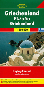
Double-sided road map of Greece at 1:500, 000 from Freytag & Berndt with a separate index booklet which also includes a 16-page English language cultural guide with tourist information and brief descriptions of numerous archaeological, historical and other sites.Bold relief shading with names of mountain ranges and main peaks shows the country’s topography. All place names are given in both Greek and Latin alphabets. Road network includes small local roads but without distinguishing between surfaced and gravel roads. Toll roads and motorway services are shown, with diving distances marked on many secondary routes. The map also shows railway network and ferry routes.National parks and protected areas are highlighted and symbols show various places of interest including archaeological
and historical sites, marinas, campsites, etc. Latitude and longitude lines are drawn at intervals of 30’. Multilingual map legend includes English.A separate 66-page booklet attached to the map cover includes an index (with postcodes) and multilingual cultural guide to the country’s history and its heritage. Modern Greek names are used for the archaeological sites, e.g. Mikines for Mycenae, etc.)
and historical sites, marinas, campsites, etc. Latitude and longitude lines are drawn at intervals of 30’. Multilingual map legend includes English.A separate 66-page booklet attached to the map cover includes an index (with postcodes) and multilingual cultural guide to the country’s history and its heritage. Modern Greek names are used for the archaeological sites, e.g. Mikines for Mycenae, etc.)

Product Description
Reviews/Comments
Add New
Intelligent Comparison
Archived Product
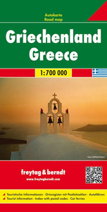
Greece 700K F&B Stanfords
£10.99
Archived Product
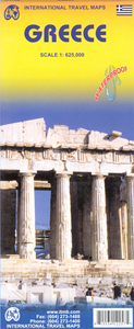
Greece ITMB Stanfords
£9.99
Archived Product
Greece Stanfords
£5.99
Archived Product
Greece Stanfords
£12.50
Archived Product
Greece Stanfords
£10.95
Archived Product
Greece Stanfords
£9.50
Archived Product
Greece Stanfords
£13.59
Archived Product
Greece Stanfords
£12.79
Vouchers
No voucher codes found.
Do you know a voucher code for this product or supplier? Add it to Insights for others to use.
Do you know a voucher code for this product or supplier? Add it to Insights for others to use.
 Denmark