
 United Kingdom
 France
 Germany
 Netherlands
 Sweden
 USA
USA
 Italy
Italy
 Spain
Spain
More From Contributor


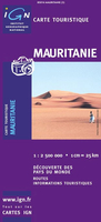
Mauritania
Road map od Mauritania with bold relief shading and spot heights, indicating different types of terrain and vegetation. Roads include seasonal tracks and routes requiring assistance from local guides. Railways and local aerodromes are also marked. Latitude and longitude are shown in the margins at 2º degrees intervals and by cross ticks on the map itself. Map legend is in French only.The map includes the whole of the Western Sahara, but with only limited road information and no topography.

Product Description
Reviews/Comments
Add New
Intelligent Comparison
Archived Product

Mauritania ITMB Stanfords
£9.99
Archived Product
Evritania Stanfords
£7.95
Archived Product
Mauritius Stanfords
£4.99
Archived Product

Britannia Stanfords
£18.99
Archived Product
Mauritius Stanfords
£9.99
Archived Product

Flag Of Mauritania Stanfords
£8.99
Archived Product

Mauriac Stanfords
£11.50
Archived Product
Catania Stanfords
£10.99
Vouchers
No voucher codes found.
Do you know a voucher code for this product or supplier? Add it to Insights for others to use.
Do you know a voucher code for this product or supplier? Add it to Insights for others to use.
 Denmark