More From Contributor

£7.99
Maui, Moloka'i & Lana'i in the Eyewitness Top 10 series from Dorling Kindersley is a condensed format guide book featuring dozens of illustrated, top ten lists for the traveller regardless of their disposable budget. To save you time & money a Top 10 Things to Avoid is also included. Top 10 lists are given for things to see & do on the islands, as well as the top ten features of particular locations or events. Practicalities are not forgotten as Top 10s are also provided for topics such as planning your trip, getting around & shopping. Accommodation lists provide the ten most recommended places to stay for a range of budgets, whilst restaurant top tens feature as the guide works its way through the location in question. Simple, small street plans illustrate the location of the top ten recommends within their neighbourhoods & basic, fold out maps form the inside covers. A glossary of useful words & phrases is included which will help the traveller to acclimatise. ...
Archived Product
£11.50
Topographic survey of France at 1:25, 000 in IGN`s excellent TOP25 / Série Bleue series. All the maps are GPS compatible, with a 1km UTM grid plus latitude & longitude lines at 5’ intervals. Contours are at 5m intervals except for mountainous areas where the maps have contours at 10m intervals, vividly enhanced by hill shading & graphics for rocky terrain. Colouring with graphics indicates different types of vegetation or land use (deciduous or coniferous forests, moors, orchards, vineyards, etc). PLEASE NOTE: coverage of France at this scale is currently being revised – the format & the presentation of each title are indicated by the letters at the end of its Sheet Reference number (e.g. 0416ET, 3531ETR, 1923SB, etc.)MAPS WITH FULL TOURIST OVERPRINT & AN ENGLISH MAP LEGEND: all TOP25 maps & the SB editions of Série Bleue have an overprint highlighting waymarked walking trails including long-distance GR routes &, where appropriate, ski routes. Symbols indicate campsites, gîtes d’etape, refuges, equestrian centres & other recreational facilities or sites, tourist information centres, cultural heritage, etc. Towns & locations of particular interest are highlighted.- ET or OT = single-sided TOP25 map covering approx. 29x 21 km / 18x 13 miles.- ETR or OTR = waterproof & tear resistant TOP25 map covering the same area as the corresponding ET or OT number, but double-sided, printed on a smaller size sheet with a good overlap between the sides.- SB = Série Bleue map with full tourist overprint; these maps, first introduced in summer 2014, each cover approx. 29x 24km / 18x 15 miles.SÉRIE BLEUE maps with numbers ending in E (Est) or O (Ouest): most editions now indicate the GR routes, but do not show any other tourist information. Map legend is in French only. Each map covers approx. 14x 20km / 9x 12 miles. ...
Archived Product
£15.95
Maule & Bio Bio regions of Chile at 1:400, 000 in a series of nine indexed & GPS compatible regional maps from Compass Editorial, printed on light, waterproof & tear-resistant synthetic paper. The maps provide an excellent representation of the topography & show many more locations than general maps of the whole country. Coverage in this title extends from just above 34 ...
Archived Product
£16.99
Maule & Bio Bio regions of Chile at 1:400, 000 in a series of nine indexed & GPS compatible regional maps from Compass Editorial, printed on light, waterproof & tear-resistant synthetic paper. The maps provide an excellent representation of the topography & show many more locations than general maps of the whole country. Coverage in this title extends from just above 34°30’ (Pichilemu
- Rengo)) to just beyond 39° south (Gorbea), &

Includes::
Talca, Concepción & Temuco. Each map in the Compass Editorial series is double-sided, with a small overlap between the sides & the adjoining titles. The maps provide an exceptionally vivid picture of the terrain, using satellite imagery as a base, with shading & altitude colouring, plus plenty of names of mountain ranges, peaks, passes, salt flats, etc. National parks & other protected areas are prominently highlighted. Classification of the road network indicates dirt roads & tracks, as well as hard & soft 4WD roads, & shows locations of border crossings, petrol stations, toll booths & police units. Driving distances are marked on main & selected secondary routes. Railway lines are included & local airports/aerodromes are marked. A range of symbols indicate various places of interest & areas for recreational activities, including tourist information offices, UNESCO World Heritage & other cultural or historical sites, beaches, hot springs, trekking & skiing areas, etc. Each side of the map has its own index & a distance table. The maps have a latitude & longitude grid at 15’ intervals. Map legend

Includes::
English.


...
Archived Product
£12.99
Topographic survey of France at 1:25, 000 in IGN`s excellent TOP25 / Série Bleue series. All the maps are GPS compatible, with a 1km UTM grid plus latitude & longitude lines at 5’ intervals. Contours are at 5m intervals except for mountainous areas where the maps have contours at 10m intervals, vividly enhanced by hill shading & graphics for rocky terrain. Colouring with graphics indicates different types of vegetation or land use (deciduous or coniferous forests, moors, orchards, vineyards, etc). PLEASE NOTE: coverage of France at this scale is currently being revised – the format & the presentation of each title are indicated by the letters at the end of its Sheet Reference number (e.g. 0416ET, 3531ETR, 1923SB, etc.)MAPS WITH FULL TOURIST OVERPRINT & AN ENGLISH MAP LEGEND: all TOP25 maps & the SB editions of Série Bleue have an overprint highlighting waymarked walking trails including long-distance GR routes &, where appropriate, ski routes. Symbols indicate campsites, gîtes d’etape, refuges, equestrian centres & other recreational facilities or sites, tourist information centres, cultural heritage, etc. Towns & locations of particular interest are highlighted.- ET or OT = single-sided TOP25 map covering approx. 29x 21 km / 18x 13 miles.- ETR or OTR = waterproof & tear resistant TOP25 map covering the same area as the corresponding ET or OT number, but double-sided, printed on a smaller size sheet with a good overlap between the sides.- SB = Série Bleue map with full tourist overprint; these maps, first introduced in summer 2014, each cover approx. 29x 24km / 18x 15 miles.SÉRIE BLEUE maps with numbers ending in E (Est) or O (Ouest): most editions now indicate the GR routes, but do not show any other tourist information. Map legend is in French only. Each map covers approx. 14x 20km / 9x 12 miles. ...
Archived Product
£11.50
Topographic survey of France at 1:25, 000 in IGN`s excellent TOP25 / Série Bleue series. All the maps are GPS compatible, with a 1km UTM grid plus latitude & longitude lines at 5’ intervals. Contours are at 5m intervals except for mountainous areas where the maps have contours at 10m intervals, vividly enhanced by hill shading & graphics for rocky terrain. Colouring with graphics indicates different types of vegetation or land use (deciduous or coniferous forests, moors, orchards, vineyards, etc). PLEASE NOTE: coverage of France at this scale is currently being revised – the format & the presentation of each title are indicated by the letters at the end of its Sheet Reference number (e.g. 0416ET, 3531ETR, 1923SB, etc.)MAPS WITH FULL TOURIST OVERPRINT & AN ENGLISH MAP LEGEND: all TOP25 maps & the SB editions of Série Bleue have an overprint highlighting waymarked walking trails including long-distance GR routes &, where appropriate, ski routes. Symbols indicate campsites, gîtes d’etape, refuges, equestrian centres & other recreational facilities or sites, tourist information centres, cultural heritage, etc. Towns & locations of particular interest are highlighted.- ET or OT = single-sided TOP25 map covering approx. 29x 21 km / 18x 13 miles.- ETR or OTR = waterproof & tear resistant TOP25 map covering the same area as the corresponding ET or OT number, but double-sided, printed on a smaller size sheet with a good overlap between the sides.- SB = Série Bleue map with full tourist overprint; these maps, first introduced in summer 2014, each cover approx. 29x 24km / 18x 15 miles.SÉRIE BLEUE maps with numbers ending in E (Est) or O (Ouest): most editions now indicate the GR routes, but do not show any other tourist information. Map legend is in French only. Each map covers approx. 14x 20km / 9x 12 miles. ...
Archived Product
£9.99
Maurice Hall is a young man who grows up confident in his privileged status & well aware of his role in society. Modest & generally conformist, he nevertheless finds himself increasingly attracted to his own sex. Through Clive, whom he encounters at Cambridge, & through Alec, the gamekeeper on Clive`s country estate, Maurice gradually experiences a profound emotional & sexual awakening. A tale of passion, bravery & defiance, this intensely personal novel was completed in 1914 but remained unpublished until after Forster`s death in 1970. Compellingly honest & beautifully written, it offers a powerful condemnation of the repressive attitudes of British society, & is at once a moving love story & an intimate tale of one man`s erotic & political self-discovery. ...
Archived Product
£10.99
Road map od Mauritania with bold relief shading & spot heights, indicating different types of terrain & vegetation. Roads include seasonal tracks & routes requiring assistance from local guides. Railways & local aerodromes are also marked. Latitude & longitude are shown in the margins at 2º degrees intervals & by cross ticks on the map itself. Map legend is in French only. The map

Includes::
the whole of the Western Sahara, but with only limited road information & no topography.

...
Archived Product
£9.99
Mauritania & Western Sahara with excellent topographic information on an indexed map with a street plan of central Nouakchot. Vivid altitude colouring with graphics for deserts, flood plains & salt flats shows the terrain. Oases, water wells & numerous spot heights are marked & the map provides plenty of names of geographical

Features:
peaks, mountain chains & rock outcrops, plains, etc. Road network shows distances on main roads &

Includes::
dirt tracks. The map also shows locations of local airfields & the route of the iron ore railway line from the mines at Zouérat to the coast. Symbols highlight various places of tourist interest including world heritage sites, forts & archaeological remains, national parks & protected areas, beaches, etc. Names of main towns & important geographical features are also given in Arabic. Internal administrative boundaries are shown with names of the provinces. The map had latitude & longitude lines at intervals of 1º. Map legend

Includes::
English. The index lists separately locations in Mauritania, Western Sahara, plus the adjoining regions of Mali & Senegal. Also included is a plan of central Nouakchott indicating main public buildings, hotels & various facilities. Please note: this title is also available as a wall map.


...
Archived Product
£9.99
Indexed map of the country with a plan of Nouakchott & coverage of the whole of Western Sahara. Altitude colouring (in feet) with occasional spot heights is complemented by names of main hill ranges, plus cliffs or scarps within the Saharan region. Both permanent & intermittent streams & creeks are marked, as wells as dry lakes or salt flats, & desert areas are indicated. Also shown are numerous wells, many with names. Road network

Includes::
minor roads & tracks, with approximate driving distances between selected points & location of petrol stations. The railway line from Nouadhibou to Zouerat is shown, as well as local aerodromes. Local administrative boundaries are marked, with names of districts, & national parks are shown. Symbols indicate border crossings, antiquities, places of interest, various types of accommodation, hospital & medical facilities, etc. Latitude & longitude grid lines are drawn at 2º30` intervals. The maps

Includes::
a simple street plan of Nouakchott, showing main streets, a glossary of geographic terms, & an index listing only main towns & villages.


...
Archived Product

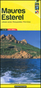
Maures - Esterel Didier Richard 15

Massif de Maures and the Esterel area of Provence and the French Riviera at 1:60, 000 on a contoured and GPS compatible map from Didier Richard with a base derived from IGN’s topographic survey, highlighting both local hiking routes and the GR network of long-distance paths, gîtes d’etape, interesting natural and cultural sites, etc. The map extends along the coast from Toulon to Mandelieu-la-Napoule, and inland from Brignoles to Le Muy and Pégomas. Covarage includes Ile de Porquerolles, Ile de Port-Cros and Ile du Lavant (indicating ferry links with the mainland and between the islands), Hyères, Giens, Le Lavandou, Cavalaire-sur Mer, St-Tropez, Ste-Maxime, les Issambres, Fréjus, St-Raphaël, Théoule-sur-Mer, Bagnols-en-Fôret, Les Arcs, Le Luc, le Thoronet,
etc.Relief is portrayed by contours at 50m intervals with additional hill shading and colouring for different types of vegetation. An overprint highlights local hiking trails, indicating routes which are part of the GR network. Bold symbols show gîtes d’etape and equestrian lodge, climbing sites, interesting cultural or natural locations, etc. The map has a UTM grid. Map legend includes English. To see the list of all the titles in this series please click on the series link.
RIP - This product is no longer available on our network. It was last seen on 25.09.2019

This page now acts as a permanent archive for this product. Add more information using the comments box below to ensure it can still be found by future generations.

Use our search facility to see if it is available from an alternative contributor.
  • Availability: Out Of Stock
  • Supplier: Stanfords
  • SKU: 9782723491686
Availability: In Stock
£13.99

Product Description

Massif de Maures & the Esterel area of Provence & the French Riviera at 1:60, 000 on a contoured & GPS compatible map from Didier Richard with a base derived from IGN’s topographic survey, highlighting both local hiking routes & the GR network of long-distance paths, gîtes d’etape, interesting natural & cultural sites, etc. The map extends along the coast from Toulon to Mandelieu-la-Napoule, & inland from Brignoles to Le Muy & Pégomas. Covarage

Includes::
Ile de Porquerolles, Ile de Port-Cros & Ile du Lavant (indicating ferry links with the mainland & between the islands), Hyères, Giens, Le Lavandou, Cavalaire-sur Mer, St-Tropez, Ste-Maxime, les Issambres, Fréjus, St-Raphaël, Théoule-sur-Mer, Bagnols-en-Fôret, Les Arcs, Le Luc, le Thoronet, etc. Relief is portrayed by contours at 50m intervals with additional hill shading & colouring for different types of vegetation. An overprint highlights local hiking trails, indicating routes which are part of the GR network. Bold symbols show gîtes d’etape & equestrian lodge, climbing sites, interesting cultural or natural locations, etc. The map has a UTM grid. Map legend

Includes::
English. To see the list of all the titles in this series please click on the series link.

Reviews/Comments

Add New

Intelligent Comparison

Oooops!
We couldn't find anything!
Perhaps this product's unique.... Or perhaps we are still looking for comparisons!
Click to bump this page and we'll hurry up.

Price History

Vouchers

No voucher codes found.
Do you know a voucher code for this product or supplier? Add it to Insights for others to use.

Facebook

Jargon Buster

GPS - Global Positioning System - Global position using satellites
Hiking - An outdoor activity envolving walking in nature
Natural - not manmade
Network - A link and communication between things. Often computers or people.

Supplier Information

Stanfords
Stanfords was established in 1853 and opened their iconic Covent Garden flagship store in 1901. They have become the top retailer of maps, travel books and accessories in the UK and arguably offer the largest selection of maps and travel books worldwide. Famous names such as Captain Robert Falcon Scott, Ranulph Fiennes and Michael Palin have purchased from Stanfords. They now have a shop in Bristol and both stores together with other venues operate a calendar of events including talks, book signings and exhibitions. As a specialist map retailer, the map selection is comprehensive and includes road maps, street maps and walking maps from worldwide destinations, as well as a selection of world atlases and wall maps. Books include travel guides and travel literature. Stanfords also stock globes, from miniatures made of blue marble to magnificent floor-standing globes. The website features a selection of interesting articles on travel topics.
Page Updated: 2023-11-12 20:15:36

Community Generated Product Tags

Oh No! The productWIKI community hasn't generated any tags for this product yet!
Menu