
 United Kingdom
 France
 Germany
 Netherlands
 Sweden
 USA
USA
 Italy
Italy
 Spain
Spain
More From Contributor


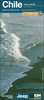


Maule & Bio Bio Regions
Maule and Bio Bio regions of Chile at 1:400, 000 in a series of nine indexed and GPS compatible regional maps from Compass Editorial, printed on light, waterproof and tear-resistant synthetic paper. The maps provide an excellent representation of the topography and show many more locations than general maps of the whole country.Coverage in this title extends from just above 34°30’ (Pichilemu - Rengo)) to just beyond 39° south (Gorbea), and includes Talca, Concepción and Temuco.Each map in the Compass Editorial series is double-sided, with a small overlap between the sides and the adjoining titles. The maps provide an exceptionally vivid picture of the terrain, using satellite imagery as a base, with shading and altitude colouring, plus plenty of names of mountain ranges,
peaks, passes, salt flats, etc. National parks and other protected areas are prominently highlighted. Classification of the road network indicates dirt roads and tracks, as well as hard and soft 4WD roads, and shows locations of border crossings, petrol stations, toll booths and police units. Driving distances are marked on main and selected secondary routes. Railway lines are included and local airports/aerodromes are marked. A range of symbols indicate various places of interest and areas for recreational activities, including tourist information offices, UNESCO World Heritage and other cultural or historical sites, beaches, hot springs, trekking and skiing areas, etc. Each side of the map has its own index and a distance table. The maps have a latitude and longitude grid at
15’ intervals. Map legend includes English.

Product Description
Reviews/Comments
Add New
Vouchers
No voucher codes found.
Do you know a voucher code for this product or supplier? Add it to Insights for others to use.
Do you know a voucher code for this product or supplier? Add it to Insights for others to use.
 Denmark