More From Contributor
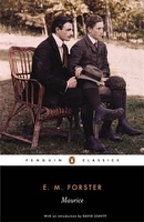
£15.95
Maule & Bio Bio regions of Chile at 1:400, 000 in a series of nine indexed & GPS compatible regional maps from Compass Editorial, printed on light, waterproof & tear-resistant synthetic paper. The maps provide an excellent representation of the topography & show many more locations than general maps of the whole country. Coverage in this title extends from just above 34 ...
Archived Product
£16.99
Maule & Bio Bio regions of Chile at 1:400, 000 in a series of nine indexed & GPS compatible regional maps from Compass Editorial, printed on light, waterproof & tear-resistant synthetic paper. The maps provide an excellent representation of the topography & show many more locations than general maps of the whole country. Coverage in this title extends from just above 34°30’ (Pichilemu
- Rengo)) to just beyond 39° south (Gorbea), &

Includes::
Talca, Concepción & Temuco. Each map in the Compass Editorial series is double-sided, with a small overlap between the sides & the adjoining titles. The maps provide an exceptionally vivid picture of the terrain, using satellite imagery as a base, with shading & altitude colouring, plus plenty of names of mountain ranges, peaks, passes, salt flats, etc. National parks & other protected areas are prominently highlighted. Classification of the road network indicates dirt roads & tracks, as well as hard & soft 4WD roads, & shows locations of border crossings, petrol stations, toll booths & police units. Driving distances are marked on main & selected secondary routes. Railway lines are included & local airports/aerodromes are marked. A range of symbols indicate various places of interest & areas for recreational activities, including tourist information offices, UNESCO World Heritage & other cultural or historical sites, beaches, hot springs, trekking & skiing areas, etc. Each side of the map has its own index & a distance table. The maps have a latitude & longitude grid at 15’ intervals. Map legend

Includes::
English.


...
Archived Product
£12.99
Topographic survey of France at 1:25, 000 in IGN`s excellent TOP25 / Série Bleue series. All the maps are GPS compatible, with a 1km UTM grid plus latitude & longitude lines at 5’ intervals. Contours are at 5m intervals except for mountainous areas where the maps have contours at 10m intervals, vividly enhanced by hill shading & graphics for rocky terrain. Colouring with graphics indicates different types of vegetation or land use (deciduous or coniferous forests, moors, orchards, vineyards, etc). PLEASE NOTE: coverage of France at this scale is currently being revised – the format & the presentation of each title are indicated by the letters at the end of its Sheet Reference number (e.g. 0416ET, 3531ETR, 1923SB, etc.)MAPS WITH FULL TOURIST OVERPRINT & AN ENGLISH MAP LEGEND: all TOP25 maps & the SB editions of Série Bleue have an overprint highlighting waymarked walking trails including long-distance GR routes &, where appropriate, ski routes. Symbols indicate campsites, gîtes d’etape, refuges, equestrian centres & other recreational facilities or sites, tourist information centres, cultural heritage, etc. Towns & locations of particular interest are highlighted.- ET or OT = single-sided TOP25 map covering approx. 29x 21 km / 18x 13 miles.- ETR or OTR = waterproof & tear resistant TOP25 map covering the same area as the corresponding ET or OT number, but double-sided, printed on a smaller size sheet with a good overlap between the sides.- SB = Série Bleue map with full tourist overprint; these maps, first introduced in summer 2014, each cover approx. 29x 24km / 18x 15 miles.SÉRIE BLEUE maps with numbers ending in E (Est) or O (Ouest): most editions now indicate the GR routes, but do not show any other tourist information. Map legend is in French only. Each map covers approx. 14x 20km / 9x 12 miles. ...
Archived Product
£13.99
Massif de Maures & the Esterel area of Provence & the French Riviera at 1:60, 000 on a contoured & GPS compatible map from Didier Richard with a base derived from IGN’s topographic survey, highlighting both local hiking routes & the GR network of long-distance paths, gîtes d’etape, interesting natural & cultural sites, etc. The map extends along the coast from Toulon to Mandelieu-la-Napoule, & inland from Brignoles to Le Muy & Pégomas. Covarage

Includes::
Ile de Porquerolles, Ile de Port-Cros & Ile du Lavant (indicating ferry links with the mainland & between the islands), Hyères, Giens, Le Lavandou, Cavalaire-sur Mer, St-Tropez, Ste-Maxime, les Issambres, Fréjus, St-Raphaël, Théoule-sur-Mer, Bagnols-en-Fôret, Les Arcs, Le Luc, le Thoronet, etc. Relief is portrayed by contours at 50m intervals with additional hill shading & colouring for different types of vegetation. An overprint highlights local hiking trails, indicating routes which are part of the GR network. Bold symbols show gîtes d’etape & equestrian lodge, climbing sites, interesting cultural or natural locations, etc. The map has a UTM grid. Map legend

Includes::
English. To see the list of all the titles in this series please click on the series link.


...
Archived Product
£11.50
Topographic survey of France at 1:25, 000 in IGN`s excellent TOP25 / Série Bleue series. All the maps are GPS compatible, with a 1km UTM grid plus latitude & longitude lines at 5’ intervals. Contours are at 5m intervals except for mountainous areas where the maps have contours at 10m intervals, vividly enhanced by hill shading & graphics for rocky terrain. Colouring with graphics indicates different types of vegetation or land use (deciduous or coniferous forests, moors, orchards, vineyards, etc). PLEASE NOTE: coverage of France at this scale is currently being revised – the format & the presentation of each title are indicated by the letters at the end of its Sheet Reference number (e.g. 0416ET, 3531ETR, 1923SB, etc.)MAPS WITH FULL TOURIST OVERPRINT & AN ENGLISH MAP LEGEND: all TOP25 maps & the SB editions of Série Bleue have an overprint highlighting waymarked walking trails including long-distance GR routes &, where appropriate, ski routes. Symbols indicate campsites, gîtes d’etape, refuges, equestrian centres & other recreational facilities or sites, tourist information centres, cultural heritage, etc. Towns & locations of particular interest are highlighted.- ET or OT = single-sided TOP25 map covering approx. 29x 21 km / 18x 13 miles.- ETR or OTR = waterproof & tear resistant TOP25 map covering the same area as the corresponding ET or OT number, but double-sided, printed on a smaller size sheet with a good overlap between the sides.- SB = Série Bleue map with full tourist overprint; these maps, first introduced in summer 2014, each cover approx. 29x 24km / 18x 15 miles.SÉRIE BLEUE maps with numbers ending in E (Est) or O (Ouest): most editions now indicate the GR routes, but do not show any other tourist information. Map legend is in French only. Each map covers approx. 14x 20km / 9x 12 miles. ...
Archived Product
£10.99
Road map od Mauritania with bold relief shading & spot heights, indicating different types of terrain & vegetation. Roads include seasonal tracks & routes requiring assistance from local guides. Railways & local aerodromes are also marked. Latitude & longitude are shown in the margins at 2º degrees intervals & by cross ticks on the map itself. Map legend is in French only. The map

Includes::
the whole of the Western Sahara, but with only limited road information & no topography.

...
Archived Product
£9.99
Mauritania & Western Sahara with excellent topographic information on an indexed map with a street plan of central Nouakchot. Vivid altitude colouring with graphics for deserts, flood plains & salt flats shows the terrain. Oases, water wells & numerous spot heights are marked & the map provides plenty of names of geographical

Features:
peaks, mountain chains & rock outcrops, plains, etc. Road network shows distances on main roads &

Includes::
dirt tracks. The map also shows locations of local airfields & the route of the iron ore railway line from the mines at Zouérat to the coast. Symbols highlight various places of tourist interest including world heritage sites, forts & archaeological remains, national parks & protected areas, beaches, etc. Names of main towns & important geographical features are also given in Arabic. Internal administrative boundaries are shown with names of the provinces. The map had latitude & longitude lines at intervals of 1º. Map legend

Includes::
English. The index lists separately locations in Mauritania, Western Sahara, plus the adjoining regions of Mali & Senegal. Also included is a plan of central Nouakchott indicating main public buildings, hotels & various facilities. Please note: this title is also available as a wall map.


...
Archived Product
£9.99
Indexed map of the country with a plan of Nouakchott & coverage of the whole of Western Sahara. Altitude colouring (in feet) with occasional spot heights is complemented by names of main hill ranges, plus cliffs or scarps within the Saharan region. Both permanent & intermittent streams & creeks are marked, as wells as dry lakes or salt flats, & desert areas are indicated. Also shown are numerous wells, many with names. Road network

Includes::
minor roads & tracks, with approximate driving distances between selected points & location of petrol stations. The railway line from Nouadhibou to Zouerat is shown, as well as local aerodromes. Local administrative boundaries are marked, with names of districts, & national parks are shown. Symbols indicate border crossings, antiquities, places of interest, various types of accommodation, hospital & medical facilities, etc. Latitude & longitude grid lines are drawn at 2º30` intervals. The maps

Includes::
a simple street plan of Nouakchott, showing main streets, a glossary of geographic terms, & an index listing only main towns & villages.


...
Archived Product
£13.50
Mauritania & Western Sahara Wall Map at 1:1, 750, 000 from Gizi Map, size 95 x 88cm (37.5” x 34.5”), with excellent presentation of the country’s topography, an index next to the map, plus a street plan of central Nouakchot. Vivid altitude colouring with graphics for deserts, flood plains & salt flats shows the terrain. Oases, water wells & numerous spot heights are marked & the map provides plenty of names of geographical

Features:
peaks, mountain chains & rock outcrops, plains, etc. Names of main towns & important geographical features are also given in Arabic. Road network shows distances on main roads &

Includes::
dirt tracks. The map also shows locations of local airfields & the route of the iron ore railway line from the mines at Zouérat to the coast. Symbols highlight various places of tourist interest including UNESCO world heritage sites, forts & archaeological remains, national parks & protected areas, beaches, etc. Internal administrative boundaries are shown with names of the provinces. The map had latitude & longitude lines at intervals of 1º. The index, placed next to the map, lists separately locations in Mauritania, Western Sahara, & the adjoining regions of Mali & Senegal. Map legend

Includes::
English & Arabic. Also included is a plan of central Nouakchott indicating main public buildings, hotels & various facilities. Please note: this title is also available in a folded format.


...
Archived Product
£14.95
Map No. J-1B in the TPC series: military topographic survey mapping covering the world's land masses & significant islands at 1:500, 000. The maps are useful as general topographical coverage where nothing else is available, although they are designed primarily as flying charts for military aircraft. TPC stands for Tactical Pilotage Chart. Relief is portrayed by a combination of contours (basic interval 500ft, intermediate contours shown where appropriate), elevation tinting & relief shading, plus spot heights. Towns, villages, major roads, railways & airports are shown but please note that many of the smaller settlements are not named & the road information is not necessarily up to date, as compilation & revision dates vary. Some air navigation information also appears on the map, such as radio beacons & restricted flying zones. Each TPC chart has both UTM & latitude/longitude grids overprinted on it, with additional margin ticks. IMPORTANT
- PLEASE NOTE: The series is gradually being withdrawn from sale to the general public & some sheets may no longer be available when ordered by us. Due to the nature of the map projection assembling these sheets to make a larger map is not recommended. in addition, colours used for relief are not constant throughout the series. In some areas of central Africa & South America the maps have blank spaces, reflecting localized deficiencies or inconsistencies in the survey data.
...
Archived Product

Maurice

Maurice Hall is a young man who grows up confident in his privileged status and well aware of his role in society. Modest and generally conformist, he nevertheless finds himself increasingly attracted to his own sex. Through Clive, whom he encounters at Cambridge, and through Alec, the gamekeeper on Clive`s country estate, Maurice gradually experiences a profound emotional and sexual awakening. A tale of passion, bravery and defiance, this intensely personal novel was completed in 1914 but remained unpublished until after Forster`s death in 1970. Compellingly honest and beautifully written, it offers a powerful condemnation of the repressive attitudes of British society, and is at once a moving love story and an intimate tale of one man`s erotic and political self-discovery.
RIP - This product is no longer available on our network. It was last seen on 25.09.2019

This page now acts as a permanent archive for this product. Add more information using the comments box below to ensure it can still be found by future generations.

Use our search facility to see if it is available from an alternative contributor.
  • External links may include paid for promotion
  • Availability: Out Of Stock
  • Supplier: Stanfords
  • SKU: 9780141441139
Availability: In Stock
£9.99

Product Description

Maurice Hall is a young man who grows up confident in his privileged status & well aware of his role in society. Modest & generally conformist, he nevertheless finds himself increasingly attracted to his own sex. Through Clive, whom he encounters at Cambridge, & through Alec, the gamekeeper on Clive`s country estate, Maurice gradually experiences a profound emotional & sexual awakening. A tale of passion, bravery & defiance, this intensely personal novel was completed in 1914 but remained unpublished until after Forster`s death in 1970. Compellingly honest & beautifully written, it offers a powerful condemnation of the repressive attitudes of British society, & is at once a moving love story & an intimate tale of one man`s erotic & political self-discovery.

Reviews/Comments

Add New

Intelligent Comparison

Oooops!
We couldn't find anything!
Perhaps this product's unique.... Or perhaps we are still looking for comparisons!
Click to bump this page and we'll hurry up.

Price History

Vouchers

No voucher codes found.
Do you know a voucher code for this product or supplier? Add it to Insights for others to use.

Facebook

Jargon Buster

Love - Someone who shows deep affection for someone else.
Hall - A room at the inside of an entrance of a house.
Personal - Something that belongs more to an individual due to it affecting them more by relating to them.
Estate - A group of houses on the same land or area.

Supplier Information

Stanfords
Stanfords was established in 1853 and opened their iconic Covent Garden flagship store in 1901. They have become the top retailer of maps, travel books and accessories in the UK and arguably offer the largest selection of maps and travel books worldwide. Famous names such as Captain Robert Falcon Scott, Ranulph Fiennes and Michael Palin have purchased from Stanfords. They now have a shop in Bristol and both stores together with other venues operate a calendar of events including talks, book signings and exhibitions. As a specialist map retailer, the map selection is comprehensive and includes road maps, street maps and walking maps from worldwide destinations, as well as a selection of world atlases and wall maps. Books include travel guides and travel literature. Stanfords also stock globes, from miniatures made of blue marble to magnificent floor-standing globes. The website features a selection of interesting articles on travel topics.
Page Updated: 2023-11-12 20:15:36

Community Generated Product Tags

Oh No! The productWIKI community hasn't generated any tags for this product yet!
Menu