
 United Kingdom
 France
 Germany
 Netherlands
 Sweden
 USA
USA
 Italy
Italy
 Spain
Spain
More From Contributor


Leigh North 1910
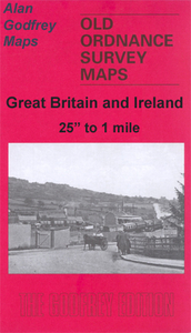
Leigh North in 1905 in a fascinating series of reproductions of old Ordnance Survey plans in the Alan Godfrey Editions, ideal for anyone interested in the history of their neighbourhood or family. The map covers the northern part of Leigh, extending from Bradshawgate northward to Atherton Hall, and from Findlay Street eastward to Green Lane. Part of the town centre is shown, including St Mary`s church, Town Hall, Market Place, Lord Street, Church Street, Westleigh station (at margin of map), Athletic Ground, Avenue Mill, Leigh & Bedford station, Brook Mill, Leigh Brewery, Brookside Mill, Platfold Mill, Church Fields, Kirkhall Lane, Victoria Mills, Parsonage, Workhouse, Infirmary, Kirkhall Lane Mills, Atherton Old Hall, Wood End, Atherton Hall, Bedford Colliery,
mineral railways, LNWR Bedford Leigh Line, etc. On the reverse is a commercial directory, entries A to L.About the Alan Godfrey Editions of the 25” OS Series:Selected towns in Great Britain and Ireland are covered by maps showing the extent of urban development in the last decades of the 19th and early 20th century. The plans have been taken from the Ordnance Survey mapping and reprinted at about 15 inches to one mile (1:4, 340). On the reverse most maps have historical notes and many also include extracts from contemporary directories. Most maps cover about one mile (1.6kms) north/south, one and a half miles (2.4kms) across; adjoining sheets can be combined to provide wider coverage.FOR MORE INFORMATION AND A COMPLETE LIST OF ALL AVAILABLE TITLES PLEASE CLICK ON THE SERIES LINK.
mineral railways, LNWR Bedford Leigh Line, etc. On the reverse is a commercial directory, entries A to L.About the Alan Godfrey Editions of the 25” OS Series:Selected towns in Great Britain and Ireland are covered by maps showing the extent of urban development in the last decades of the 19th and early 20th century. The plans have been taken from the Ordnance Survey mapping and reprinted at about 15 inches to one mile (1:4, 340). On the reverse most maps have historical notes and many also include extracts from contemporary directories. Most maps cover about one mile (1.6kms) north/south, one and a half miles (2.4kms) across; adjoining sheets can be combined to provide wider coverage.FOR MORE INFORMATION AND A COMPLETE LIST OF ALL AVAILABLE TITLES PLEASE CLICK ON THE SERIES LINK.

Product Description
Reviews/Comments
Add New
Intelligent Comparison
Archived Product

Leigh South 1905 Stanfords
£3.50
Archived Product

Keighley North 1913 Stanfords
£3.50
Archived Product

Wigan North 1907 Stanfords
£3.50
Archived Product

Colne North 1910 Stanfords
£3.50
Archived Product

Evesham North 1903 Stanfords
£3.50
Archived Product
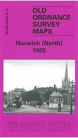
Norwich North 1905 Stanfords
£3.50
Archived Product
Wrexham North 1909 Stanfords
£3.50
Archived Product
Horwich North 1907 Stanfords
£2.95
Vouchers
No voucher codes found.
Do you know a voucher code for this product or supplier? Add it to Insights for others to use.
Do you know a voucher code for this product or supplier? Add it to Insights for others to use.
 Denmark