
 United Kingdom
 France
 Germany
 Netherlands
 Sweden
 USA
USA
 Italy
Italy
 Spain
Spain
More From Contributor


Wigan North 1907
Wigan North in 1907 in a fascinating series of reproductions of old Ordnance Survey plans in the Alan Godfrey Editions, ideal for anyone interested in the history of their neighbourhood or family. The map covers the northern part of Wigan, stretching from Swinley Lane eastward to New Springs, and from Whelley station northward to Leyland Mill Brow. Features include Lindsay Pit, Alexandra Pit, Leeds & Liverpool Canal, railway (Lancashire Union Line), Dairy Pit, Bridge Pit, Haigh Saw Mill, Wigan Sanatorium, New Springs, Bottling Wood, Whelley station (disused), Haigh Lower Plantations, Mariebonne, Swinley, Infirmary, Whitley Reservoir, Haigh Foundries, tramways, several old shafts, etc. Directories of Aspull and Haigh are on the reverse. About the Alan Godfrey Editions
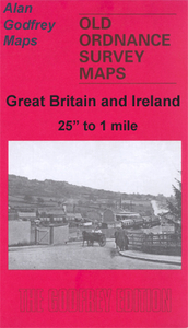
of the 25” OS Series:Selected towns in Great Britain and Ireland are covered by maps showing the extent of urban development in the last decades of the 19th and early 20th century. The plans have been taken from the Ordnance Survey mapping and reprinted at about 15 inches to one mile (1:4, 340). On the reverse most maps have historical notes and many also include extracts from contemporary directories. Most maps cover about one mile (1.6kms) north/south, one and a half miles (2.4kms) across; adjoining sheets can be combined to provide wider coverage.FOR MORE INFORMATION AND A COMPLETE LIST OF ALL AVAILABLE TITLES PLEASE CLICK ON THE SERIES LINK.
of the 25” OS Series:Selected towns in Great Britain and Ireland are covered by maps showing the extent of urban development in the last decades of the 19th and early 20th century. The plans have been taken from the Ordnance Survey mapping and reprinted at about 15 inches to one mile (1:4, 340). On the reverse most maps have historical notes and many also include extracts from contemporary directories. Most maps cover about one mile (1.6kms) north/south, one and a half miles (2.4kms) across; adjoining sheets can be combined to provide wider coverage.FOR MORE INFORMATION AND A COMPLETE LIST OF ALL AVAILABLE TITLES PLEASE CLICK ON THE SERIES LINK.

Product Description
Reviews/Comments
Add New
Intelligent Comparison
Archived Product
Wigan North West 1907 Stanfords
£2.95
Archived Product
Wigan 1907 Stanfords
£2.95
Archived Product

Wigan 1907 Stanfords
£3.50
Archived Product

Leigh North 1910 Stanfords
£3.50
Archived Product

Irvine North 1908 Stanfords
£3.50
Archived Product
Wigan West 1908 Stanfords
£3.50
Archived Product
Bridgnorth 1901 Stanfords
£3.50
Archived Product

Halifax North 1930 Stanfords
£3.50
Vouchers
No voucher codes found.
Do you know a voucher code for this product or supplier? Add it to Insights for others to use.
Do you know a voucher code for this product or supplier? Add it to Insights for others to use.
 Denmark