
 United Kingdom
 France
 Germany
 Netherlands
 Sweden
 USA
USA
 Italy
Italy
 Spain
Spain
More From Contributor


Ledbury 1926
Ledbury in 1926 in a fascinating series of reproductions of old Ordnance Survey plans in the Alan Godfrey Editions, ideal for anyone interested in the history of their neighbourhood or family. Selected towns in Great Britain and Ireland are covered by maps showing the extent of urban development in the last decades of the 19th and early 20th century.In this title: the town is in the centre of the map. Coverage stretches from Fairtree Farm in the east through to Ledbury Park in the west. From north to south is Newbury Park and the Mortuary Chapel and Cemetery. Features include St Katherine's Chapel, Belle Orchard House, Fairtree Farm, Dog Hill Wood, St Michael and All Angels Church, railway line and the Cattle Market. Main streets are New Street, The Homend, High Street and
Worcester Road. On the reverse is a list of private residents, with extracts from a commercial directory. About the Alan Godfrey Editions of the 25
Worcester Road. On the reverse is a list of private residents, with extracts from a commercial directory. About the Alan Godfrey Editions of the 25
Product Description
Reviews/Comments
Add New
Intelligent Comparison
Archived Product

Ledbury 1926 Stanfords
£3.50
Archived Product

Sudbury 1902 Stanfords
£3.50
Archived Product

Tenbury 1902 Stanfords
£3.50
Archived Product
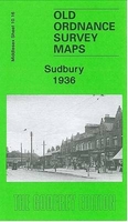
Sudbury 1936 Stanfords
£3.50
Archived Product
Wednesbury 1902 Stanfords
£3.50
Vouchers
No voucher codes found.
Do you know a voucher code for this product or supplier? Add it to Insights for others to use.
Do you know a voucher code for this product or supplier? Add it to Insights for others to use.
 Denmark