
 United Kingdom
 France
 Germany
 Netherlands
 Sweden
 USA
USA
 Italy
Italy
 Spain
Spain
More From Contributor


Wednesbury 1902
Wednesbury in 1902 in a fascinating series of reproductions of old Ordnance Survey plans in the Alan Godfrey Editions, ideal for anyone interested in the history of their neighbourhood or family. The map covers the Black Country town of Wednesbury, together with the industrial hinterland to its west, with the site of many disused collieries. Coverage stretches from the town centre and Market Place westward to Gospel Oak Road, and from Bilston Road southward to Ocker Hill Road. Features include the town centre, tramways, St Peter`s church, St John`s church, St Bartholomew`s church, Monway Collieries (disused), Walsall Canal, Monway Branch canal, Willingsworth Collieries (disused), Gosepel Oak area, Moorcroft Old Colliery, Doe Bank area, GWR railway with Wednesbury station
and goods station, Brunswick Sidings, LNWR Princes End Branch with Ocker Hill station, LNWR South Staffordshire Line with Wednesbury station an stretch of Darlaston Branch, several large factories, etc. On the reverse are extracts from a 1901 directory. About the Alan Godfrey Editions of the 25” OS Series:Selected towns in Great Britain and Ireland are covered by maps showing the extent of urban development in the last decades of the 19th and early 20th century. The plans have been taken from the Ordnance Survey mapping and reprinted at about 15 inches to one mile (1:4, 340). On the reverse most maps have historical notes and many also include extracts from contemporary directories. Most maps cover about one mile (1.6kms) north/south, one and a half miles (2.4kms) across; adjoining
sheets can be combined to provide wider coverage.FOR MORE INFORMATION AND A COMPLETE LIST OF ALL AVAILABLE TITLES PLEASE CLICK ON THE SERIES LINK.
Product Description
Reviews/Comments
Add New
Intelligent Comparison
Archived Product

Tenbury 1902 Stanfords
£3.50
Archived Product

Sudbury 1902 Stanfords
£3.50
Archived Product
Ledbury 1926 Stanfords
£2.95
Archived Product

Ledbury 1926 Stanfords
£3.50
Archived Product
Pendlebury 1907 Stanfords
£3.50
Archived Product

Tewkesbury 1923 Stanfords
£3.50
Archived Product
Queensbury 1932 Stanfords
£2.95
Archived Product
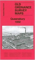
Queensbury 1932 Stanfords
£3.50
Vouchers
No voucher codes found.
Do you know a voucher code for this product or supplier? Add it to Insights for others to use.
Do you know a voucher code for this product or supplier? Add it to Insights for others to use.
 Denmark