
 United Kingdom
 France
 Germany
 Netherlands
 Sweden
 USA
USA
 Italy
Italy
 Spain
Spain
More From Contributor


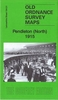


Pendlebury 1907
Pendlebury in 1907 in a fascinating series of reproductions of old Ordnance Survey plans in the Alan Godfrey Editions, ideal for anyone interested in the history of their neighbourhood or family. The map covers Pendlebury and part of Swinton, north of Salford. Bolton Road, with tramway, runs through the map and to the west of this are Newtown Mill, Bridgewater Mill, Moss Side Mill, Market Place, Royal Oak Print Works, and the area known as Newtown. Further south the LYR Pendleton & Hindley railway includes Swinton and Pendlebury stations and south of this is part of Swinton, including Acme Mill, Albion Mill, Albion Foundry, Hope Mill, Cyclone Works, St Peter`s church, Swinton Schools, Albert Mill. The eastern half of the map, east of Bolton Road, includes Newtown
Colliery with tramway, the disused Botany Bay collieries, Pepper Hill, Pendlebury Colliery with tramway, Clifton Hall Colliery, Clifton Junction station and stretches of the LNWR and LYR railways. Street directory entries are on the reverse, including Moss Lane, Pendlebury Road, Stafford Road, and Station RoadAbout the Alan Godfrey Editions of the 25” OS Series:Selected towns in Great Britain and Ireland are covered by maps showing the extent of urban development in the last decades of the 19th and early 20th century. The plans have been taken from the Ordnance Survey mapping and reprinted at about 15 inches to one mile (1:4, 340). On the reverse most maps have historical notes and many also include extracts from contemporary directories. Most maps cover about one mile (1.6kms)
north/south, one and a half miles (2.4kms) across; adjoining sheets can be combined to provide wider coverage.FOR MORE INFORMATION AND A COMPLETE LIST OF ALL AVAILABLE TITLES PLEASE CLICK ON THE SERIES LINK.

Product Description
Reviews/Comments
Add New
Intelligent Comparison
Archived Product

Hindley 1907 Stanfords
£3.50
Archived Product

Tenbury 1902 Stanfords
£3.50
Archived Product
Wednesbury 1902 Stanfords
£3.50
Vouchers
No voucher codes found.
Do you know a voucher code for this product or supplier? Add it to Insights for others to use.
Do you know a voucher code for this product or supplier? Add it to Insights for others to use.
 Denmark