
 United Kingdom
 France
 Germany
 Netherlands
 Sweden
 USA
USA
 Italy
Italy
 Spain
Spain
More From Contributor


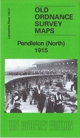
Pendleton North 1889
Pendleton North in 1889 in a fascinating series of reproductions of old Ordnance Survey plans in the Alan Godfrey Editions, ideal for anyone interested in the history of their neighbourhood or family. Three versions have been published for this area, showing how it developed across the years. The maps cover the northern part of Pendleton, north of Salford, from Doveleys Road and Gerald Road northward to Kersal Cell, and include Charlestown, Lower Kersal and part of Irlams o`th`Height. Features include Pendleton Colliery, Agecroft Hall Paper Works, Agecroft engine depot and railways; Kersal Cell, St George`s church, Douglas Green, Manchester Racecourse, River Irwell, Pendleton Old Hall, Agecroft Colliery, Higginson`s Brow, Agecroft Print Works, Summerville, Bridge Mill,
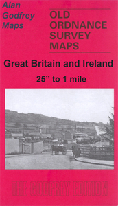
Bridgewater Works, Manchester Bolton & Bury Canal, Willow Bank Mill, Globe Mill, Irwell Bleach Works, Selections of street directory entries are on the reverse.About the Alan Godfrey Editions of the 25” OS Series:Selected towns in Great Britain and Ireland are covered by maps showing the extent of urban development in the last decades of the 19th and early 20th century. The plans have been taken from the Ordnance Survey mapping and reprinted at about 15 inches to one mile (1:4, 340). On the reverse most maps have historical notes and many also include extracts from contemporary directories. Most maps cover about one mile (1.6kms) north/south, one and a half miles (2.4kms) across; adjoining sheets can be combined to provide wider coverage.FOR MORE INFORMATION AND A COMPLETE LIST OF
ALL AVAILABLE TITLES PLEASE CLICK ON THE SERIES LINK.

Product Description
Reviews/Comments
Add New
Intelligent Comparison
Archived Product
Pendleton North 1915 Stanfords
£3.50
Archived Product

Milton North 1898 Stanfords
£3.50
Archived Product
Middleton North 1915 Stanfords
£2.95
Archived Product

Middleton North 1915 Stanfords
£3.50
Archived Product

Bolton North 1908 Stanfords
£3.50
Archived Product

Kendal North 1911 Stanfords
£3.50
Vouchers
No voucher codes found.
Do you know a voucher code for this product or supplier? Add it to Insights for others to use.
Do you know a voucher code for this product or supplier? Add it to Insights for others to use.
 Denmark